✦ Discover Sri Lanka
Breathtaking Destinations
From ancient rock fortresses to pristine beaches — explore 25+ extraordinary places across the Pearl of the Indian Ocean.
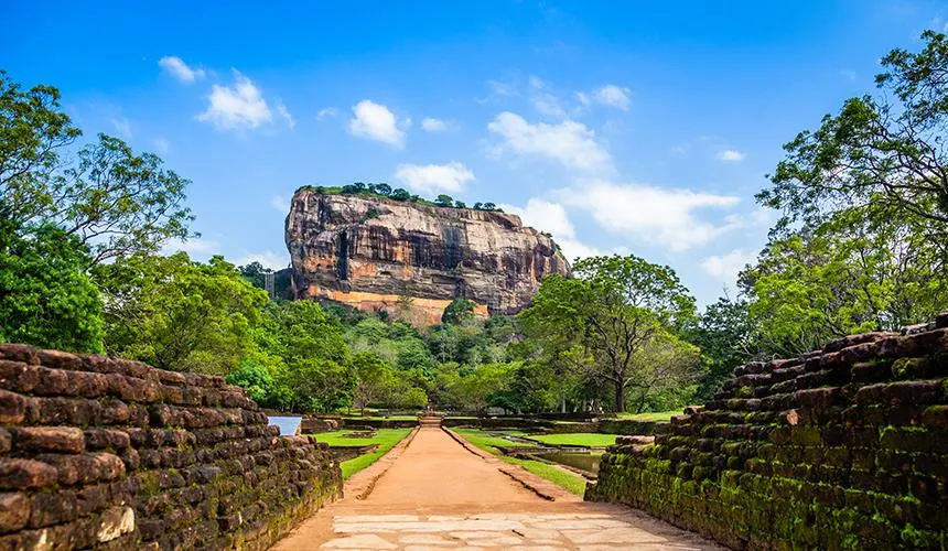
Sigiriya
Central Province
# Sigiriya Rock Fortress: Climbing Sri Lanka's Rock in the Sky Some places you look at. Sigiriya you climb into. Rising almost 200 metres straight out of the green plains of the Cultural Triangle, this fifth-century column of ancient magma has been called the eighth wonder of the world more than once — and after the 1,200 steps to the summit, you'll understand why. It's Sri Lanka's most iconic landmark and a UNESCO World Heritage Site. Here's what makes it worth the climb, and how to do it well. ## The History of Sigiriya In the late fifth century, a prince named Kashyapa seized the throne from his father, King Dhatusena — walling the old king up alive, according to the chronicles — and pushed aside his half-brother Moggallana, the rightful heir. Moggallana fled to India, vowing to return with an army. Kashyapa, knowing that day would come, moved his capital from Anuradhapura to this improbable rock and built a fortress-palace on top of it. For roughly 18 years the plateau held a royal city: gardens, pools, pavilions, and a palace perched where nothing but wind should be. When Moggallana finally returned around 495 CE, Kashyapa met him on the plains, was abandoned by his troops, and took his own life. The rock passed to Buddhist monks and became a monastery for centuries afterward. ## Things to See at Sigiriya The climb unfolds in acts, and part of Sigiriya's genius is that it was *designed* to be experienced in sequence. ### The Water Gardens Before you even reach the rock, you walk through symmetrical gardens with fountains that — remarkably — still work during heavy rain, fed by 1,500-year-old hydraulics and gravity alone. They're among the oldest landscaped gardens in the world. ### The Sigiriya Frescoes Partway up, a spiral staircase leads to a sheltered pocket in the rock face where a series of painted women survive from Kashyapa's time. Golden-skinned and bejewelled, they're astonishingly vivid for their age. Once there may have been hundreds wrapping the western face; today around twenty remain, and photography isn't allowed here. ### The Mirror Wall Below the frescoes runs a wall once polished smooth enough for the king to see his reflection. What makes it extraordinary now is the graffiti — verses scratched into it by visitors between the 8th and 10th centuries. It's one of the earliest bodies of Sinhala writing we have: essentially ancient tourists leaving reviews. ### The Lion's Paw At the final terrace you reach the feature that names the site (*Sīhāgiri*, "Lion Rock"). The last stretch was once entered through the mouth of a colossal brick-and-plaster lion. Today only the enormous paws remain, flanking the staircase — enough to suggest the scale of what once loomed here. ### The Summit The top is a windswept plateau of foundations, cisterns and terraces where the royal palace stood. The 360-degree view over the jungle canopy toward Pidurangala and the distant hills is the payoff — and it is a genuinely spectacular one. ## Ticket Prices & Opening Hours (2026) Sigiriya is one of Sri Lanka's pricier sites, with rates pegged in US dollars and paid in rupees at the day's rate. Gates open around 5:00 AM daily. - Foreign (non-SAARC) adults: around **US$35** - SAARC-country visitors: roughly **50% off** on presentation of a passport - Local tickets: a small fee in rupees > Prices change with tax adjustments, so check the official [Central Cultural Fund site](https://www.ccf.gov.lk) before you go, and carry cash — card terminals aren't always reliable. ## Practical Tips for Visiting Sigiriya - **Go early.** First light means cooler air, thinner crowds and softer photos. Between 10:00 AM and 3:30 PM the exposed staircases turn into an oven. - **Budget the effort.** Around 1,200 steps, some of them steep spiral staircases. A reasonable level of fitness and a head for heights help. - **Bring the essentials.** Water, a hat, sunscreen and comfortable shoes are non-negotiable — there's little shade up top. - **Mind the wildlife.** Wasps sometimes nest in the rock face and staff may close sections; monkeys near the summit will happily investigate an open bag. ## How to Get to Sigiriya Sigiriya sits in the Cultural Triangle in central Sri Lanka, an easy pairing with [Dambulla's cave temples](/dambulla-cave-temple) (about 30 minutes away) and [Polonnaruwa's ancient city](/polonnaruwa-ancient-city). It's roughly a 4-to-5 hour drive from Colombo, and most visitors base themselves in Sigiriya, Dambulla or Habarana for a night or two. ## Sigiriya vs Pidurangala: Which Rock Should You Climb? About a kilometre north, Pidurangala Rock is a cheaper, rougher, more hands-on scramble — and it gives you the one view Sigiriya itself can't: the Lion Rock standing alone above the plain. > Many travellers do both — climbing Pidurangala for sunrise, then Sigiriya later in the morning (or the reverse). ## Why Sigiriya Stays With You Plenty of ruins tell you a civilization existed. Sigiriya makes you feel the personality of one very specific, very driven man — a usurper who, given a rock in the middle of nowhere, decided to build paradise on top of it and defend it to the death. Fifteen centuries later, the army is long gone. The view is still worth guarding. ## Frequently Asked Questions ### How much does it cost to visit Sigiriya in 2026? Foreign (non-SAARC) adults pay around **US$35**, paid in rupees at the day's rate. SAARC visitors get roughly 50% off with a passport, and locals pay a small fee in rupees. Prices are pegged in USD and change with tax adjustments, so confirm on ccf.gov.lk before you go. ### What time does Sigiriya open? Gates open around 5:00 AM daily. Arrive early for cooler air and thinner crowds; 10:00 AM to 3:30 PM is the hottest, busiest window. ### How many steps are there to the top of Sigiriya? Roughly 1,200 steps, including steep metal spiral staircases. Allow two to three hours for the full climb and descent. ### Is Sigiriya or Pidurangala better to climb? They offer different things. Sigiriya has the frescoes, gardens and ancient palace; Pidurangala is a cheaper scramble with the best view *of* Sigiriya. Many travellers climb both.
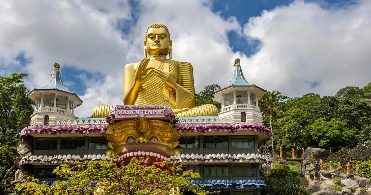
Dambulla
Central Province
# Dambulla Cave Temple: Sri Lanka's Golden Cave Sanctuary Carved into a 160-metre rock that rises over the plains of the Cultural Triangle, the Dambulla Cave Temple is the largest and best-preserved cave-temple complex in Sri Lanka and a UNESCO World Heritage Site. Five caves hold more than 150 Buddha statues and some 2,100 square metres of painted ceilings and walls — a living monastery that has been in continuous use for over two thousand years. It's an easy, rewarding pairing with Sigiriya, just 30 minutes north. ## The History of Dambulla The story begins in the 1st century BCE, when King Valagamba (Vattagamani Abhaya) was driven from his throne in Anuradhapura and spent 14 years in exile hiding among these caves, sheltered by the local monks. When he reclaimed his kingdom, he repaid the debt by converting the caves into a magnificent rock temple. Over the following centuries, successive kings expanded and embellished it. King Nissanka Malla is credited with gilding the interior in the 12th century — the origin of the name "Golden Temple." Later rulers restored the statues, repainted the murals and added the entrance structures you see today. Through wars, invasions and dynasties, the caves have remained a place of worship, which is exactly what gives them their atmosphere: this is a working temple, not a museum. ## What to See at Dambulla The complex has five main caves, each opening off a long sheltered terrace high on the rock face. ### Cave 1 — Devaraja Lena (Temple of the King of Gods) The oldest cave, dominated by a 14-metre reclining Buddha carved directly from the living rock, right down to the pillow beneath his head. ### Cave 2 — Maharaja Viharaya (Temple of the Great Kings) The largest and most spectacular chamber, with more than 50 standing and seated Buddhas, statues of kings and gods, and ceilings covered edge to edge in murals of the Jataka tales. A natural spring drips sacred water from the ceiling into a vessel — even in drought. ### Cave 3 — Maha Alut Viharaya (Great New Temple) An 18th-century addition from the Kandyan period, full of statues and vividly painted ceilings in the classic Kandyan style. ### Caves 4 & 5 Smaller shrines completing the complex, with their own Buddha images and a quieter, more intimate feel away from the crowds. ## Ticket Prices & Opening Hours The temple usually opens around 7:00 AM. The ticket booth sits at the *bottom* of the hill, near the giant golden Buddha statue — not at the caves themselves. - Foreign adults: around **LKR 2,000** (about US$6–7) - SAARC-country visitors: reduced rate on presentation of a passport - Children: half price, and free for the very young > Buy your ticket at the booth by the golden Buddha *before* you start climbing — there's no counter at the top, and travellers regularly climb all the way up only to be sent back down. Prices have risen recently and are paid in cash, so carry small notes. ## Practical Tips for Visiting Dambulla - **Bring socks.** Shoes must be removed before the caves, and the sun-baked paving and green entrance carpet get scorching by midday — socks save your feet. - **Dress respectfully.** Shoulders and knees must be covered for everyone; a light scarf or wrap does the job. - **Go early or late.** The climb is about 15 minutes of steps in the open. Early morning is cool and quiet; late afternoon brings a beautiful light and sunset over the plains. - **Watch the monkeys.** Troops around the entrance are bold and food-aggressive — keep snacks and lotus flowers out of sight. - **No flash.** Photography is allowed inside, but flash is banned to protect the ancient murals. ## How to Get to Dambulla Dambulla sits right on the main road in the heart of the Cultural Triangle, making it one of the easiest heritage sites to reach. It's about 30 minutes from [Sigiriya](/sigiriya-rock-fortress-travel-guide), an hour from [Polonnaruwa](/polonnaruwa-ancient-city), and roughly a 4-hour drive from Colombo. Most travellers visit as a half-day stop, often on the same day as Sigiriya — climbing the rock in the cool morning and the caves in the golden afternoon. ## Why Dambulla Stays With You Sigiriya impresses you with ambition; Dambulla moves you with devotion. Stepping from the glare of the terrace into a cool, incense-heavy cave — where a reclining Buddha stretches the length of the rock and two thousand years of painted stories arc overhead — is one of those quiet moments Sri Lanka does so well. It has been a place of refuge and faith for 22 centuries, and it still is. ## Frequently Asked Questions ### How much does it cost to enter Dambulla Cave Temple? Foreign adults pay around LKR 2,000 (roughly US$6–7), with reduced rates for SAARC nationals and children. Prices have been rising and are paid in cash, so confirm at the booth and carry small notes. ### What time does Dambulla Cave Temple open? It generally opens around 7:00 AM. Early morning is coolest and quietest; late afternoon offers great light and sunset views. ### How long does a visit take? Allow about two to three hours, including the roughly 15-minute climb and time to explore all five caves. ### Is there a dress code? Yes. As an active temple, shoulders and knees must be covered, and shoes are removed before entering the caves — bring socks for the hot paving. ### Can I combine Dambulla with Sigiriya? Easily. They're only about 30 minutes apart, and doing both in one day — Sigiriya in the morning, Dambulla in the afternoon — is the classic Cultural Triangle plan.

Kandy
Central Province
# Kandy: Sri Lanka's Hill Capital of Culture and Calm Nestled among misty mountains and tea-covered hills, Kandy is the cultural heart of Sri Lanka. Home to the sacred Temple of the Tooth Relic, a shimmering lake, and lush botanical gardens, this UNESCO World Heritage city offers a perfect blend of spirituality, history, and natural beauty. --- ## Getting There Kandy is roughly 3 hours from Colombo by car, or a scenic 3–4 hour train ride through emerald paddy fields and hillside villages. - By train: The Colombo–Kandy line is one of the most scenic rail journeys in the country - By car or taxi: Fastest option via the Colombo–Kandy Expressway - By bus: Budget-friendly, frequent departures from Colombo > Book train tickets in advance, especially for the observation carriage — it fills up fast during peak season. --- ## What to See Kandy's charm lies in its mix of sacred sites and natural escapes. 1. Temple of the Sacred Tooth Relic (Sri Dalada Maligawa) — the city's spiritual centerpiece 2. Kandy Lake — a peaceful walking spot right in the city center 3. Royal Botanical Gardens, Peradeniya — home to over 4,000 species of plants 4. Udawattakele Forest Reserve — a quiet jungle escape just above the city 5. Kandy Cultural Triangle — nearby ancient cities like Sigiriya and Dambulla > Visit the Temple of the Tooth during the evening puja (offering ceremony) for a truly memorable cultural experience. --- ## Culture and Experiences Kandy is best known for the *Esala Perahera*, a spectacular ten-day festival featuring drummers, dancers, and beautifully adorned elephants parading through the streets. - Watch a traditional Kandyan dance performance in the evening - Explore local markets for handmade crafts, batik, and spices - Try authentic Sri Lankan curry and rice at a family-run restaurant - Visit a working tea factory in the surrounding hills --- ## Where to Stay Kandy offers everything from boutique hillside villas to budget guesthouses. - Luxury: Hotels overlooking the lake with panoramic mountain views - Mid-range: Boutique stays near the temple, walkable to major sights - Budget: Guesthouses in the surrounding hills, often with home-cooked meals --- ## Best Time to Visit The dry season from *December to April* offers the most pleasant weather for sightseeing. However, visiting during the *Esala Perahera* festival (July or August) is a once-in-a-lifetime cultural experience, even with larger crowds. --- ## Final Tips - Dress modestly when visiting temples — shoulders and knees should be covered - Remove shoes and hats before entering temple grounds - Carry a light jacket, as evenings in the hills can be cool - [Learn more about Sri Lankan Cultural Triangle sites](https://example.com/) Kandy isn't just a destination — it's a slower, gentler rhythm of Sri Lanka, where sacred traditions and natural beauty exist side by side.
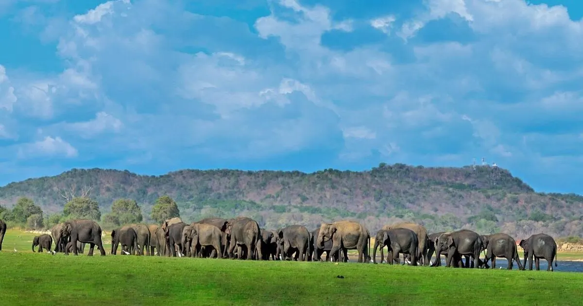
Minneriya
North Central Province
# Minneriya: Where the Herds Come Home Minneriya National Park, in Sri Lanka's North Central Province, is the stage for one of Asia's greatest wildlife spectacles: The Gathering, when as many as 300 wild Asian elephants converge on the shore of an ancient reservoir. Set squarely inside the Cultural Triangle near Habarana, Sigiriya and Polonnaruwa, the park spans roughly 89 square kilometres of grassland, scrub and wetland around the 3rd-century Minneriya Tank. Entry costs around USD $25 per adult (closer to $35 all-in with fees and VAT, jeep hire extra), the park is open daily from about 6:00 AM to 6:00 PM, and the elephants are at their most dramatic between July and October. We've lost count of the times we've watched first-timers fall silent in a jeep here. You come expecting a few elephants in the distance. Instead the treeline breaks open and a hundred of them are already there — bulls, matriarchs, gangly adolescents and calves small enough to disappear behind their mothers' legs — all drawn to the same shrinking water. It is, quietly, one of the most moving things you can witness in Sri Lanka. --- ## History The story of Minneriya begins not with elephants but with an engineer-king. In the **3rd century AD, King Mahasena** ordered the construction of the *Minneriya Wewa* (the Minneriya Tank), a vast irrigation reservoir fed by canal from the Amban River. It was part of the astonishing hydraulic civilisation that made the dry-zone kingdoms of [Anuradhapura](/anuradhapura) and later [Polonnaruwa](/polonnaruwa) flourish — a network of tanks so sophisticated that some are still in use seventeen centuries later. For most of its life the tank was about water and rice. Only in **1997 was the surrounding land declared a national park**, and in 2002 it was folded into a wider protected corridor linking Minneriya with [Kaudulla](/kaudulla) and Wasgamuwa. What the ancient builders never intended, but inadvertently created, was the perfect elephant magnet: a reliable body of water in a landscape that bakes dry every summer. > The Minneriya Tank was built to feed a kingdom's rice paddies. Fifteen hundred years later it feeds something else entirely — the largest seasonal gathering of wild elephants on Earth. --- ## What to See ### The Gathering This is why you're here. As the dry season deepens, water sources across the region evaporate, and the receding tank exposes a fringe of lush, freshly grown grass on the old lakebed. Elephants — who each need up to 150 kg of food and 100–200 litres of water a day — walk in from as far as 50 kilometres away. By **August and September**, herds that normally keep to the forest merge into a single, restless congregation. On a good afternoon you may see **200 to 350 elephants** at once, socialising, sparring, bathing and shepherding their young. ### Birdlife on the Tank Even when the giants aren't the story, the wetland is. The tank draws **painted storks, spot-billed pelicans, the rare lesser adjutant, cormorants, egrets and eagles**, while the surrounding scrub hides jungle fowl, hornbills and hanging parrots. Come early in the morning and the birds, not the elephants, are the main event. ### The Supporting Cast Minneriya is *elephant country first* — you won't get the big-cat odds of [Yala](/yala) here — but patient eyes are rewarded. **Spotted deer and sambar** graze the margins, **water buffalo** wallow in the shallows, and you may glimpse **wild boar, purple-faced langur, toque macaque, crocodiles and monitor lizards**. Leopard and sloth bear exist in the park but sightings are genuinely rare, so treat any as a gift rather than an expectation. ### The Landscape Itself Don't spend the whole drive scanning for animals. The park is a mosaic of grassland, scrub, forest, rocky outcrops and the wide silver sheet of the tank — and in the late-afternoon light, with dust hanging gold in the air and elephants silhouetted against the water, it's as photogenic a scene as the island offers. --- ## Ticket Prices & Opening Hours Sri Lankan national park pricing is layered, so here's how it actually breaks down for a foreign visitor: - **Park entry fee:** around **USD $25 per adult** (non-SAARC foreigner) - **Typical all-in cost:** **~$35 per person** — that's entry plus the per-vehicle service charge (~$8–10), a vehicle permit (Rs 150–500) and **18% VAT**, calculated for two adults sharing one jeep. Larger groups pay less per head. - **Jeep hire (separate):** roughly **Rs 7,000–8,000** for a half-day, **Rs 14,000–17,000** for a full day - **SAARC nationals and children (6–12):** roughly **50%** of the standard rate - **Payment:** in **Sri Lankan rupees, in cash, at the gate** — even where a price is quoted in dollars, you pay the LKR equivalent at the day's rate (~319 LKR to the dollar in early 2026) **Opening hours:** open **daily, roughly 6:00 AM to 6:00 PM**. Safaris run in two slots — a **morning drive from around 6:00 AM** and an **afternoon drive from around 3:00 PM** — each lasting about three hours. > Prices shift with the exchange rate and periodic government revisions. Treat these as a planning guide and confirm the current figure with your operator or the Department of Wildlife Conservation before you go — and always ask for an **all-in written quote** so the jeep, entry and VAT are clear up front. --- ## Practical Tips - **Go in the afternoon for elephants.** The herds emerge from the forest to graze and drink as the day cools; the 3:00 PM safari is your best shot, and the low light is far kinder to photographs. - **Go in the morning for birds and calm.** If you care more about the wetland and want fewer jeeps around you, the 6:00 AM slot is quieter. - **Check whether the elephants have moved.** In some years the herds shift to neighbouring [Kaudulla](/kaudulla) or Wasgamuwa. A good guide will know that morning where the animals actually are — ask before you commit. - **Book a reputable operator, not just the cheapest jeep.** Naturalist drivers know the tank's seasonal patterns and, crucially, keep a respectful distance instead of crowding the herd for a photo. - **Keep your distance and stay quiet.** Guidance is at least 50 metres from elephants. Don't approach, feed or provoke — a startled matriarch with calves is not something to test. - **Bring the basics:** water, a hat, sunscreen, binoculars, and a zoom lens if you have one. There are only basic facilities at the entrance, so eat in Habarana or Sigiriya. - **Carry LKR cash.** Card terminals are unreliable at the gate. - **Pair it with the Cultural Triangle.** Minneriya slots naturally into a day that also takes in [Sigiriya](/sigiriya), [Dambulla](/dambulla) or [Polonnaruwa](/polonnaruwa) — it's a half-day, not a full one. --- ## How to Get There The park entrance sits on the **Habarana–Polonnaruwa road**, deep in the Cultural Triangle, which makes it one of the easiest safaris to reach in Sri Lanka. - **From Habarana:** about 15–20 minutes by road — this is the natural base, and most safari operators pick up here. - **From [Sigiriya](/sigiriya):** roughly 30–40 minutes, an easy add-on after a morning at Lion Rock. - **From [Dambulla](/dambulla):** around 45 minutes to an hour. - **From [Polonnaruwa](/polonnaruwa):** about 45 minutes, so you can pair the ancient city with an afternoon safari. - **From Colombo:** roughly a 4.5–5 hour drive; most visitors come as part of a wider Cultural Triangle loop rather than a day trip. The simplest approach is to have your accommodation or a local operator arrange a **jeep with hotel pickup** — self-driving into the park isn't the way you experience it. --- ## The Gathering vs the Rest: Why Minneriya Is Special It's fair to ask how Minneriya compares to Sri Lanka's other elephant parks, because the honest answer shapes when you should go. - **[Udawalawe](/udawalawe)** offers the most *reliable* elephant sightings year-round — if you simply want to be sure of seeing elephants on any given day, it's the safer bet. - **[Kaudulla](/kaudulla)** is Minneriya's twin, sharing the same herds; in some months the animals are here instead, and a good operator will send you to whichever park is holding the elephants. - **[Yala](/yala)** is the leopard park — a different kind of safari altogether, with big-cat drama but nothing like Minneriya's numbers. What makes Minneriya *singular* is scale. Nowhere else on the planet do this many wild Asian elephants gather in one place at one time. In peak season it isn't a sighting — it's a congregation, a whole society of elephants assembled on a single shore. That's the experience you can't replicate, and it's the reason Minneriya earns its place on so many Sri Lanka itineraries. --- ## Why Minneriya Stays With You Most wildlife encounters are a matter of luck and glimpses — a tail, a rustle, a shape that might have been something. Minneriya, in the right season, gives you the opposite: abundance. You sit in a jeep at the edge of a golden lakebed and the elephants keep coming, family after family, until the count stops mattering and you just watch. We think what lingers isn't the number, though. It's the ordinariness of it from the elephants' side — the calves stumbling, the teenagers shoving, the old matriarchs ignoring you entirely while they get on with the serious business of drinking. For an hour you're not the main character. You're a guest at something ancient and unbothered, held together by a reservoir a king built to grow rice. That's the feeling you carry back down the Habarana road — and the one that pulls people back. --- ## Frequently Asked Questions ### What is the best time of year to see the elephant gathering at Minneriya? The Gathering runs roughly **July to October**, with **August and September the peak**, when the dry season is at its most intense and the largest herds converge on the tank. Outside these months you can still see wild elephants — just in smaller numbers and less predictably. ### How much does a Minneriya safari cost in total? Budget around **USD $35 per person all-in** for park entry, service charge, vehicle permit and VAT (based on two adults sharing a jeep), **plus jeep hire** of roughly Rs 7,000–8,000 for a half-day. Always ask your operator for a single written quote that includes everything, and confirm current rates before you travel. ### What time should I do the safari — morning or afternoon? For **elephants, go in the afternoon** (the ~3:00 PM slot), when the herds leave the forest to feed and drink near the water and the light is best for photos. For **birds and a quieter park**, take the ~6:00 AM morning drive. ### Can you see elephants at Minneriya outside the Gathering season? Yes, though not in the same numbers. Elephants are present year-round, and even a January or off-season visit usually turns up wild elephants along with deer, buffalo, monkeys and abundant birdlife. If guaranteed elephants matter more than the spectacle, [Udawalawe](/udawalawe) is the more reliable year-round option. ### Is Minneriya or Kaudulla better for elephants? They share the same herds, so the better park depends on **where the elephants are that week**. In some months the animals shift to [Kaudulla](/kaudulla). Book with an operator who checks on the day and takes you to whichever park is holding the gathering. ### How long does a Minneriya safari take? A typical jeep safari lasts about **three hours** inside the park, so allow a **half-day** overall once you factor in pickup and travel time from Habarana or Sigiriya. ### Is Minneriya National Park worth visiting? If you're anywhere near the Cultural Triangle during the dry season, yes — the scale of the Gathering is something you genuinely can't see elsewhere. Pair it with [Sigiriya](/sigiriya), [Dambulla](/dambulla) or [Polonnaruwa](/polonnaruwa) and it becomes one of the most memorable half-days of a Sri Lanka trip.
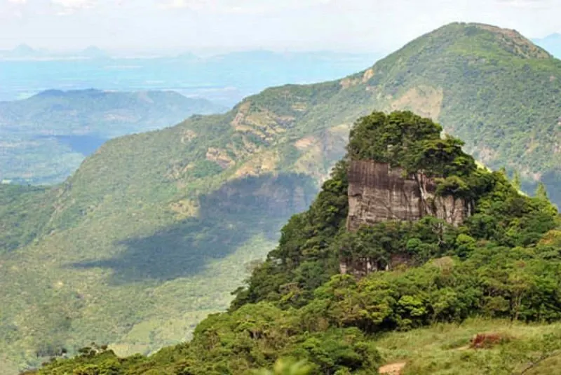
Riverstone
Central Province
# Riverstone: Where the Mountains Breathe Mist Riverstone (often spelled Riverston) is a windswept stretch of the Knuckles Mountain Range in Sri Lanka's Matale District, roughly 30 kilometres from Matale town at around 1,265 metres above sea level. Its centrepiece is Pitawala Pathana, a rare montane grassland that ends abruptly at Mini World's End — a sheer 300-metre drop reached by an easy 800-metre walk across the plain. Entry to the grassland costs around LKR 975 (about USD $3) for foreign visitors, the area is open daily from roughly 6:00 AM to 6:00 PM, and the best months for clear mountain views are December to April. With waterfalls, a mist-wrapped viewpoint tower and endemic species found nowhere else on Earth, Riverstone is the hill country at its wildest and least crowded. We always tell people the same thing about Riverstone: roll your window down on the drive up. Long before you reach the ticket office, the air changes — warm lowland heat giving way to something cool and clean, mist spilling across the road, the whole world hushed except for the wind. This is a place you feel on your skin before you see it, and by the time you're standing at the edge of the plain with the Knuckles rolling away into cloud, you understand why locals guard it so fondly. --- ## History Riverstone sits inside the **Knuckles Conservation Forest**, part of the range the British named for its resemblance to a clenched fist and that Sri Lankans call *Dumbara Kanduvetiya* — the "misty mountains." In 2010 the Knuckles range was inscribed, alongside Horton Plains and the Peak Wilderness, as part of the **Central Highlands of Sri Lanka UNESCO World Heritage Site**, recognised for extraordinary endemism and a climate that shifts from soaking wet to near-arid within a few kilometres. The colonial-era planters who came for the cool climate are said to have felt at home in these hills, and the anglicised name stuck. But the land itself is far older than any estate. **Pitawala Pathana** — *patana* being the Sinhala word for the natural upland grasslands of the hill country — is an ancient plain of turf grown thin over a sloping slab of rock, a habitat the IUCN describes as a rare grassland type that evolved for these exact conditions and exists nowhere else in the country. > The Knuckles range packs the climate of half of Sri Lanka into one massif — cloud forest, wet grassland and dry scrub, sometimes on opposite sides of the same ridge. --- ## What to See ### Mini World's End at Pitawala Pathana The star of Riverstone. A gentle **800-metre walk** across the velvety grassland brings you to *Punchi Lokanthaya* — "Mini World's End" — where the plateau simply falls away in a vertical drop of around 300 metres. Two rocky outcrops let you stand right at the lip, with the northern foothills of the Knuckles unrolling to the horizon. On a clear morning the view is immense; when the cloud rushes up the escarpment, you're left staring into pure white. ### The Riverston Gap & Viewpoint Tower Before the grassland, the road crests at the **Riverston Gap**, one of the windiest, most exposed points on the whole route. A short climb leads to a **viewpoint tower** that delivers a 360-degree sweep of the central hills. It's the kind of spot where you plant your feet, lean into the gale and grin — and it's especially magical at sunrise, before the day's haze rolls in. ### Sera Ella & the Waterfalls The range's hydrology feeds a string of cascades. **Sera Ella** is the beauty — a wide, umbrella-shaped fall with a *dry cave tucked behind the curtain of water*, where you can sit on the rocks and feel the cold spray. **Bambarakiri Ella** is dramatic but demands respect (see our safety note below), and the crystal-cold **Thelgamu Oya** offers bracing pools for a dip. *Waterfalls run fullest between November and March.* ### The Grassland's Endemic Life Look closer and Pitawala Pathana reveals its rarities. It shelters two species found only in Sri Lanka — a grass called *Patan Ala* and a frog named after the Knuckles itself, the *Dumbara galpara* toad — alongside insect-eating sundew plants, hornbills, eagles and a wealth of reptiles and amphibians. This is a place to walk slowly and tread lightly. --- ## Ticket Prices & Opening Hours - **Foreign visitors:** around **LKR 975 (about USD $3)** per person for Pitawala Pathana / Mini World's End - **Local visitors:** a nominal fee, roughly **LKR 60** (some sources quote less) - **Where you pay:** at the ticket office near the car park on the Riverston road; a valid **Knuckles Range ticket** is required to enter the grassland - **Opening hours:** open **daily, roughly 6:00 AM to 6:00 PM** - **Time needed:** the walk to Mini World's End and back takes about **45–60 minutes** at a relaxed pace > Prices and ticketing arrangements here change more often than at the big cultural sites, and some operators now bundle entry with a compulsory guide. Treat these figures as a guide and confirm the current rate at the office before you set out — carry small **LKR cash**, as there's nowhere to pay by card. --- ## Practical Tips - **Come early.** Mornings are cooler, mistier and far clearer; by midday the haze builds and the magic thins. Sunrise at the Riverston tower is worth the alarm. - **Dress for wind and weather.** It can be genuinely cold and ferociously windy up top, and mist can turn to drizzle in minutes. Bring a light jacket even on a sunny lowland day. - **Respect Bambarakiri Ella.** Bathing is prohibited after multiple drownings, and the hanging bridge between the upper and lower falls is broken and unsafe to cross — admire it from the bank only. - **Mind the cliff edge.** There are no railings at Mini World's End, the wind is strong and the rock can be slick — keep well back from the lip, especially with children. - **Wear proper shoes** and, in the wet season, pack **leech socks** — the damp grassland and forest trails attract them. - **Bring your own food and water.** Facilities are basic: toilets and a small canteen near the entrance, but little else. Carry out all your rubbish. - **Check the road and your vehicle.** The Matale–Rattota approach is winding with hairpin bends; a tuk-tuk manages it, but go slow. - **Pair it with a hill-country or Cultural Triangle loop.** Riverstone slots naturally into a trip that also takes in [Kandy](/kandy), the Aluvihara cave temple near Matale, or a run north to [Dambulla](/dambulla) and [Sigiriya](/sigiriya). --- ## How to Get There Riverstone lies about **30 kilometres from Matale** along the scenic, hairpin-laced Matale–Rattota–Girandurukotte road, with **Rattota** the gateway town before the climb. - **From Matale:** roughly 1 to 1.5 hours by car or tuk-tuk over about 30 km of winding road - **From [Kandy](/kandy):** about 2.5 hours (~75 km), the most common base for day-trippers - **From [Dambulla](/dambulla):** around 1.5–2 hours, so it pairs with a Cultural Triangle itinerary - **From Colombo:** a long 4–5 hour drive (~160 km); best done as an overnight rather than a day trip - **By public transport:** take a bus or train to Matale, then arrange a tuk-tuk or taxi up to Riverston — there's no direct service to the grassland itself The simplest option is a **day trip from Kandy or Matale** with a driver who knows the road, or an overnight at one of the small eco-lodges near the range. --- ## Riverstone vs Horton Plains: Two Mini World's Ends Sri Lanka has more than one "World's End," and travellers often ask how Riverstone's compares to the famous one at [Horton Plains](/horton-plains). The honest answer is that they're cut from the same cloth but feel completely different. - **Crowds:** Horton Plains draws big tour convoys and early-morning queues. Riverstone is *gloriously quiet* — on a weekday you may have the plain almost to yourself. - **Cost & effort:** Horton Plains carries a steep national-park fee and a 9 km loop. Riverstone asks a few dollars and an easy 800-metre stroll. - **The edge itself:** at Horton Plains you view World's End from a fenced platform; at Riverstone's Mini World's End you can stand right at the unguarded lip — thrilling, and a reason for real caution. What makes Riverstone special isn't that it out-does the big names — it's that it stays *undiscovered*. This is the hill country before the tour buses found it, and that rarity is the whole point. --- ## Why Riverstone Stays With You Some places impress you; Riverstone gets under your skin. It's the wind, mostly — the way it never stops, the way it pushes clouds across the grass so fast that the whole plain seems to breathe. You walk out to the edge of the world, the mist parts for a heartbeat to reveal a hundred kilometres of blue-green mountains, and then it closes again like a held secret. We think what lingers is the *emptiness*, in the best sense. No railings, no crowds, no gift shops — just grass and rock and sky, and the sense that you've slipped through to a Sri Lanka that most visitors never see. You come down the mountain wind-scoured and a little exhilarated, already half-planning the next trip up. That's Riverstone's quiet magic: it doesn't perform for you, and somehow that's exactly why it stays. --- ## Frequently Asked Questions ### How much does it cost to visit Riverstone and Mini World's End? Foreign visitors pay around **LKR 975 (roughly USD $3)** per person for Pitawala Pathana, where Mini World's End is located; locals pay a small nominal fee. Ticketing and prices change fairly often and some operators bundle a guide, so confirm the current rate at the office and carry LKR cash. ### What is the best time of year to visit Riverstone? For **clear views and comfortable hiking**, aim for the dry season, roughly **December to April** (January to March is ideal). The **May–August monsoon** brings heavier mist, lush greenery and the fullest waterfalls, but tougher, leech-prone trails. Whatever the season, go **early in the morning** before the afternoon haze. ### How long is the walk to Mini World's End? It's an easy **800-metre walk** each way across the grassland, and the whole visit — out to the viewpoint and back — usually takes about **45 to 60 minutes**, longer if you linger for photos. ### Is Riverstone better than Horton Plains? They're similar in spirit but different in feel. [Horton Plains](/horton-plains) has the famous World's End but bigger crowds, a higher fee and a longer loop. Riverstone is **cheaper, quieter and easier to reach on a short walk** — though its cliff edge is unfenced, so it demands more care. ### How do I get to Riverstone from Kandy? It's about a **2.5-hour drive (~75 km)** from Kandy, usually via Matale and Rattota along a winding mountain road. Most visitors come as a **day trip with a driver**, or take a bus/train to Matale and hire a tuk-tuk or taxi from there. ### Is Riverstone safe to visit? Generally yes, with sensible care. Keep **well back from the unguarded cliff edge** at Mini World's End, don't bathe at **Bambarakiri Ella** (bathing is banned after several drownings and its hanging bridge is broken), and drive the winding roads slowly. Bring warm layers for the wind and cold. ### Can you see waterfalls at Riverstone? Yes — the area is dotted with cascades, the loveliest being **Sera Ella**, known for the dry cave behind its curtain of water. Waterfalls are at their most powerful between **November and March**, after the wetter months have fed the streams.
Anuradhapura
North Central Province
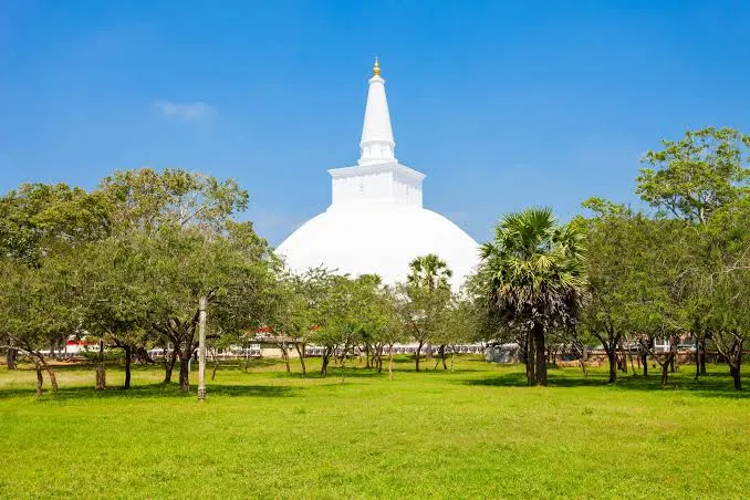
# Anuradhapura: Sri Lanka's First Sacred Capital Anuradhapura is Sri Lanka's oldest capital and the spiritual heart of the Cultural Triangle, a vast sacred city in the North Central Province where colossal white stupas, ruined monasteries, and the world's oldest historically documented tree have drawn pilgrims for more than two thousand years. Founded in the 4th century BC and the seat of Sinhalese kings for close to fourteen centuries, it is a UNESCO World Heritage Site spread across roughly 40 square kilometres of dry-zone plain. We come to Anuradhapura not for a single monument but for a whole vanished civilisation, still half-alive under the bo trees. Monkeys pick their way along ruined walls, saffron-robed monks cross the grass in the early light, and pilgrims in white file past dagobas so large they seem to belong to the landscape rather than to any king. This is the oldest and quietest corner of the Cultural Triangle — less theatrical than [Sigiriya], less compact than [Polonnaruwa], but older and more sacred than either. --- ## History Legend and history braid together here. The city takes its name from a minister called Anuradha who first settled the site, but it entered the record in the 4th century BC when King Pandukabhaya made it his capital and laid out its reservoirs, boundaries and quarters. For the next fourteen hundred years, until the court finally shifted south to Polonnaruwa in the 11th century AD, Anuradhapura was the beating heart of the island. Its golden age arrived with Buddhism. In the 3rd century BC the missionary *Mahinda*, son of the Indian emperor Ashoka, met King Devanampiya Tissa at nearby [Mihintale] and converted the court — the moment Sri Lanka became a Buddhist nation. Soon after, the nun *Sangamitta* arrived carrying a sapling from the very tree at Bodh Gaya under which the Buddha attained enlightenment. That sapling still grows today. What followed was one of the ancient world's great hydraulic civilisations. Kings such as *Dutugemunu*, *Vasabha* and *Mahasena* raised enormous *dagobas* (stupas) and dug vast reservoirs — the *wewas* — that turned the parched northern plain into rice country. At its height Anuradhapura was among the largest cities on earth. Invasions from South India, and the slow silting of its tanks, eventually emptied it; the jungle closed over the ruins until British surveyors and archaeologists began clearing them in the 19th century. > Anuradhapura was continuously inhabited for around 1,400 years — making it one of the longest-lived capital cities in human history, and older than Rome's imperial peak. --- ## What to See The sacred city is huge, and the great monuments sit kilometres apart across parkland, tanks and forest. A bicycle is the classic way to link them. Here are the ones we would not miss. ### Sri Maha Bodhi The spiritual centre of the entire city, and arguably of the island. The *Jaya Sri Maha Bodhi* is a sacred fig grown from a branch of the Bodhi tree at Bodh Gaya, planted here in the 3rd century BC — the oldest tree in the world with a continuous written record of its planting and care. Approached up terraces hung with prayer flags, tended by generations of custodians, it is a place of hushed, powerful devotion. Come at dawn, cover your shoulders and knees, and remove your shoes. ### Ruwanwelisaya The most beloved of the great stupas — a brilliant white dome raised by King Dutugemunu in the 2nd century BC to enshrine relics of the Buddha. Ringed by a wall of stone elephants and endlessly whitewashed by devotees, it glows almost painfully bright at midday and turns rose-gold at sunset. Pilgrims in white circle it clockwise; sitting on the warm marble terrace to watch them is one of Anuradhapura's quietly unforgettable experiences. ### Jetavanaramaya A mountain of red brick. When it was completed in the 3rd century AD, this *dagoba* stood over 120 metres high and was one of the tallest structures in the ancient world — behind only the great pyramids of Giza. Even ruined and un-plastered, its sheer bulk is staggering. The nearby museum displays exquisite carvings, jewellery and ritual objects recovered from the monastery that once surrounded it. ### Abhayagiri Once a vast and cosmopolitan monastic university that drew monks from across Asia, Abhayagiri today is a serene spread of dagoba, ruins and forest north of the centre. Two of Anuradhapura's finest treasures sit within its complex: the *Samadhi Buddha*, a 4th–5th century seated statue whose calm expression Nehru famously kept a photograph of for solace, and the *Kuttam Pokuna* or Twin Ponds, a pair of elegantly engineered bathing tanks fed by an ingenious ancient filtration system. ### Thuparamaya The oldest *dagoba* in Sri Lanka, built in the 3rd century BC to enshrine the Buddha's collarbone relic. Slender and graceful, ringed by the broken stone columns that once supported a roof over the whole structure, it is smaller and more intimate than the great stupas — a good place to understand how these monuments began. ### Isurumuniya A rock temple on the southern edge of the city, carved into a boulder above a lotus pond, and home to the famous *Isurumuniya Lovers* — a tender 6th-century stone carving of a seated couple. Small, atmospheric and only a short walk from the Tissa Wewa reservoir, it makes a lovely late-afternoon stop. ### Lovamahapaya (the Brazen Palace) A ghostly forest of some 1,600 stone pillars, all that remains of a nine-storey monastic building that once had a roof of bronze tiles. Little survives above the columns, but standing among them gives a vivid sense of the scale on which Anuradhapura's monks once lived and studied. --- ## Ticket Prices & Opening Hours *Opening hours:* CCF ticket counters run from **7:00 am to 5:00 pm**. The sacred precincts themselves open earlier — around 5:30–6:00 am — for dawn devotions, and museums close at 5:00 pm. The ancient-city roads stay walkable at dusk. Your ticket is valid for **single entry on the day of purchase only**. > Buy online in advance through the official CCF portal (eservices.ccf.gov.lk) to skip the counter queues — then collect the physical ticket at the site with your order receipt and original passport. Photocopies are not accepted. --- ## Practical Tips - *Start at dawn.* The light is soft, the stones are still cool underfoot, and the pilgrimage atmosphere at Sri Maha Bodhi and Ruwanwelisaya is at its most moving before the heat and crowds arrive. - *Rent a bicycle.* The sites are spread across kilometres of flat parkland; a bike (around LKR 300 per day) is the ideal pace, letting you glide between stupas under the trees. - *Dress respectfully.* Shoulders and knees must be covered at all sacred sites. White is traditional and practical in the heat. You will remove shoes and hats at the stupas — carry thick socks, as the sun-baked stone gets fierce by midday. - *Beware ticket scams.* Ignore tuk-tuk drivers who offer to route you around checkpoints or collect the entrance fee on your behalf. Buy only from official CCF counters or the online portal. - *Manage the heat.* Anuradhapura sits in the dry zone and runs hot year-round (28–36°C). Carry plenty of water, a hat and sunscreen, and rest through the midday hours. - *Drones need permission.* Filming with drone cameras at heritage and religious sites requires prior written approval from the CCF. - *Give it time.* A full day covers the highlights; two lets you slow down and take in Abhayagiri, Mihintale and Isurumuniya without rushing. --- ## How to Get There Anuradhapura lies in Sri Lanka's North Central Province, roughly 200–205 km north of Colombo, and forms the northwestern anchor of the Cultural Triangle. - *By train:* The Northern Line runs from Colombo Fort in about 4–5 hours, a scenic and affordable ride with several morning departures. Reserve seats in advance through the official railway site or at station counters when you can. - *By car or private driver:* Around 4–4.5 hours via the Kandy or Puttalam roads. A hired car with driver is the most flexible option and pairs well with a wider Cultural Triangle loop. - *By bus:* Frequent intercity and CTB buses connect Colombo, Kandy and Dambulla to Anuradhapura's central bus stand. Cheap, if slower and busier than the train. - *Within the Triangle:* [Sigiriya] is about 70 km east, [Polonnaruwa] roughly 100 km, and [Dambulla] around 65 km — all comfortable half-day connections by car. --- ## Anuradhapura vs Polonnaruwa: Which Ancient City? Travellers with time for only one of Sri Lanka's ruined capitals often agonise over this choice. The short version: they offer very different experiences. - *Anuradhapura* is older, larger, more sacred and more atmospheric. It is a *living* pilgrimage site — its stupas are still worshipped, its bo tree still tended — but its monuments are spread far apart, so you cover ground and the story unfolds slowly. - *[Polonnaruwa]* is younger, more compact and more archaeologically legible. Its ruins — palaces, the Gal Vihara Buddhas, garden pavilions — sit close together and are easier to cover in half a day. If you want spirituality, scale and a sense of deep time, choose Anuradhapura. If you want concentrated, camera-ready ruins on a tighter schedule, choose Polonnaruwa. With two days, do both — and let [Sigiriya] and [Dambulla] complete the set. --- ## Why Anuradhapura Stays With You Some places impress you; Anuradhapura settles into you. It is the sheer accumulation of time — a tree that has been watered by hand for more than two thousand years, a dome of whitewashed brick still circled every dawn by pilgrims who never once think of it as a ruin. There is no single dramatic view to tick off, no viral photograph to chase. Instead there is space, and silence, and the slow realisation that faith here is not a museum piece but an unbroken thread. We remember the small things most: the warmth of marble under bare feet, the flap of prayer flags at Sri Maha Bodhi, a monk's robe bright against grey stone, the enormous quiet of Jetavanaramaya at the end of the day. Anuradhapura asks you to slow down to its own ancient pace — and rewards you, if you do, with a feeling of standing inside history rather than merely looking at it. --- ## Frequently Asked Questions ### How much does it cost to visit Anuradhapura? Foreign adults need a Sacred City ticket costing around US$30 (about LKR 9,000), issued by the Central Cultural Fund and covering the major stupas, monasteries and museums. Children aged 6–12 pay roughly half, and under-6s go free. A few sites — Isurumuniya, Mihintale and Ritigala — are ticketed separately. Prices are set in US dollars but paid in rupees at the day's rate, so confirm the exact figure at the counter. ### How many days do you need in Anuradhapura? One full day is enough to see the headline monuments — Sri Maha Bodhi, Ruwanwelisaya, Jetavanaramaya, Abhayagiri and Thuparamaya — especially if you start at dawn and cycle between them. Two days let you add Mihintale, Isurumuniya and the quieter corners at a gentler pace, which suits the contemplative mood of the place. ### Is Anuradhapura or Polonnaruwa better to visit? Anuradhapura is older, larger and more sacred, with monuments spread across a wide, atmospheric landscape and living pilgrimage still at its centre. Polonnaruwa is younger, more compact and easier to cover quickly. Choose Anuradhapura for scale and spirituality, Polonnaruwa for concentrated ruins on a tight schedule — or visit both if your itinerary allows. ### Can you visit Anuradhapura and Sigiriya in one day? It is possible but rushed — the two sites are about 70 km apart. Most travellers base themselves in the Cultural Triangle for two or three days and give each site its own morning. If you must combine them, climb Sigiriya at dawn and reach Anuradhapura for a late-afternoon visit, or vice versa. ### What is the best time of day to visit Anuradhapura? Early morning, without question. The sacred precincts open around dawn, the light is beautiful, the stone is cool underfoot, and the pilgrimage atmosphere is at its most powerful before the midday heat. Late afternoon into sunset is the fine second choice, when Ruwanwelisaya glows gold and the tanks turn to mirrors. ### Do you need a guide for Anuradhapura? Not strictly, but a good guide adds a great deal — the ruins are spread out and lightly labelled, and the history is dense. A knowledgeable driver-guide or a licensed site guide can turn scattered stones into a coherent, moving story. Independent travellers do fine with a map, a bicycle and a little reading beforehand. ### What should you wear in Anuradhapura? Cover your shoulders and knees at all sacred sites, and be ready to remove shoes and hats at the stupas and the bo tree. Light, loose clothing suits the heat; white is traditional and cooling. Bring thick socks — the sun-baked stone around the shrines can be scorching by midday.
Polonnaruwa
North Central Province
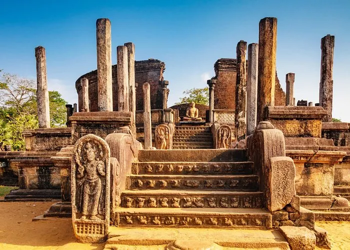
# Polonnaruwa: Sri Lanka's Medieval Capital in Stone Polonnaruwa is Sri Lanka's second ancient capital and the most complete of the Cultural Triangle cities, a compact medieval kingdom of palaces, temples and rock-cut Buddhas set beside a vast man-made sea in the North Central Province. It flourished from the 11th to the 13th century, after the fall of Anuradhapura, and is a UNESCO World Heritage Site whose ruins are far better preserved and more tightly clustered than its older neighbour's. Where Anuradhapura is sprawling and sacred, Polonnaruwa is legible and worldly — a real medieval city you can read like a map. We wheel between a king's audience hall and his bathing pool, past a circular relic-house ringed with guardstones, and end up standing silent before four colossal Buddhas carved from one living rock. It is the Cultural Triangle at its most rewarding for anyone who wants to understand how an ancient capital actually *worked*, and it pairs perfectly with [Sigiriya] and the [Dambulla] cave temples on a two- or three-day loop. --- ## History Polonnaruwa's story begins with a conquest. In the late 10th century the South Indian Chola empire sacked [Anuradhapura] and moved the island's capital here, to a more defensible spot beside the Mahaweli plain. For decades Polonnaruwa was a Chola city, studded with Hindu shrines — a legacy still visible in its stone *devales* today. Sinhalese rule returned in the 11th century when King *Vijayabahu I* drove out the Cholas and made Polonnaruwa his own capital. But the city's golden age belongs to *Parakramabahu I* (1153–1186), one of the great builder-kings of Asia. He unified the island, laid out planned quarters and monasteries, and — most famously — dammed the plain into the enormous *Parakrama Samudra*, the "Sea of Parakrama," a reservoir so vast it looks like an inland ocean. His guiding principle has echoed down the centuries. > "Let not even a single drop of rainwater reach the sea without first serving the people." — the philosophy of King Parakramabahu I, whose irrigation works still water the region today. After Parakramabahu came *Nissanka Malla*, a prolific (and self-promoting) builder who added many of the monuments in the sacred quadrangle. But renewed invasions and the shifting of the kingdom southward saw Polonnaruwa abandoned within a century. Because its life was short and its collapse relatively gentle, the city was never rebuilt over — which is exactly why its ruins survive so intact. --- ## What to See Polonnaruwa's monuments run roughly north from the museum and old town, strung along a single main road that a bicycle covers easily. These are the essentials. ### Gal Vihara The undisputed masterpiece, and reason enough to visit. Four enormous Buddha images — a seated figure, a second seated in an artificial cavern, a 7-metre standing figure, and a 14-metre reclining Buddha entering *parinirvana* — are carved from one long wall of grey-and-pink granite. The serenity of the faces and the fluid folds of stone robe rank among the finest sculpture in Asia. Come early, stay a while; these figures reward slow looking. ### The Royal Palace of Parakramabahu The ruined heart of the medieval city, once a great hall said to have risen seven storeys. Thick brick walls, the sockets that held massive wooden beams, and the adjoining *Council Chamber* — its base carved with a procession of elephants, each subtly different — give a vivid sense of royal power. The nearby *Kumara Pokuna*, the royal bathing pool with its crocodile-mouth spouts, completes the palace quarter. ### The Sacred Quadrangle (Dalada Maluwa) A raised terrace packed with the city's most exquisite religious buildings. The circular *Vatadage* — a relic-house ringed by stone pillars, guardstones and moonstones, with a seated Buddha at each cardinal point — is the jewel. Around it stand the *Hatadage*, the *Atadage*, the curious stone "book" of the *Gal Potha* inscription, and the pyramid-like *Satmahal Prasada*. No other spot packs so much artistry into so small a space. ### Rankot Vihara & Kiri Vihara Polonnaruwa's great dagobas. *Rankot Vihara*, built by Nissanka Malla, is the largest — a red-brick dome echoing the giant stupas of Anuradhapura. *Kiri Vihara* ("Milk-White Shrine") is smaller but famous for its lime plaster, which survived so well that it was still gleaming white when the jungle was cleared seven centuries later. ### Lankatilaka & the Northern Group At the city's northern end, the towering brick walls of *Lankatilaka* frame a huge standing (now headless) Buddha in a roofless cathedral of a shrine — the scale is genuinely awe-inducing. Nearby lie the delicate *Lotus Pond*, carved as tiers of stone petals, and the *Tivanka Image House*, whose interior still holds fragile traces of ancient frescoes. ### Parakrama Samudra Not a monument but the setting for everything else: a 2,500-hectare reservoir built by Parakramabahu, still functioning after eight centuries. A colossal rock-carved statue on its bund — often identified as the king himself, holding what may be a palm-leaf manuscript or the yoke of kingship — gazes out over the water. Sunset here, with fishermen's silhouettes and distant birds, is the loveliest hour in Polonnaruwa. --- ## Ticket Prices & Opening Hours Tickets are issued by the *Central Cultural Fund (CCF)* and pegged in US dollars but paid in Sri Lankan rupees at the day's exchange rate, so treat these as a close guide and confirm at the counter. *Opening hours:* CCF ticket counters and the site run from roughly **7:00 am to around 5:00–6:00 pm**, with the museum closing at 5:00 pm. Tickets are valid for a *single day's entry*. Start at 7–8 am to beat both the heat and the tour buses. > Visit the museum *first*. Its scale models and recovered artefacts turn what could feel like scattered brick foundations into a living, understandable city — and it's already covered by your ticket. --- ## Practical Tips - *Hire a bicycle.* At LKR 300–500 a day, a bike is the perfect way to cover Polonnaruwa's flat, tree-shaded main road. The site is compact enough to cycle comfortably in a morning, before the midday heat sets in. - *Go early or late.* The dry-zone sun is fierce by mid-morning. An early start rewards you with soft light and empty ruins; a tuk-tuk is the more comfortable choice if you must move around at midday. - *Dress respectfully.* Shoulders and knees covered at religious sites; remove shoes and hats at the Vatadage, Gal Vihara and other shrines. Light clothing and thick socks (for hot stone) both help. - *Give Gal Vihara extra time.* Most visitors rush it. Sit with the four Buddhas for a while — early morning, before the coaches arrive, is magical. - *Carry water and sun protection.* There's little shade at some of the larger monuments, and no reliable shops mid-site. - *Watch for wildlife.* Wild elephants roam the surrounding reserves, and toque macaques (the "temple monkeys" of a famous nature documentary) are everywhere — keep food sealed away. - *Plan a full day.* Polonnaruwa is compact but dense; 5–8 hours does it justice without rushing the highlights. --- ## How to Get There Polonnaruwa lies in the eastern Cultural Triangle, about 140 km northeast of Kandy and roughly 210 km from Colombo, making it an easy hub for the wider region. - *By car or private driver:* The most flexible option — around 3–3.5 hours from Kandy, or 5–6 from Colombo. Ideal if you're looping the Cultural Triangle. - *By train:* Colombo's eastern line reaches Polonnaruwa (Gal Oya / Polonnaruwa stations) in roughly 6–7 hours — scenic but slow; best as part of a longer journey. - *By bus:* Direct intercity buses run from Colombo (Bastian Mawatha), Kandy and Dambulla to Polonnaruwa's new town; cheap and frequent, if crowded. - *Within the Triangle:* [Sigiriya] is about 70 km west, [Dambulla] around 65 km, and [Anuradhapura] roughly 100 km — all comfortable half-day connections. [Minneriya] National Park, famous for its elephant "gathering," is barely 30 minutes away. --- ## Polonnaruwa vs Anuradhapura: Which Ancient City? If your schedule allows only one of Sri Lanka's ruined capitals, here's the honest comparison. - *Polonnaruwa* is younger, more compact and more intact. Its palaces, dagobas and the masterpiece of Gal Vihara sit close together along one road, so you can cover the whole medieval city in a single satisfying day — ideal for photographers and anyone on a tight schedule. - *[Anuradhapura]* is older, larger and more sacred — a living pilgrimage site whose monuments are spread across a wide, atmospheric landscape, and which asks for a slower, more contemplative visit. Choose Polonnaruwa for concentrated, well-preserved ruins and superb sculpture; choose Anuradhapura for scale, spirituality and deep time. With two days you can do both — and [Sigiriya] and [Dambulla] complete the classic Cultural Triangle set. --- ## Why Polonnaruwa Stays With You Polonnaruwa lingers because it lets you *inhabit* the past rather than merely glimpse it. You cycle the same avenues a medieval court once walked, rest in the shade of a king's council chamber, and trace your fingers (from a respectful distance) along elephants carved by hands eight centuries gone. Nothing here is guessed at or half-imagined; the city is whole enough that the leap of imagination is small. And then there is Gal Vihara — four faces of stone so calm and so exact that visitors fall quiet without being asked. We remember the reclining Buddha most: fourteen metres of granite that somehow reads as weightless, the soles of the feet turned toward us, the whole figure poised at the threshold between life and *nirvana*. You come to Polonnaruwa for a ruined city and leave having stood in front of one of the world's great works of art. --- ## Frequently Asked Questions ### How much does it cost to visit Polonnaruwa? Foreign adults need an Ancient City ticket costing around US$30 (about LKR 9,000), issued by the Central Cultural Fund, which covers all the main archaeological sites and the on-site museum. Children aged 6–12 pay roughly half, under-6s and local visitors go free, and SAARC nationals get a reduced rate. Prices are set in US dollars but paid in rupees at the day's rate, so confirm the figure at the counter. ### How many days do you need in Polonnaruwa? One full day is plenty. Because the ruins are compact and well-clustered, 5–8 hours on a bicycle covers the Royal Palace, the Sacred Quadrangle, the great dagobas, the northern group and Gal Vihara without rushing. Many travellers see Polonnaruwa as a day trip from a base in Sigiriya or Habarana. ### Is Polonnaruwa or Anuradhapura better to visit? Polonnaruwa is younger, more compact and more intact, with monuments close together and easier to cover in a day — great for a tighter schedule. Anuradhapura is older, larger and more sacred, spread across a wide landscape and still an active pilgrimage centre. Choose Polonnaruwa for concentrated ruins and sculpture, Anuradhapura for scale and spirituality — or do both if you can. ### What is the best way to see Polonnaruwa? By bicycle. The site is flat, shaded along its main road, and compact enough that cycling between monuments in the early morning is both practical and enjoyable. Bikes hire for around LKR 300–500 a day at the entrance; in the midday heat, a tuk-tuk with a driver is the more comfortable alternative. ### Can you visit Polonnaruwa and Sigiriya in one day? It's possible but rushed — the two are about 70 km apart, Sigiriya needs 2–3 hours and Polonnaruwa deserves a full day. If time is very short, climb Sigiriya at dawn and reach Polonnaruwa for the afternoon, accepting that you'll miss some of it. Better, if you can, to give each site its own day. ### What is Gal Vihara and why is it special? Gal Vihara is a group of four Buddha statues carved from a single granite outcrop in the 12th century — a seated figure, another seated in a cave, a large standing figure and a great reclining Buddha. The serenity of the faces and the mastery of the stone-carving place it among the finest sculpture in Asia, and it's widely considered the highlight of the entire Cultural Triangle. ### What should you wear in Polonnaruwa? Cover your shoulders and knees at religious sites, and be ready to remove shoes and hats at the shrines. Light, loose clothing suits the dry-zone heat, and thick socks help on stone that gets scorching by midday. A hat, sunscreen and plenty of water are essential, as shade is limited at some of the larger ruins.

Jaffna
North Province
# Jaffna: Sri Lanka's Northern Soul, Where the Island Leans Toward India Jaffna is the capital of Sri Lanka's Northern Province and the beating heart of the island's Tamil and Hindu culture, sitting roughly 400 kilometres and about seven and a half hours by road north of Colombo. It is a low, flat, sun-bleached peninsula of golden temples, a shattered-and-rebuilt Dutch fort, palmyra palms, coral-fringed islands you reach by Navy ferry, and some of the most electrifying food in the country. Long closed to visitors during the civil war and only fully reopened in the years after 2009, Jaffna still feels gloriously off the standard tourist trail — closer in spirit to Tamil Nadu than to the beaches of the south, and best visited in the drier northern window of roughly May to September. We came to Jaffna expecting ruins and history lessons. We left thinking about the smell of crab curry, the colour of a gopuram at dawn, and the wild horses of an island at the edge of the country. This is a place that rewards curiosity. --- ## History Jaffna's story is one of kingdoms, colonisers, and remarkable resilience. The peninsula was the seat of the medieval *Jaffna Kingdom* (the Kingdom of Aryacakravarti), a Tamil power that flourished from the 13th century and controlled the north for some three hundred years before falling to the Portuguese in the early 1600s. The Europeans arrived in layers. The *Portuguese* built the first fort here around 1618; the *Dutch* seized and dramatically expanded it after 1658 into one of the great star-forts of Asia; and the *British* held it from 1796 until independence in 1948. Each left fingerprints — in churches, street grids, and the clipped colonial bones of the old town. The modern chapter is harder and more recent. Jaffna was a focal point of Sri Lanka's civil war, changing hands more than once and enduring years of siege and shelling. The burning of the *Jaffna Public Library* in 1981 — and the loss of tens of thousands of irreplaceable Tamil manuscripts — remains one of the most wounding symbols of that era. The library has since been lovingly rebuilt, its white façade once again gleaming, and it stands today as a monument to memory and recovery. > To understand Jaffna is to understand that its beauty and its grief share the same streets. The rebuilt library, the army-occupied fort, the flourishing temples — these are not separate stories but one continuous act of return. --- ## What to See Jaffna is a city you explore in fragments — a temple here, a colonial ruin there, a beach or an island a tuk-tuk ride away. Here are the pieces we'd never skip. ### Jaffna Fort (the Dutch Fort) Sprawling over the lagoon in a great five-pointed star, this is the second-largest fort in Sri Lanka and the town's defining landmark. Much of the interior was reduced to rubble during the war and remains atmospherically ruined — crumbling ramparts, a part-restored Dutch church, and wide grassy bastions. Walk the walls in the late afternoon, when the light turns gold over the lagoon and the Kayts causeway. Note that the fort is still an active army garrison, so you're wandering a working military site as much as a heritage one. ### Nallur Kandaswamy Kovil The spiritual epicentre of the peninsula and, for us, the single most unforgettable sight in Jaffna. This vast Hindu complex, dedicated to Lord Murugan and rebuilt in its present form in 1734, is a riot of golden *gopurams*, deep red-and-white striped walls, and hypnotic Dravidian carving. Time your visit for a *pooja* ceremony, when drums and bells fill the courtyards. Dress is strictly traditional — more on that below. ### Jaffna Public Library One of the most moving buildings in Sri Lanka. Its serene white colonial architecture belies a turbulent history, and stepping inside is a quiet act of solidarity with a community that rebuilt what was taken from it. Even a short visit lands differently once you know the story. ### The Islands: Nagadeepa and Delft West of the peninsula, a scatter of islands sits in the Palk Strait, halfway to India. *Nainativu (Nagadeepa)* holds two revered pilgrimage sites side by side — the Buddhist Nagadeepa Purana Viharaya and the Hindu Nagapooshani Amman Kovil — a rare, beautiful coexistence. Further out, *Delft Island (Neduntheevu)* is windswept and half-empty, famous for its herds of wild horses, Dutch ruins, a giant baobab, and a curious "growing stone." Both are reached by ferry from Kurikkaduwan Jetty. ### Keerimalai Springs & the Far North For a day beyond the town, string together the freshwater *Keerimalai Springs* beside the sea, the ancient Buddhist stupa ruins at *Kadurugoda (Kandarodai)*, the northernmost tip of the island at *Point Pedro*, and the miniature desert of the *Manalkadu Dunes*. Cap it with a swim at Casuarina or Kankesanthurai (KKS) beach. --- ## Ticket Prices & Opening Hours Because Jaffna is a whole region rather than a single monument, most of its landmarks are free — the costs are in the getting-around. Here's the current picture, though northern tourism figures change often, so treat these as a guide and confirm locally. - *Jaffna Fort:* Open daily, roughly *8:00 AM to 6:00 PM*. Entry was free for years, but recent 2026 reports list a fee of *around USD 5 for foreign adults* (about USD 2.50 for children 6–12, under-6s free, SAARC nationals 50% off; locals around LKR 60). Because sources disagree, confirm at the gate. - *Nallur Kandaswamy Kovil:* *Free entry*, donations customary. Open daily, broadly from early morning until midday and again from mid-afternoon into the evening, with several *pooja* times through the day. Strict dress code applies. - *Jaffna Public Library:* Free or a nominal charge; open on weekdays and Saturday mornings, generally closed Sunday and on public holidays. - *Nainativu (Nagadeepa) ferry:* Around *LKR 80–160* per person from Kurikkaduwan Jetty, roughly a 20-minute crossing, running frequently through the day. - *Delft Island ferry:* Navy-operated and free or nominal, but typically *one round trip a day* — out around 9:00 AM, back around 2:30 PM — with island residents given priority for seats. > Prices are stated in Sri Lankan rupees and are best paid in cash. Foreign-visitor fees at ticketed sites are usually recalculated from a US-dollar rate, so carry small notes and don't rely on card machines. --- ## Practical Tips - *Come in the right season.* Jaffna runs on the opposite rhythm to the south — the driest, most comfortable months are roughly *May to September*, while the northeast monsoon brings rain from about October to January. - *Dress for the temples.* At Nallur and other kovils, men are expected to *remove their shirts* to enter the inner sanctum, and everyone should cover shoulders and legs. Remove footwear before entering. - *Hire a tuk-tuk by the day.* A full-day driver (roughly LKR 3,000–5,000) is the easiest way to stitch together the scattered sights, and drivers double as informal guides. - *Bring cash.* ATMs exist in town, but islands, beaches, and small eateries are cash-only. Card acceptance is thin. - *Pack for the islands.* Delft has almost no facilities — take water, snacks, sun cover, and anything you'll need for the day. - *Photography etiquette.* Inside temple sanctums, photos (and sometimes phones) are prohibited. Always ask before photographing people or ceremonies. - *Eat adventurously.* Jaffna's cuisine is a highlight in itself — spicier and more seafood-forward than the south, built on palmyra, crab, and mango. --- ## How to Get There Jaffna sits at the northern end of the A9 highway and the northern railway line, so reaching it is genuinely part of the experience. - *By train:* The most scenic and comfortable option. The *Yal Devi Express* from Colombo Fort takes about *7 hours*, with second-class reserved seats around *LKR 1,200–2,500*. It's calmer and less crowded than the famous hill-country lines. A lovely shortcut for Cultural Triangle travellers: pick the train up at [Anuradhapura] and reach Jaffna in roughly three hours. - *By bus:* Direct services along the A9 take *6–7 hours* for about *LKR 1,500–2,000* — cheap, frequent, and no-frills. - *By car:* Around *400 km* and *7 to 7.5 hours* from Colombo. The A9 has been substantially resurfaced and the drive is smoother than it once was. - *By air:* Domestic flights serve Jaffna (Palaly) with limited schedules, cutting the journey to about an hour; there are also direct international flights from Chennai. --- ## Why Jaffna Is Different from the Cultural Triangle It's worth being clear about geography, because Jaffna is often lumped in with Sri Lanka's ancient heartland and it really shouldn't be. The [Cultural Triangle] — [Sigiriya], [Dambulla], [Polonnaruwa], [Anuradhapura] — is Sinhalese-Buddhist, monumental, and clustered in the centre of the island. Jaffna is Tamil-Hindu, living rather than archaeological, and a long way north. Where [Sigiriya] gives you a single breathtaking climb and a crowd, Jaffna gives you a *whole culture* to wander through, largely to yourself. Think of it not as another ancient-city checkbox but as the natural, revelatory *extension* of a Cultural Triangle trip: base yourself at [Anuradhapura], then ride the rails north into a Sri Lanka that most visitors never see. The two halves make each other richer — the deep Buddhist past in the centre, and the vivid Tamil present at the top of the map. --- ## Why Jaffna Stays With You Some destinations impress you and fade; Jaffna lodges itself somewhere deeper. Maybe it's the moment a temple courtyard erupts into drums at dusk, or the strange peace of walking a ruined fort where soldiers still stand guard. Maybe it's the wild horses on Delft, unbothered at the edge of the country, or a plate of crab curry so good it reorganises your idea of Sri Lankan food. But mostly it's the resilience. This is a place that was closed off, fought over, and grieved, and that has quietly, stubbornly reopened its temples, rebuilt its library, and set out its ferries again. To visit Jaffna is to be welcomed into that return. We think you'll leave, as we did, already planning the trip back. --- ## Frequently Asked Questions ### Is Jaffna safe to visit now? Yes. Jaffna has been open to visitors for well over a decade and is a calm, welcoming place to travel, with developing but perfectly workable tourist infrastructure. The fort remains an active army site and you'll see a military presence, but for ordinary travellers the peninsula is straightforward and friendly. ### How many days do you need in Jaffna? Two full days is a sensible minimum — one for the town (fort, Nallur, library, market) and one for an island trip to Nagadeepa or Delft. Three days lets you add the second island plus the far-north loop of Keerimalai, Point Pedro, and the beaches without rushing. ### What is the best time of year to visit Jaffna? Roughly *May to September*, the drier northern season, is ideal. This is the reverse of the south's calendar, which makes Jaffna a smart dry-weather escape when the southwest is wet. The northeast monsoon brings rain from about October to January. ### Is Jaffna part of the Cultural Triangle? No. Jaffna is the capital of the Northern Province, a Tamil-Hindu region far to the north, whereas the Cultural Triangle is the Sinhalese-Buddhist ancient heartland in the centre of the island. They pair beautifully on a longer itinerary — the [Anuradhapura]-to-Jaffna train is the easy link — but they are distinct regions. ### How do you get from Colombo to Jaffna? By train (the Yal Devi Express, about 7 hours), by direct A9 bus (6–7 hours), by car (around 400 km and 7–7.5 hours), or by a short domestic flight to Palaly. The train is the most comfortable and scenic choice for most travellers. ### What food is Jaffna famous for? Jaffna is a food destination in its own right, celebrated for crab curry, *odiyal kool* (a hearty palmyra-and-seafood broth), fiery Tamil-style curries, and palmyra-based sweets and mango. Local ice cream is also something of an institution — save room. ### Can non-Hindus enter Nallur Kandaswamy Kovil? Yes, non-Hindus are welcome, provided you respect the strict dress code — men remove their shirts for the inner sanctum, and everyone covers shoulders and legs and goes barefoot. Avoid photographing the sanctum, and visit during a *pooja* for the fullest experience.
Ella
Central
# Ella: Where Sri Lanka's Hills Learn to Float Ella is a small hill-country town in Sri Lanka's Uva Province, perched at around 1,000 metres where endless tea gardens give way to a dramatic notch in the mountains known as Ella Gap. Famous for the Nine Arch Bridge, gentle hikes up Little Adam's Peak and Ella Rock, tumbling waterfalls, and one of the world's most beautiful train journeys, Ella is the highlands' most-loved base — cool, green, and refreshingly walkable. Most of its headline sights are free to visit, which makes it one of the best-value stops on any Sri Lanka itinerary. We came to Ella for one photograph and stayed for three days. That is the pattern here. You arrive planning to tick off a bridge, and you leave having learned the name of the woman who pours your morning tea, having watched mist pour over a ridge like something spilled, having missed a train on purpose. Ella doesn't rush. Neither, eventually, do you. --- ## History Ella is young by Sri Lankan standards. While the island's [Cultural Triangle](/sigiriya-travel-guide) was raising rock fortresses and cave temples over a thousand years ago, these hills stayed quiet, forested, and largely unpeopled until the nineteenth century. *The tea came first.* When leaf blight destroyed Ceylon's coffee estates in the 1870s and 80s, British planters replanted the Uva highlands with tea, and the cool, misty slopes around Ella turned out to be some of the finest growing country on earth. Uva tea — bright, brisk, faintly menthol from the seasonal winds — still carries a reputation among connoisseurs today. The estates brought roads, bungalows, and eventually a railway. ### The Bridge in the Sky That railway gave Ella its most famous landmark. The **Nine Arch Bridge** was raised in the early twentieth century as the line pushed east toward Badulla, and it was built almost entirely of stone, brick, and cement — very little steel. The much-loved local story holds that steel was scarce during the First World War, so the crews improvised with what the hills could offer. A Ceylonese builder often named in the telling, P.K. Appuhami, is remembered as the man who made it stand. Whether or not every detail is history or folklore, the result is undeniable: a graceful, curving span of nine arches, floating between two tunnels in a sea of green. ### Ravana's Kingdom Ella also lives in far older story. In the *Ramayana*, the demon-king Ravana is said to have carried the princess Sita to Lanka and hidden her in the caves and waterfalls of these very hills. **Ravana Falls** and **Ravana Cave** take their names from that epic, and for many Hindu pilgrims the landscape around Ella is not just scenic — it is scripture made solid. ## What to See Ella's great gift is that almost everything worth seeing is a walk, not a queue. Here is where we'd point you first. ### Nine Arch Bridge The one you came for, and it earns the hype. Set the alarm early — arrive by 7 a.m. and you'll have the viaduct nearly to yourself, the light soft and gold, the valley still cool. When a blue train curls slowly across the arches, the whole crowd holds its breath at once. You can walk the trackside path down from Ella town or take the jungle trail; either way, the last stretch is a lovely 15–20 minute descent through tea and forest. > *Tip:* Train times over the bridge shift constantly, and even more so under the post-cyclone special timetable. Don't chase a fixed schedule — ask your guesthouse the night before, then get there early and be patient. The bridge is worth a wait even when the train is late. ### Little Adam's Peak The friendliest big view in Sri Lanka. Named for its resemblance to the far taller sacred [Adam's Peak](/adams-peak-travel-guide), this is a gentle roughly two-hour round trip from town, most of it an easy stroll through tea gardens before a short climb to a ridge of viewpoints. From the top you look straight across Ella Gap, with Ella Rock brooding opposite. Go for sunrise if you can; go anyway if you can't. ### Ella Rock The serious sibling. Ella Rock is a steeper, longer half-day hike (allow 4–5 hours round trip) that follows the railway line before turning up through eucalyptus and tea to a cliff-edge summit. The trail is famously easy to lose — hand-painted signs, forks, and "helpful" locals who materialise to guide you for a tip. We'd suggest a proper guide or a downloaded offline map, an early start, and no plans afterward. ### Ravana Falls & Ravana Cave A few kilometres south of town, **Ravana Falls** spills in wide ribbons right beside the road — no hike, no ticket, just pull over and look (skip the swimming when the water is high and fast). Nearby, **Ravana Cave** rewards a stiff climb of several hundred steps with a modest cavern steeped in legend and a broad view; most visitors come for the myth and the effort more than the cave itself. ### Tea Country You are standing in it, so drink it in properly. A working tea factory such as the Uva Halpewatte estate above town runs guided tours through the whole journey from plucked leaf to graded black tea, ending — of course — with a tasting and a view. It's the best hour you'll spend learning what all this green is actually *for.* ## Ticket Prices & Opening Hours Here is the happy headline: **Ella is astonishingly cheap.** Its signature sights are free, and the paid ones cost pocket change. - *Ella town, viewpoints & Ella Gap* — **Free.** - *Nine Arch Bridge* — **Free.** It's a live railway bridge, not a gated attraction; open access in daylight, best very early morning. - *Little Adam's Peak* — **Free.** Open trail, dawn to dusk. - *Ella Rock* — **Free** (you may choose to tip a guide). Open trail; start early. - *Ravana Falls (roadside view)* — **Free**, viewable any time. - *Ravana Cave* — a small fee, around **Rs 250** for foreigners (roughly USD 1); open daylight hours, about 6 a.m.–6 p.m. *Confirm on arrival, as local-site fees change often.* - *Tea factory tour* — a modest guided-tour fee including tasting; factories such as Halpewatte typically run tours from about **8:30 a.m. to late afternoon.** *Confirm the current price and last-tour time on site.* ### The Train The famous journey is a bargain if you buy from the railway itself. Official government fares are tiny — *around USD 2 for third class and around USD 4 for second class* on the standard service — though prices should always be confirmed at the station, and reserved second/first-class observation seats and special tourist trains (the Ella Odyssey and Calypso services) cost considerably more. > *Be warned:* agents and touts buy up the scenic-route tickets and resell them for €15–25 or more. Reserved seats open exactly 30 days before travel and vanish within minutes, so book early and buy from official channels where you can. ### An Important 2026 Update Cyclone Ditwah tore through the hill country in late November 2025 and badly damaged the upcountry railway. The good news: the spectacular **Nanu Oya–Ella–Badulla stretch — the section that crosses the Nine Arch Bridge — reopened for passenger service in mid-2026** and is running again on a special timetable. The catch: the **Kandy end of the line was still under repair** at the time of writing, so the classic all-the-way Kandy-to-Ella train may not be running as one seamless ride. Full restoration is targeted for late 2026, but deadlines have slipped before — *always check the current status with Sri Lanka Railways or your guesthouse before you plan around a specific train.* ## Practical Tips - *Stay at least two nights.* Ella is a place to slow down; one night is a photo, two is a visit, three is a small love affair. - *Set early alarms.* The good light, the empty trails, and the clear views all belong to sunrise. By mid-morning the crowds and the cloud both roll in. - *Pack layers.* At 1,000 metres the mornings and evenings are genuinely cool, and rain can arrive without warning even in "dry" months. - *Wear real shoes.* Trails get slick and stepped, especially after rain — flip-flops will betray you on Ella Rock. - *Carry small cash.* Café bills, cave fees, and tuk-tuks are easiest in rupees; ATMs exist in town but can be temperamental. - *Book train seats ~30 days ahead* through official channels, and treat any "sold out, but I have tickets" offer with healthy suspicion. - *Hire a guide for Ella Rock* if you're at all unsure — the navigation, not the climb, is the hard part. - *Respect the railway.* People walk the tracks for photos, but trains are quiet and quick — keep children close and step well clear. ## How to Get There Ella sits in the southeast of the hill country and is a natural link between the highlands and the south coast. - *By train:* The obvious romantic choice, health of the line permitting (see the 2026 update above). The Nanu Oya–Ella–Badulla run is one of the world's great rail journeys; from [Nuwara Eliya](/nuwara-eliya-travel-guide), Nanu Oya is the nearest station. - *By road from [Kandy](/kandy-travel-guide):* Roughly 5–6 hours by car or van through winding tea country — slow but gorgeous, and a reliable fallback when the train is disrupted. - *By road from the south coast:* Around 3–4 hours up from the Mirissa/Tangalle area, often paired with a safari at Udawalawe or [Yala National Park](/yala-national-park-travel-guide) on the way. - *Getting around town:* Ella itself is walkable, and tuk-tuks fill every other need. Many travellers hire one for a half-day loop of the bridge, cave, falls, and a tea factory. ## Why Ella Beats "Just One More Temple" If you've spent days among the ancient stones of [Sigiriya](/sigiriya-travel-guide), [Dambulla](/dambulla-travel-guide), and [Polonnaruwa](/polonnaruwa-travel-guide), Ella is the exhale your itinerary needs. Where the Cultural Triangle asks you to look *up* — at frescoes, at summits, at fifteen centuries of history — Ella asks you to look *out,* across tea and cloud, and to move at the pace of a walking morning. It also pairs beautifully with its highland neighbours. A classic loop threads [Kandy](/kandy-travel-guide) into [Nuwara Eliya](/nuwara-eliya-travel-guide) for tea and the misty plateau of [Horton Plains](/horton-plains-travel-guide), then down to Ella to slow the whole trip's heartbeat before the coast. Few places give you world-class scenery, gentle hikes, and near-zero entrance fees all at once. Ella does. ## Why Ella Stays With You Long after the photos are filed away, it isn't the Nine Arch Bridge you remember most sharply. It's the *quiet* around it — the way the valley holds its breath before a train, the smell of woodsmoke and wet tea at dawn, the particular blue of the hills going dark from your seat by an open carriage door. Ella is not a monument you conquer and leave. It's a rhythm you slip into and are reluctant to leave behind. We came for one photograph. We think about the mornings. ## Frequently Asked Questions ### Is Ella worth visiting, and how many days do you need? Yes — for many travellers Ella is a highlight of the whole island. Two nights is the sweet spot: enough for the Nine Arch Bridge and Little Adam's Peak at sunrise, a waterfall or tea factory, and one longer hike like Ella Rock. Add a third night if you want to genuinely relax rather than tick boxes. ### How much does it cost to visit Ella's attractions? Very little. Ella's most famous sights — the Nine Arch Bridge, Little Adam's Peak, Ella Rock, and the roadside Ravana Falls view — are all free. Ravana Cave charges a small fee (around Rs 250 for foreigners), and a guided tea-factory tour costs a modest amount including a tasting. The scenic train, bought officially, is only a few US dollars in standard classes. ### Is the Kandy to Ella train running in 2026? Partly. Cyclone Ditwah damaged the upcountry line in late 2025. The scenic Nanu Oya–Ella–Badulla section that crosses the Nine Arch Bridge reopened in mid-2026, but the Kandy end of the line was still under repair at the time of writing, so a single seamless Kandy-to-Ella ride may not be available. Full restoration is expected by late 2026 — check the current status with Sri Lanka Railways before you plan. ### What is the best time of day to see the Nine Arch Bridge? Early morning, ideally by 7 a.m. The light is soft and golden, the temperature is cool, and the crowds haven't arrived. Train crossing-times shift often — and more so under the current special timetable — so ask your guesthouse the night before and get there early rather than chasing a fixed time. ### Little Adam's Peak or Ella Rock — which hike should I choose? If you want a short, easy, family-friendly walk with a huge payoff, choose Little Adam's Peak (about two hours round trip). If you're a confident hiker after something longer and quieter, choose Ella Rock (a steeper 4–5 hour round trip on a trail that's easy to lose). With time and legs for it, do both — on separate mornings. ### What's the best time of year to visit Ella? Ella's driest, clearest window is roughly **December to March**, with generally good conditions stretching into the shoulder months. Being in the hills, Ella can catch cloud and showers year-round, so early starts beat afternoon mist in any season. Pack for cool mornings whenever you come. ### How do I get from Nuwara Eliya or the south coast to Ella? From Nuwara Eliya, the nearest railhead is Nanu Oya, from which the scenic line runs down to Ella (line status permitting), or it's a few hours by road. From the south coast around Mirissa or Tangalle, Ella is roughly 3–4 hours by car, often combined with a safari at Udawalawe or Yala en route.
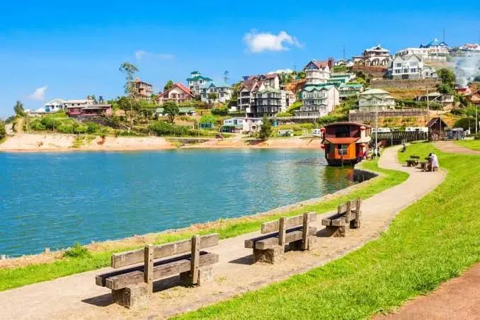
Nuwara Eliya
Central Province
# Nuwara Eliya: Little England, Wrapped in Mist Nuwara Eliya is Sri Lanka's highest town, a former British hill station sitting at around 1,868 metres in the heart of the central highlands, famous for its cool climate, emerald tea estates, colonial architecture, Gregory Lake, and its role as the gateway to Horton Plains and the sheer drop of World's End. Nicknamed "Little England," it swaps tropical heat for log fires, Tudor gables, clipped hedges, and hillsides quilted in tea. It's the place Sri Lankans come to feel cold on purpose — and the coolest, greenest pause on any hill-country itinerary. We arrived in Nuwara Eliya wearing shorts and spent the first evening buying a jumper. That is the town's small joke on every visitor: you come to a tropical island and end up beside a fire, watching mist slide down a hill of tea while somebody pours a pot of the finest Ceylon. It shouldn't quite make sense, and that's exactly why we loved it. --- ## History Nuwara Eliya — the name means "City on the Plain," though "City of Light" is the translation locals prefer — barely existed two centuries ago. It was a cold, marshy plateau known to Kandyan kings but settled by almost no one until the British arrived. *The turning point was an Englishman with a gun and an idea.* The explorer Samuel Baker — later famous for tracing the Nile — stumbled on the plain while hunting in the 1840s and decided this cool, high country could be made into a slice of home. Within a few decades the British had built exactly that: a hill station of stone churches, a racecourse, a golf course, half-timbered bungalows, and grand hotels, all arranged around a climate that let homesick colonials wear tweed and light fires in the tropics. ### Little England The colonial bones are still everywhere. The pink-brick **Post Office**, the **Grand Hotel** and the members-only **Hill Club**, the **Victoria Park** gardens, the 18-hole golf course, and Anglican churches like Holy Trinity give the town its enduring nickname. It became the *summer capital* of British Ceylon, where the government and its tea planters retreated from the lowland heat — and much of that stage set survives, a little faded, wholly charming. ### The Tea That Built It Coffee came first, then blight, then tea — the same story as the wider hill country, but Nuwara Eliya's altitude gave it a special place in it. The high, cool estates around town produce some of the world's most prized *high-grown* Ceylon tea: light, bright, and delicate. The plantations that clothe every surrounding slope aren't scenery bolted onto the town; they are the reason the town exists. ### An Older Legend Just south of town, the **Hakgala Botanical Garden** carries a thread of far older story. In the *Ramayana*, it is identified by many with *Ashok Vatika* — the garden where the demon-king Ravana held the princess Sita captive — linking these cool highland slopes to the same epic that names the waterfalls and caves down in [Ella](/ella-travel-guide). ## What to See Nuwara Eliya rewards both the active and the idle — you can hike a cloud-forest escarpment at dawn and be taking afternoon tea in a colonial lounge by three. ### Horton Plains & World's End The region's headline act. **Horton Plains National Park**, a UNESCO-listed montane plateau above town, holds one of Sri Lanka's great walks: a roughly 9 km loop across silver grasslands and cloud forest to **World's End**, where the land simply stops and falls away nearly 900 metres into the haze. Baker's Falls waits on the return leg. Go at dawn — this view has a strict deadline (see the tip below). > *Tip:* World's End clouds over by mid-to-late morning almost every day. Enter the park at opening (6 a.m.) and reach the cliff before roughly 9–10 a.m., or you'll be photographing a wall of white mist instead of the drop. ### Gregory Lake The town's easygoing heart. This colonial-era reservoir is now a lakeside park where families paddle swan boats, couples cycle the shore, and pony rides plod past flowerbeds. It's not wild nature — it's a gentle, pretty, thoroughly enjoyable afternoon, especially good with kids or tired legs. ### The Tea Estates You are ringed by them, so step inside one. Working factories such as **Pedro, Labookellie, Bluefield,** and **Damro (Mackwoods)** run short tours from plucked leaf to graded black tea, always ending with a cup and a view over the rows. Watching the process — and tasting the difference altitude makes — is the single best way to understand what all this green is *for.* ### Victoria Park & the Colonial Town In the town itself, **Victoria Park** is a tidy Victorian garden famous with birdwatchers for its highland species, while a slow wander past the Post Office, the Grand Hotel, and the old churches is a walk through Ceylon's imperial daydream. It's touristy, it's a touch kitsch, and it's genuinely lovely. ### Hakgala Botanical Garden A few kilometres south, this high-altitude garden tumbles down the flank of Hakgala Rock in terraces of roses, orchids, and cool-climate trees, wrapped in the Ramayana legend of Ashok Vatika. Quieter than the town-centre sights and glorious when the blooms are out. ## Ticket Prices & Opening Hours Unlike Nuwara Eliya's free-to-roam neighbour [Ella](/ella-travel-guide), the marquee sight here — Horton Plains — is one of Sri Lanka's pricier tickets, while everything else in town stays cheap. - *Horton Plains National Park* — the foreign-adult entry is **around USD 35**, but the all-in cost with the per-group service charge and VAT comes closer to **roughly Rs 11,000–11,250 (about USD 35–40) per adult;** children pay less. *Prices are pegged in USD and paid in rupees at the gate — confirm the day's total on arrival.* Gates open at **6 a.m.**; arrive at opening. Note: plastic bottles are not allowed inside. - *Gregory Lake* — a small entry fee, **around Rs 700** (a couple of US dollars); boat rides, pedalos, and pony rides cost extra. Open through the day into the evening. - *Tea factory tours* — cheap and cheerful, typically **around Rs 1,000** (a few US dollars) including a tasting, and some estates tour for free. Factories generally run **~8:30 a.m. to 4:30 p.m., Monday–Saturday.** *Confirm last-tour time on site.* - *Hakgala Botanical Garden* — a modest fee for foreigners, **cited between roughly Rs 1,500 and Rs 3,800 across sources — confirm the current rate at the gate.** Open daytime, roughly 8 a.m. to 5:30 p.m. - *Victoria Park* — a small entry fee; open through the day, best in the morning for birdlife. > *Good to know:* Sri Lanka's headline heritage sites price in US dollars and convert at the day's rate (around Rs 319 to the dollar in early 2026), so rupee totals drift with the exchange rate. Carry cash — card terminals at gates are unreliable. ## Practical Tips - *Pack genuinely warm clothes.* Nights fall to single digits Celsius and the town can see frost; a fleece or jacket isn't optional, it's essential. Most visitors underpack for the cold. - *Start Horton Plains before dawn.* A 5–5:30 a.m. departure from town is normal and necessary to beat the mist to World's End. - *Carry LKR cash.* Tea factories, small shops, the post office, and park gates lean heavily on cash, and highland ATMs can be temperamental. - *Book Horton Plains transport ahead.* There's no easy public transport to the gate; arrange a car or a shared tuk-tuk the night before. - *Mind the April "Season."* Around the Sinhala-Tamil New Year, Nuwara Eliya fills with domestic holidaymakers for horse racing and flower shows — festive, but prices spike and rooms vanish. - *Give yourself two nights.* One rushed night means a pre-dawn hike and a groggy departure; two lets you actually enjoy the town's slower colonial charm. - *Layer for the day, too.* Misty-cold mornings turn to strong high-altitude sun by midday — bring both a jacket and sunscreen. ## How to Get There Nuwara Eliya sits high in the central hills, roughly midway between [Kandy](/kandy-travel-guide) and [Ella](/ella-travel-guide) on the classic hill-country route. - *By train:* The town has **no station of its own** — the nearest railhead is **Nanu Oya, about 8 km away,** a short taxi or tuk-tuk from the centre. The line through here is one of the world's most scenic, but check its status first (see below). - *By road from Kandy:* Around 3–4 hours by car or van up a winding, gorgeous tea-country road — the reliable option regardless of the railway. - *By road from Ella:* Roughly 2.5–3 hours, a stunning drive that pairs the two hill-country stars into one trip. - *Getting around:* The town centre is walkable; tuk-tuks handle everything else (short hops are a dollar or two, a bit more out to Gregory Lake). Bicycles are popular around the lake and estates. ### A 2026 Rail Note Cyclone Ditwah damaged the upcountry railway in late 2025. As of writing, the scenic **Nanu Oya–Ella–Badulla** stretch has reopened and is running on a special timetable, but the **Kandy end of the line (toward Nanu Oya) was still under repair,** so a seamless Kandy-to-Nuwara-Eliya train may not be available. Full restoration is targeted for late 2026, though deadlines have slipped — *check the current status with Sri Lanka Railways before planning around a specific train, and treat road transport as the dependable fallback.* ## Why Nuwara Eliya Feels Like Nowhere Else in Sri Lanka Most of Sri Lanka asks you to manage the heat. Nuwara Eliya asks you to remember your jumper — and that single inversion changes everything. Where the [Cultural Triangle](/sigiriya-travel-guide) delivers ancient stone under a hard sun and the south coast delivers surf and palm shade, this town delivers *cold-weather comfort in the tropics:* fires, fog, tweed, and tea. It also plays a specific role in the great hill-country journey. The classic route threads [Kandy](/kandy-travel-guide) up to Nuwara Eliya for tea and the wild plateau of Horton Plains, then down to [Ella](/ella-travel-guide) for gentler hikes and the Nine Arch Bridge before the coast. Skip Nuwara Eliya and you miss the highlands at their highest and coolest — the strange, misty, half-English heart of the whole island. ## Why Nuwara Eliya Stays With You What lingers isn't the colonial kitsch, charming as it is. It's the *cold* — so unexpected on a tropical island that it rewires how you remember the trip. The bite of a 5 a.m. departure. The way the grasslands of Horton Plains hold their breath in the dark before the mist lifts off World's End. Steam rising off a cup of high-grown tea while the hillside outside the window goes from white to green as the fog burns away. Nuwara Eliya is Sri Lanka in a cardigan — and somehow that's one of the most memorable things the island does. We came for the tea. We remember being pleasantly, absurdly cold. ## Frequently Asked Questions ### Is Nuwara Eliya worth visiting, and how long should I stay? Yes — it's the cool, green high point of Sri Lanka's hill country and a natural stop between Kandy and Ella. Two nights is ideal: one for the pre-dawn Horton Plains hike and one to enjoy the tea estates, Gregory Lake, and the colonial town at a slower pace. A single night works but means a rushed dawn start and departure. ### How much does it cost to visit Nuwara Eliya's attractions? It varies widely. Horton Plains National Park is the big expense — around USD 35 (roughly Rs 11,000 all-in with service charge and VAT) per foreign adult. Almost everything else is cheap: Gregory Lake is about Rs 700, tea factory tours around Rs 1,000 (some free), and Hakgala Botanical Garden a modest few dollars. Carry rupees in cash for all of them. ### What time should I start the Horton Plains World's End hike? As early as you can. The park opens at 6 a.m., and World's End almost always clouds over by mid-to-late morning, so you'll want to be at the cliff before roughly 9–10 a.m. That means leaving Nuwara Eliya around 5–5:30 a.m. — arrange your transport the night before. ### How do I get from Kandy or Ella to Nuwara Eliya? By road, Kandy is about 3–4 hours and Ella about 2.5–3 hours, both on scenic tea-country routes. By train, the nearest station is Nanu Oya, roughly 8 km from town. Note that after the 2025 cyclone the Kandy end of the line may still be under repair, so confirm train services before relying on them and keep road transport as a backup. ### Is Nuwara Eliya cold? What should I pack? Genuinely, yes — it's Sri Lanka's highest town at around 1,868 metres, with nights dropping into single-digit Celsius and occasional frost. Pack a warm fleece or jacket, long trousers, and closed shoes, plus a waterproof layer for mist and rain. You'll still want sunscreen for the strong midday high-altitude sun. ### When is the best time to visit Nuwara Eliya? The driest, clearest window is roughly December to March, with generally good conditions into the shoulder months. April brings the famous "Season" — horse racing, flower shows, and a flood of domestic tourists around the New Year — which is lively but crowded and pricey. Being in the hills, expect some mist and showers in any month. ### Nuwara Eliya or Ella — which should I choose? Ideally, both, as they're an easy few hours apart and complement each other. Nuwara Eliya is cooler, more colonial, and better for tea estates and the big Horton Plains hike; Ella is warmer, more laid-back, and better for gentle hikes, the Nine Arch Bridge, and a backpacker café scene. Nuwara Eliya first, then downhill to Ella, is the classic order.
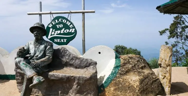
Haputale
Central Province
# Haputale: The Ridge Where the Highlands Meet the Sea Haputale is a small, mist-wrapped town on the southern rim of Sri Lanka's hill country, perched at around 1,430 metres on a knife-edge ridge in Uva Province where the highlands drop away toward the distant southern plains — and, on the clearest mornings, the sea itself. Famous for Lipton's Seat, the historic Dambatenne Tea Factory, the Tudor-style Adisham monastery, and some of the island's finest tea-country hiking, Haputale is the quieter, more authentic alternative to nearby [Ella](/ella-travel-guide). It sits right on the reopened scenic railway, which makes it one of the highlands' most rewarding — and least crowded — stops. We almost skipped Haputale, and we're still a little embarrassed about it. Everyone funnels into Ella; far fewer carry on one ridge further to this working tea town balanced on the edge of the world. Those who do are rewarded with the same tea, the same trains, and the same misty grandeur — but with the volume turned down, the prices kept honest, and a view that on a clear dawn runs all the way to the coast. --- ## History Haputale's story, like so much of the hill country, is written in tea — but here it carries one of the most famous names in the trade. *This was Lipton country.* In the 1890s the Scottish grocer-turned-tycoon **Sir Thomas Lipton** bought up vast estates across these hills, and it was from a viewpoint above his Dambatenne estate that he is said to have surveyed his growing empire — the spot now known the world over as **Lipton's Seat.** He built the **Dambatenne Tea Factory** in 1890, and it still processes tea today, more than a century on. ### A Town on the Line Haputale grew up around the **Colombo–Badulla railway**, one of the great feats of early twentieth-century engineering, which threads this ridge through tunnels, bridges, and switchback loops. The station, perched dramatically on the spine of the hills, gave the tea estates their route to the world and gave the town its shape. To this day the railway is Haputale's backbone as much as its scenery. ### The Planter's Bungalow In 1931, another British planter — Sir Thomas Lester Villiers — built himself a grand Tudor-style country house nearby and named it **Adisham.** Modelled on an English manor and wrapped in cool-climate gardens, it passed after independence to the Benedictine order, who run it today as **St Benedict's Monastery** — a strange, lovely fragment of England marooned in the Sri Lankan clouds, famous now for its fruit preserves as much as its architecture. ## What to See Haputale's sights reward early risers and unhurried walkers. The best of them ask only that you beat the mist. ### Lipton's Seat The unmissable one. From this lofty lookout above the Dambatenne estate, the tea fields fall away in every direction and — on a clear morning — the view reportedly stretches across several provinces toward the southern coast. The catch is the mist, which almost always swallows the panorama by mid-morning. > *Tip:* Be at Lipton's Seat by 6:30–7 a.m. for any hope of the big view. By 9 or 10 a.m. you'll likely be standing in cloud. The classic approach is to hike up through the tea from the Dambatenne factory (around 7 km) — a beautiful walk in itself. ### Dambatenne Tea Factory Thomas Lipton's original 1890 factory is still a working mill, and its tour is among the most thorough in the country: withering, rolling, oxidising, drying, and grading, all explained end to end, with a cup at the finish. It sits below Lipton's Seat, so the two pair naturally into one morning. ### Adisham Bungalow A Benedictine monastery in an English manor house, surrounded by gardens and a forest reserve. You can wander selected rooms, the chapel, and the grounds — but note the *restricted opening days* (see prices below). Don't leave without the monastery's homemade jams, cordials, and fruit wines. ### Diyaluma Falls Southeast toward Koslanda plunges **Diyaluma Falls**, one of Sri Lanka's tallest cascades (variously ranked second or third), dropping in a long white ribbon down the escarpment. Adventurous visitors hike to the *upper pools* — a series of natural infinity pools perched at the lip of the falls — for one of the island's most jaw-dropping swims. ### The Ridge, Thangamale & the Pekoe Trail Haputale itself is a viewpoint. The ridge behind Adisham holds the **Thangamale Bird Sanctuary,** a quiet cloud-forest reserve laced with walking trails, and the town sits on a stretch of the celebrated long-distance **Pekoe Trail** through Sri Lanka's tea country. This is walking country — some of the best in the highlands. ## Ticket Prices & Opening Hours Haputale is refreshingly cheap, and much of its magic — the ridge views, the tea-estate walks — costs nothing at all. - *Lipton's Seat* — a small fee, **around Rs 500** at the final viewpoint gate near the top; you can reach most of the area for free and only pay for the last lookout. *Confirm on arrival.* Best at dawn; go early to beat the mist. - *Dambatenne Tea Factory* — a guided tour is **around Rs 1,000** per person including a tasting. Generally open daily, roughly **8 a.m.–12:30 p.m. and 2–5 p.m.** *On Sundays there's no processing, so there's far less to see.* - *Adisham Bungalow (St Benedict's Monastery)* — entry is **around Rs 100** per person, but crucially it's usually open to the public **only on weekends and public holidays, roughly 9 a.m.–4 p.m.** *Check the days before you go — a midweek visit may find the gates closed.* - *Diyaluma Falls* — **free** to visit; there's no ticket, though a local guide is wise for the climb to the upper pools. - *Thangamale Bird Sanctuary & ridge walks* — generally free or a nominal fee; open in daylight. > *Good to know:* Haputale's paid sites run on cash and modest rupee prices, but hours (especially at Adisham and Dambatenne) shift with holidays and processing schedules — always confirm locally the day before. ## Practical Tips - *Rise early — really early.* Every headline view here, above all Lipton's Seat, belongs to the pre-dawn crowd. Mist is the enemy, and it wins by mid-morning. - *Time Adisham for a weekend or holiday.* It's one of the few sights with genuinely restricted opening days; a midweek trip can mean a locked gate. - *Pack warm layers.* At over 1,400 metres the mornings and evenings are cold and often damp — bring a fleece and a waterproof. - *Carry small cash in rupees.* Entry fees, tuk-tuks, and the factory tour are all cash, and ATMs are limited. - *Sort tuk-tuk or bus for Dambatenne ahead.* Buses from town pass the factory regularly and cheaply; a tuk-tuk return is a modest fixed fare — agree it first. - *Give Diyaluma a guide and dry-ish conditions.* The upper pools are stunning but the climb is rough and the pools are only safe when the flow is manageable — never swim near the lip in high water. - *Stay a night or two.* Haputale rewards the traveller who lingers past the day-tripping Ella crowds; sunrise and sunset from the ridge are the whole point. ## How to Get There Haputale sits on the southern edge of the hill country, on the main Colombo–Badulla railway and the A16 road, between [Ella](/ella-travel-guide) and the plains. - *By train:* Haputale is a stop on one of the world's most scenic railways, and — good news — it lies on the **reopened** stretch of line (see the 2026 note below). The station is right in town; the ride to or from [Ella](/ella-travel-guide) is short and spectacular. - *By road from Ella:* Around 1–1.5 hours by car or tuk-tuk, a gorgeous tea-country drive. - *By road from [Nuwara Eliya](/nuwara-eliya-travel-guide):* Roughly 2–2.5 hours through the high estates. - *Gateway to Horton Plains:* The train stop at **Ohiya,** one station up the line, is the southern entrance to [Horton Plains](/horton-plains-travel-guide) — making Haputale a handy, quiet base for World's End. - *Getting around:* The town is small and walkable; tuk-tuks handle the outlying sights like Dambatenne, Lipton's Seat, and Adisham. ### A 2026 Rail Note Cyclone Ditwah damaged the upcountry railway in late 2025, but the scenic **Nanu Oya–Haputale–Ella–Badulla** section — the loveliest part of the line, and the part Haputale sits on — **reopened in mid-2026** and is running on a special timetable. The **Kandy–Nanu Oya** stretch further up the line remained closed for repairs at the time of writing, so a through train all the way from Kandy may not be possible. *Check the current status with Sri Lanka Railways before you travel, and note that road transport fills any gaps.* ## Why Haputale, When Everyone Goes to Ella? It's a fair question, and the honest answer is: *for the same magic with less of the crowd.* [Ella](/ella-travel-guide) is wonderful, but it has become loud, busy, and thoroughly discovered. Haputale, one ridge south, offers the same tea-clad hills, the same historic trains, and arguably a grander panorama — plus Lipton's Seat and a working colonial tea factory — while remaining a real, unpolished Sri Lankan town. Think of it this way: where the [Cultural Triangle](/sigiriya-travel-guide) is about ancient stone and [Nuwara Eliya](/nuwara-eliya-travel-guide) is about colonial cool, Haputale is about *the edge* — the dramatic drop-off of the highlands, the sense of standing at the rim of the island. Do Ella for the Nine Arch Bridge and the café buzz; do Haputale for the silence, the sunrise, and the view that falls all the way to the sea. ## Why Haputale Stays With You What lingers is the *edge* of the place — literal and otherwise. The way the ground simply ends beyond Lipton's Seat and the whole southern half of the island seems to unroll below you. The cold bite of a 6 a.m. tuk-tuk ride up through silent tea. The absurd, wonderful sight of an English manor full of Benedictine monks selling strawberry jam in the clouds. Haputale doesn't perform for you the way busier towns do. It simply sits on its ridge, wrapped in mist, and lets you find it — and that quiet, earned beauty is exactly why it stays. We came for one sunrise. We keep meaning to go back for another. ## Frequently Asked Questions ### Is Haputale worth visiting, or should I just go to Ella? Both, ideally — they're barely an hour apart and complement each other. Haputale is quieter, cheaper, and more authentic, with Lipton's Seat, the Dambatenne tea factory, and grander ridge-top views; Ella is livelier, with the Nine Arch Bridge and a buzzing café scene. If you want the highlands without the crowds, Haputale is the pick — and an easy add-on to an Ella stay. ### How much does it cost to visit Haputale's attractions? Very little. Lipton's Seat charges around Rs 500 at the final viewpoint, the Dambatenne tea factory tour is around Rs 1,000, and Adisham Bungalow is about Rs 100. Diyaluma Falls and the ridge walks are free. Bring rupees in cash, as card payment isn't reliable. ### What time should I go to Lipton's Seat? As early as possible — ideally arriving by 6:30–7 a.m. The viewpoint almost always clouds over by mid-morning, so a pre-dawn start is essential for the famous panorama. The classic route is to hike up roughly 7 km through the tea from the Dambatenne Tea Factory, or drive most of the way and walk the final stretch. ### Is the train to Haputale running in 2026? Yes — Haputale sits on the scenic Nanu Oya–Ella–Badulla section, which reopened in mid-2026 after Cyclone Ditwah. However, the Kandy–Nanu Oya stretch higher up the line was still closed for repairs at the time of writing, so you may not be able to take a single through train from Kandy. Check Sri Lanka Railways for the current status and use road transport to bridge any gap. ### When is the best time to visit Haputale? The driest, clearest window is roughly December to March, which gives the best odds of an unclouded Lipton's Seat at dawn. Being high and south-facing, Haputale catches mist and showers in any season, so early mornings always beat afternoons for views. Pack warm layers whatever the month. ### Can I visit Horton Plains from Haputale? Yes. The train station at Ohiya, one stop up the line from Haputale, is the southern gateway to Horton Plains National Park and its famous World's End escarpment. This makes Haputale a quieter, cheaper base for the Horton Plains hike than Nuwara Eliya, though you'll still need an early start and arranged transport to the park gate. ### Is Adisham Bungalow open every day? No — this trips up many visitors. Adisham (St Benedict's Monastery) is generally open to the public only on weekends and public holidays, roughly 9 a.m. to 4 p.m., for a small entry fee of around Rs 100. Always confirm the opening days before planning a visit, as a midweek trip may find it closed.
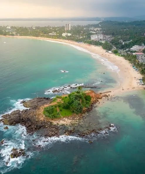
Mirissa
Southern Province
# Mirissa: Where the Ocean's Giants Come to Meet You Mirissa is a crescent-shaped beach town on Sri Lanka's south coast, about 150 km from Colombo, and it is the island's undisputed capital of whale watching — one of the few places on Earth where blue whales, the largest animals that have ever lived, cruise within a couple of hours of the harbour. Beyond the boats, Mirissa is a slow, golden place of leaning coconut palms, tide-pooled rocks you can climb at sunrise, and seafood grills that fire up as the sun drops into the Indian Ocean. The whale-watching season runs roughly November to April, but the beach itself never closes, and it is free. ## History Mirissa began, as so many south-coast villages did, as a fishing settlement — a natural harbour tucked behind a headland where outrigger canoes could shelter from the swell. For generations the town's rhythm was set by the sea: nets hauled at dawn, catch sold by mid-morning, boats mended in the heat of the afternoon. Its transformation came late and fast. When commercial whale-watching arrived on the south coast in the years after the 2004 tsunami, researchers confirmed what local fishermen had long known — that the deep water off Dondra Head, the island's southernmost point just east of town, was a highway for blue and sperm whales. The continental shelf drops away sharply here, and nutrient-rich currents rise from the depths to feed the krill that feed the giants. > Mirissa sits beside one of the deepest submarine canyons in the Indian Ocean. That single geological accident is why the world's largest animal can be reached in under two hours from a small fishing harbour. Within a decade Mirissa went from sleepy backwater to bucket-list name. The fishing boats are still here — many double as whale boats in season — but they now share the bay with surfers, honeymooners, and a steady tide of travellers who came for the whales and stayed for the sunsets. ## What to See ### Whale & Dolphin Watching This is the reason most people come, and it earns its reputation. In season, boats leave the harbour before dawn and head for the deep water off Dondra, where *blue whales*, *sperm whales*, Bryde's whales, and vast pods of spinner dolphins gather. Sightings are never guaranteed — these are wild animals in open ocean — but the odds are among the best anywhere on the planet, and the moment a blue whale's blow rises against the morning light is one you do not forget. > One responsible operator reports whale sighting rates of around 50% and dolphin sightings around 90% across the season. Choose your boat for its conduct, not its price — the cheapest, most crowded boats are often the ones that chase and crowd the animals. ### Mirissa Beach A wide, palm-fringed arc of soft sand, Mirissa Beach is the town's living room. Mornings are calm and swimmable; evenings belong to the beach bars, whose plastic tables and fairy lights spill onto the sand as fishermen grill the day's catch a few metres from the waterline. It is unpretentious, a little worn in places, and completely lovable. ### Coconut Tree Hill A red-clay promontory crowned with dozens of tall, leaning coconut palms, this is the most photographed spot in Mirissa — and one of the most photographed on the whole south coast. It is a ten-minute walk from the main beach. Come at *sunrise* for soft light and near-empty paths, or at sunset for golden colour and a crowd. Mind the steep, slippery edge at the top. ### Parrot Rock A small rocky islet just off the beach with a wooden staircase to its summit. At low tide you can wade across easily; at high tide the crossing reaches waist-deep, so time it right. From the top you get the classic panorama — Coconut Tree Hill on one side, the sweep of Mirissa Beach in the middle, and open ocean beyond. ### Secret Beach Not so secret anymore, but still quieter than the main strand because it takes a little effort to reach. A cluster of small coves reached by a short walk over the headland, with a bar or two and calmer water for swimming. A lovely spot for a late-afternoon dip away from the crowds. ## Ticket Prices & Opening Hours Mirissa has no single entrance gate — the beach, Parrot Rock and Coconut Tree Hill are essentially free to visit. The main paid experience is whale watching. All figures below were checked this year; **prices vary between operators and should be confirmed at booking.** - *Whale-watching, shared double-deck boat:* around **$50–60 USD (roughly 16,000 LKR)** per adult, typically including breakfast on board. One ethical operator quotes 16,000 LKR per adult including government tax. - *Additional harbour / check-in fee:* some operators add around **$20 USD** at check-in; others fold it into the ticket — ask before you pay. - *Private or speedboat charters:* considerably more, priced per boat rather than per head. - *Coconut Tree Hill:* entry is generally **free**, though you may be asked for a small informal fee of around 200–500 LKR, plus roughly 100 LKR for parking. - *Parrot Rock & Secret Beach:* free (Secret Beach occasionally levies a small fee). **Whale-watching hours & season:** check-in is usually around **6:00 AM**, with boats leaving the harbour about **6:30 AM**; tours last roughly **3–5 hours**. The season runs **November to April**, with the calmest seas and most reliable sightings from **December to March** — January to March is the sweet spot. Between May and October the seas turn rough and most operators suspend tours. ## Practical Tips - *Book the boat, not just the trip.* Pick a licensed operator known for keeping distance from the whales and capping passenger numbers. Overcrowded boats are cheaper for a reason. - *Take seasickness seriously.* The open ocean can be choppy even in season. Take a tablet the night before and again in the morning if you're prone to it. - *Go early in the season window if you can.* December to March offers the calmest water and the best light. - *Bring sun protection and a light layer.* Dawn on the water is cool; by 9 AM the sun is fierce. Reef-safe sunscreen, a hat, and sunglasses are essentials. - *Carry small cash in rupees.* For tuk-tuks, parking, beach cafés and any informal fees at the viewpoints. - *Visit Coconut Tree Hill and Parrot Rock at sunrise.* Fewer people, softer light, and cooler walking. - *Check the tide before Parrot Rock.* Low tide makes the crossing simple; high tide means wading. - *Respect the fishing community.* The boats and the harbour are working livelihoods, not just a backdrop. ## How to Get There Mirissa sits on the south coast between [Weligama](/weligama-travel-guide) and [Tangalle](/tangalle-travel-guide), roughly 150 km from Colombo. - *By car or private transfer:* the fastest option. Via the Southern Expressway (E01), Colombo to Mirissa takes around **2.5 to 3.5 hours**. This is the easiest way if you're carrying luggage or arriving from the airport. - *By train:* the scenic coastal railway is a joy. There's no station in Mirissa itself — the nearest is **Weligama** (about 7–8 km away), a short tuk-tuk ride from town. The larger hub of Matara is a little further east. - *By bus:* frequent buses run along the Galle–Matara coast road and stop near Mirissa; cheap, local, and slow. - *By tuk-tuk:* ideal for getting around town and to the viewpoints once you've arrived. Many travellers pair Mirissa with the walled city of [Galle](/galle-travel-guide) to the west or the calmer sands of [Unawatuna](/unawatuna-travel-guide), stringing together a south-coast run. ## Mirissa vs. Trincomalee: Choosing Your Whale Coast Sri Lanka is unusual in offering *two* world-class whale seasons on opposite coasts, so timing decides where you go. - *Mirissa (south coast):* season November–April, peaking December–March. Famous for **blue whales** and sperm whales, reached from a lively, well-developed beach town with plenty to do on land. - *Trincomalee (east coast):* season roughly May–September. Whales swim even closer to shore — often just 6–8 nautical miles out — and the crowds are thinner. If you're visiting Sri Lanka's south or hill country in the northern-hemisphere winter, Mirissa is the natural choice. Travelling in the middle of the year? Trincomalee is where the whales will be. Between them, the island offers one of the longest whale-watching seasons on Earth. --- ## Why Mirissa Stays With You Mirissa lingers because it holds two scales at once. There is the intimate scale — the warm sand under your feet at dusk, a plate of grilled fish, the fairy lights of a beach bar, the leaning palms catching the last of the sun on Coconut Tree Hill. And there is the immense scale — a creature the length of three buses rising silently from the deep, its heart the size of a small car, spending a breath in your company before slipping back into the blue. Few places let you swing between the very small and the very vast in a single morning. You leave Mirissa having been reminded, gently and unforgettably, of just how big and alive the ocean really is. ## Frequently Asked Questions ### Is whale watching in Mirissa worth it? For most travellers, yes. Mirissa is one of the best places in the world to see blue whales, and sightings — while never guaranteed — are frequent in season. Choosing a responsible, less crowded operator makes a good trip a great one. ### What is the best month for whale watching in Mirissa? The season runs November to April, but January to March offers the calmest seas and the most reliable sightings. December and April are still good, with slightly more variable weather at the edges. ### How much does a whale watching tour in Mirissa cost? A shared double-deck tour costs around $50–60 USD (roughly 16,000 LKR) per adult, usually including breakfast. Some operators add a harbour fee of around $20, and private charters cost more. Confirm the exact price and what's included when you book. ### Are you guaranteed to see whales in Mirissa? No. These are wild animals in the open ocean, so sightings can't be promised. That said, in-season success rates are high — one operator reports roughly 50% for whales and around 90% for dolphins. Some operators offer a discount or a repeat trip if nothing is seen. ### Is Mirissa or Trincomalee better for whale watching? It depends on when you visit. Mirissa (south coast) is best November–April; Trincomalee (east coast) is best May–September. For a winter trip to southern Sri Lanka, Mirissa wins; for a mid-year trip, choose Trincomalee. ### How do I get from Colombo to Mirissa? The quickest route is the Southern Expressway by car, taking about 2.5–3.5 hours. You can also take the scenic coastal train to Weligama (about 7–8 km away) and finish by tuk-tuk, or catch a coast-road bus. ### Is Mirissa good for non-swimmers and families? Yes. The main beach has calm morning water, and whale-watching boats carry life jackets for everyone. Families should still take seasickness precautions and choose a larger, stable boat for the ocean leg.
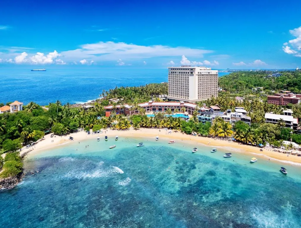
Unawatuna
Southern Province
# Unawatuna: A Sheltered Bay Where the South Coast Slows Down Unawatuna is a golden crescent bay on Sri Lanka's south coast, about 6 km from the walled city of Galle and roughly 120 km from Colombo, long loved as one of the island's safest and calmest swimming beaches thanks to a protecting offshore reef. Where much of the south coast is built for surfers, Unawatuna is built for floating — warm, shallow, turquoise water, sea turtles grazing in the shallows, and a shoreline of palm shade and easygoing cafés. The beach itself is free, the Japanese Peace Pagoda on the headland is free, and the whole town runs at the pace of an afternoon that never quite ends. ## History For most of its life Unawatuna was a quiet fishing village in the lee of Rumassala Hill, the forested headland that shelters its bay. Local legend ties that hill to the *Ramayana*: it is said to be a fragment of a Himalayan mountain dropped by the monkey god Hanuman as he carried healing herbs to a wounded prince — which is why, the story goes, rare medicinal plants still grow on its slopes. The bay's calm water and easy access from Galle made it one of the first south-coast beaches to draw travellers, and by the 1990s it had become a firm fixture on the backpacker trail. The 2004 tsunami struck hard here, reshaping the shoreline and the town that depended on it; the community rebuilt, and Unawatuna returned as a more developed but still relaxed beach town. > In 2005, Japanese monks of the Mahayana tradition completed the gleaming white Peace Pagoda on Rumassala's headland — one of many built worldwide to promote peace, and now Unawatuna's most striking landmark. Today Unawatuna balances its two identities: a working coast of fishermen and reef, and a friendly, well-worn traveller's town of guesthouses, dive shops and beach bars. ## What to See ### Unawatuna Beach The heart of it all — a sheltered, palm-fringed bay with soft sand and water so calm it feels like a lagoon. The offshore reef breaks the swell, making this one of the few south-coast beaches where families, children and nervous swimmers can relax in the sea. Cafés and seafood grills line the sand, and sunset here is a nightly event. ### Japanese Peace Pagoda A brilliant white stupa perched on the Rumassala headland, reached by a short uphill walk or tuk-tuk ride. The climb rewards you with sweeping views back over the bay and out to the Indian Ocean, and the grounds are calm and contemplative. *Sunset* is the time to come, when the pagoda glows gold and the coast softens into evening. ### Jungle Beach A small, secluded cove tucked into the forested flank of Rumassala, reached on foot by a rough trail over the headland (or a short tuk-tuk ride to the top and a walk down). The water is clear and good for snorkelling, and the setting — sand cupped by green jungle — is lovely, though it can get busy and littered at peak times. Come early for the best of it. ### Dalawella Rope Swing Just east of the main bay, a rope swing hangs from a leaning coconut palm straight out over the sea — one of the most photographed spots on the coast. It's touristy and there's usually a small fee, but the swing genuinely is fun, and the tide-pool beside it makes a natural swimming pool at high tide. ### Sea Turtles & the Turtle Hatchery Green turtles and hawksbills feed in Unawatuna's shallows, and snorkellers regularly meet them in the bay — please look, don't touch. A short tuk-tuk ride east, the *Sea Turtle Hatchery at Habaraduwa* rescues, rehabilitates and releases injured turtles and protects eggs from poaching; a guide walks you through the tanks and the conservation work. ### Diving, Snorkelling & Rumassala Rocky reefs, black coral, tropical fish and even shipwrecks like the *SS Rangoon* make Unawatuna a fine base for diving and snorkelling, with beginner-friendly sites close to shore. Inland, a walk up *Rumassala Hill* leads through the fabled medicinal-herb forest with viewpoints over the whole bay. ## Ticket Prices & Opening Hours Unawatuna is a beach town, not a ticketed monument — the beach and its headland cost nothing. All figures below were checked this year; **prices at small operators change often and should be confirmed on arrival.** - *Unawatuna Beach, Japanese Peace Pagoda, Jungle Beach, Rumassala Hill:* **free** to visit. You may pay a small amount for tuk-tuks or informal parking. - *Dalawella rope swing:* a small fee, usually a **few hundred rupees**, to use it or take photos. - *Sea Turtle Hatchery, Habaraduwa:* **around 2,000 LKR per adult**, generally free for children; releasing a hatchling costs an extra donation of around 2,000 LKR. The Koggala hatchery is a little cheaper (~1,500 LKR); the Mahamodara hatchery near Galle is donation-based. - *Diving & snorkelling trips:* priced per operator and per course — get a current quote from a reputable local dive centre. **Hours & season:** the beach is open and free at all hours; sunrise and late afternoon are gentlest for swimming. The Peace Pagoda and hatchery keep rough daytime hours (roughly morning to early evening). The best conditions and clearest water run **December to April**, peaking December–February. Unawatuna's sheltered bay stays swimmable more of the year than most south-coast beaches, but May–October brings rougher seas and reduced visibility. ## Practical Tips - *This is a swimming beach, not a surf beach.* If you want gentle water, that's the point; if you want waves, nearby [Weligama](/weligama-travel-guide) suits beginners better. - *Snorkel early.* Morning light and calm water give the best visibility and the best chance of meeting turtles before the crowds. - *Never touch or chase turtles or coral.* Keep your distance and use reef-safe sunscreen. - *Walk to Jungle Beach in proper shoes.* The headland trail is rocky and uneven — flip-flops and small children will struggle. - *Check the tide for the Dalawella swing.* High tide fills the natural rock pool and makes the whole spot far nicer. - *Carry small cash in rupees.* For tuk-tuks, the hatchery, the swing fee and beach cafés. - *Pair it with Galle.* The fort is only about 15 minutes away and makes a perfect late-afternoon outing. - *Book ahead in peak season.* December to February fills the best guesthouses quickly. ## How to Get There Unawatuna sits just south-east of [Galle](/galle-travel-guide), roughly 120 km from Colombo. - *By car or private transfer:* the quickest option. Via the Southern Expressway (E01) to Galle, then a short hop east, Colombo to Unawatuna takes around **2.5 to 3 hours**. - *By train:* the coastal railway is scenic and cheap. Unawatuna has a small halt, but the main hub is **Galle**, from where it's a 10–15 minute tuk-tuk ride. - *By bus:* frequent Galle–Matara coast-road buses stop near Unawatuna; slow but very cheap. - *By tuk-tuk:* the easiest way to reach the Peace Pagoda, Jungle Beach, the swing and the turtle hatchery once you've arrived. Many travellers string Unawatuna together with [Galle](/galle-travel-guide) and the whale-watching town of [Mirissa](/mirissa-travel-guide) further east for a classic south-coast run. ## Why Unawatuna Is Special On a coast famous for its surf, Unawatuna's quiet superpower is calm. Its reef-sheltered bay is one of the safest places to swim on the whole south coast, which changes who the town is for. - *Unawatuna:* calm, shallow, reef-protected water — ideal for families, snorkellers, floaters and anyone who just wants to be *in* the sea. - *[Mirissa](/mirissa-travel-guide):* a livelier scene built around whale-watching and sunset bars. - *[Weligama](/weligama-travel-guide):* long beginner surf breaks and board-hire culture. If your idea of a beach day is bobbing over a reef with a turtle rather than paddling for a wave, Unawatuna is your bay. --- ## Why Unawatuna Stays With You Unawatuna stays with you as a feeling more than a sight: the particular stillness of water with no waves to fight, the shade of a leaning palm at midday, the slow gold of a Peace Pagoda sunset, the small miracle of a turtle drifting past your mask in the shallows. It asks nothing of you but to slow down. It is not the wildest or most dramatic beach in Sri Lanka — but it may be the kindest, the one that lets you exhale. Long after the trip, it's the bay you'll picture when you think of doing nothing, beautifully. ## Frequently Asked Questions ### Is Unawatuna beach good for swimming? Yes — it's one of the safest swimming beaches in Sri Lanka. An offshore reef shelters the bay, keeping the water calm and shallow, which makes it well suited to families, children and less confident swimmers. Always still respect currents, especially outside the protected bay. ### Is Unawatuna better than Mirissa? They're different. Unawatuna is calmer and best for swimming, snorkelling and relaxing; Mirissa is livelier and built around whale-watching. If you want gentle water and turtles, choose Unawatuna; if you want to see blue whales in season, choose Mirissa — and ideally visit both. ### How much does the Unawatuna turtle hatchery cost? The Sea Turtle Hatchery at Habaraduwa, a short tuk-tuk ride from Unawatuna, costs around 2,000 LKR per adult and is generally free for children. Releasing a baby turtle usually costs an extra donation of around 2,000 LKR. Confirm current prices on arrival. ### Can you see turtles in Unawatuna? Yes. Green and hawksbill turtles feed in the bay's shallows and are regularly seen by snorkellers, especially in the morning. Keep a respectful distance and never touch or chase them. The nearby turtle hatchery is a good way to learn about conservation too. ### How do I get from Galle to Unawatuna? Unawatuna is only about 6 km from Galle — roughly a 10–15 minute tuk-tuk ride. You can also take a short coast-road bus or a quick taxi. From Colombo, the whole trip via the Southern Expressway takes about 2.5–3 hours. ### When is the best time to visit Unawatuna? The best conditions run December to April, with the calmest seas and clearest water for snorkelling, peaking December to February. Thanks to its sheltered reef, Unawatuna stays swimmable longer than most south-coast beaches, though May to October brings rougher seas. ### Is Jungle Beach worth visiting? It's a pretty, forest-backed cove with clear water good for snorkelling, and worth the short trek over the headland — but it's small and can get crowded and littered at busy times. Go early in the morning for the calmest, cleanest experience.
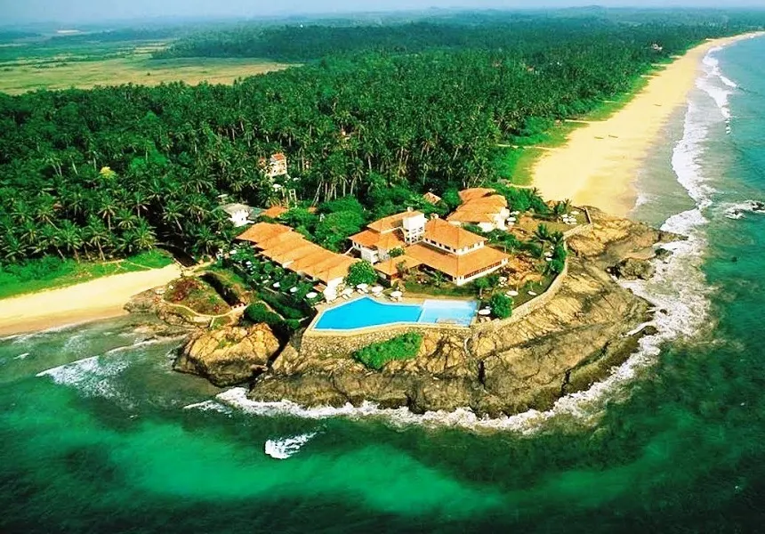
Bentota
Southern Province
# Bentota: Where the River Meets the Sea and the Fun Begins Bentota is a resort town on Sri Lanka's southwest coast, about 65 km south of Colombo, set at the golden point where the Bentota River spills into the Indian Ocean — a meeting of water that has made it the island's undisputed watersports capital. Beyond the jet skis and long sandy beach, Bentota holds two of Sri Lanka's most celebrated tropical gardens, both created by the legendary Bawa brothers, plus mangrove river safaris and a famous turtle coast just to the south. It is Sri Lanka at its most easygoing and versatile, and the best conditions run roughly November to April. ## History Bentota grew up where the river did its work — a sheltered estuary that gave fishermen calm water and traders a natural harbour on the busy southwest coast. For centuries it was a modest coastal village, its life shaped by the tides, the monsoon, and the spice and cinnamon trade that moved along this shore under successive Portuguese, Dutch and British rule. Its modern story is really the story of two brothers. In the mid-20th century, architect *Geoffrey Bawa* — the father of "tropical modernism" and Sri Lanka's most influential designer — bought a rubber and cinnamon estate on the banks of nearby Dedduwa Lake and spent decades turning it into Lunuganga, his private garden masterpiece. His elder brother, *Bevis Bawa*, had already begun Brief Garden a little inland, an artist's paradise that hosted the likes of Laurence Olivier and Vivien Leigh. > Bentota's two great gardens are a family act: Bevis Bawa's Brief Garden inspired his younger brother Geoffrey to create Lunuganga — the estate that in turn shaped Sri Lankan architecture for generations. In the 1960s and 70s, Bentota was chosen as the site of a national tourism development zone, and its beaches filled with resorts. Today it blends that resort ease with river adventure and the quiet genius of the Bawas. ## What to See ### Bentota Beach A long, wide sweep of golden sand backed by resorts and casuarina trees, Bentota Beach is made for slow days — swimming, sunbathing and long walks toward the river mouth. The section near the estuary is especially scenic, where a slender spit of sand separates the calm river from the open ocean. ### The Bentota River & Water Sports This is Bentota's beating heart. Where the *Bentota Ganga* meets the sea, a sheltered lagoon has become the country's premier watersports playground — jet skis, banana boats, tube rides, water-skiing, windsurfing and wakeboarding all run from here. The calm river water makes it beginner-friendly and far safer than the open surf. ### Lunuganga — Geoffrey Bawa's Estate The country estate where Geoffrey Bawa spent fifty years experimenting is now a serene, dreamlike garden open by guided tour. Terraces, water steps, sculptures and framed vistas blend Italian, English, Japanese and ancient Sri Lankan ideas into one flowing landscape. For anyone interested in design, it is essential — a walk through the mind of a master. ### Brief Garden — Bevis Bawa About ten kilometres inland at Kalawila, Bevis Bawa's *Brief Garden* is the wilder, more romantic of the two — a hidden green world of bamboo, moss, ponds and eccentric sculpture surrounding the artist's characterful house. Begun in 1929 and tended over nearly forty years, it feels like stepping into a secret from a storybook. ### Madu Ganga River Safari A short drive south at Balapitiya, the *Madu Ganga* is a Ramsar-protected wetland of more than 900 hectares and 64 islands, threaded with pristine mangrove tunnels. Boat safaris glide past kingfishers, monitor lizards, traditional fish kraals, a cinnamon island and an island temple — one of the loveliest wetland trips in the country. ### Kosgoda Turtle Hatchery Just south toward [Kosgoda](/kosgoda-travel-guide), conservation hatcheries protect the eggs of the endangered sea turtles that nest along this coast, rearing and releasing hatchlings. Most river-safari packages include a stop; a guide explains the life cycle and the rescue work, and you can sometimes help release a hatchling. ## Ticket Prices & Opening Hours Bentota's beach and river are free to enjoy; the gardens, safaris and water sports are the paid experiences. All figures were checked this year; **prices vary and should be confirmed before you book.** - *Lunuganga (Geoffrey Bawa's estate):* guided tours only, daily at **11:00 AM, 2:00 PM and 3:00 PM** (~90 minutes). Around **USD 20 for foreign visitors** (LKR 3,500 local; LKR 750 local students; under-7s free). It is *not* open outside tour times. - *Brief Garden (Bevis Bawa):* around **2,000 LKR per person**, open roughly **8 AM to 5 PM**. Confirm on arrival, as fees have changed. - *Bentota River mangrove safari:* from around **$30 per person** for roughly a 2-hour trip. - *Madu Ganga safari + Kosgoda turtle hatchery package:* commonly around **$65 per person** for ~3.5 hours, including boat, entry fees and hotel transfers. - *Water sports:* priced per operator and per activity — agree the rate before you get on the water. **Season & timing:** Bentota's beach and river run year-round, but the best weather and calmest seas are **November to April**. Because the watersports lagoon is sheltered, river activities are more reliable across the year than open-ocean ones. Book Lunuganga around its fixed tour times, and visit the gardens in the cooler morning where you can. ## Practical Tips - *Base your days around the river.* The estuary is where the water sports, the calm swimming and the prettiest stretch of beach all come together. - *Pre-book Lunuganga if timing matters.* Tours run only three times a day and last about 90 minutes — plan your afternoon around them. - *Do both gardens if you can.* Brief Garden and Lunuganga are very different in mood and pair beautifully into one half-day. - *Choose responsible turtle projects.* Favour hatcheries focused on genuine conservation and release rather than handling for photos. - *Agree watersports prices upfront.* Confirm the rate, duration and safety gear before you set off; wear a life jacket. - *Carry cash in rupees.* For garden entry, boat fees, tuk-tuks and beach vendors. - *Use reef-safe sunscreen and drink plenty of water.* The southwest coast is hot and humid year-round. - *Consider a driver for the gardens.* Lunuganga, Brief Garden and the Madu Ganga are spread out and awkward to reach by public transport. ## How to Get There Bentota sits on the southwest coast between Aluthgama and [Kosgoda](/kosgoda-travel-guide), roughly 65 km south of Colombo. - *By car or private transfer:* the easiest option. Via the Southern Expressway (E01), Colombo to Bentota takes around **1 to 1.5 hours** — one of the quickest beach escapes from the capital or the airport. - *By train:* the coastal railway is scenic and cheap, and Bentota has its own station on the Colombo–Galle–Matara line. The neighbouring town of Aluthgama is a larger stop just to the north. - *By bus:* frequent Colombo–Galle coast-road buses stop at Bentota and Aluthgama. - *By tuk-tuk or hired driver:* the practical way to reach the inland gardens and the Madu Ganga once you're there. Bentota makes a natural first or last stop on a southwest-coast run continuing to [Hikkaduwa](/hikkaduwa-travel-guide), [Galle](/galle-travel-guide) and [Unawatuna](/unawatuna-travel-guide). ## Why Bentota Is Special Most Sri Lankan beach towns do one thing well. Bentota does several at once, which is exactly its appeal — you can build very different days from the same base. - *For adrenaline:* the river mouth is the country's best-equipped watersports hub, from jet skis to wakeboarding. - *For design and calm:* Lunuganga and Brief Garden offer two of Asia's most beautiful private gardens within a short drive. - *For nature:* the Madu Ganga mangroves and the Kosgoda turtle coast sit right next door. - *For families:* sheltered river swimming and gentle activities suit all ages. If [Mirissa](/mirissa-travel-guide) is about whales and [Unawatuna](/unawatuna-travel-guide) is about calm snorkelling, Bentota is about variety — beach, river, garden and wildlife in one easy package. --- ## Why Bentota Stays With You Bentota lingers as a sense of ease and range — the spray of a jet ski on a bright river morning, then the deep green hush of a Bawa garden by afternoon, then a hatchling scrambling for the surf at dusk. Few places let you swing so freely between motion and stillness, and between the man-made and the wild. You leave with the feeling that you could have stayed twice as long and never repeated a day. That quiet abundance — of water, of green, of things to do and things to simply watch — is what brings people back. ## Frequently Asked Questions ### What is Bentota famous for? Bentota is best known as Sri Lanka's watersports capital, thanks to the sheltered lagoon where the Bentota River meets the sea. It's also famous for its long golden beach, luxury resorts, and two celebrated tropical gardens designed by Geoffrey and Bevis Bawa, plus nearby mangrove river safaris and turtle hatcheries. ### What water sports can you do in Bentota? At the river mouth you'll find jet skiing, banana-boat and tube rides, water-skiing, wakeboarding, windsurfing and boat trips. The calm river water makes it ideal for beginners and families. Always confirm the price and wear a life jacket before setting off. ### How much does it cost to visit Lunuganga and Brief Garden? Lunuganga (Geoffrey Bawa's estate) is visited by guided tour, around USD 20 for foreign visitors, with tours at 11 AM, 2 PM and 3 PM. Brief Garden (Bevis Bawa) costs around 2,000 LKR per person and is open roughly 8 AM to 5 PM. Confirm both before visiting, as prices change. ### Is Bentota worth visiting? Yes — especially if you want variety. In one relaxed stay you can combine beach time, river water sports, world-class gardens, a mangrove safari and a turtle hatchery, all within easy reach. It's also one of the quickest beach escapes from Colombo and the airport. ### How far is Bentota from Colombo airport? Bentota is roughly 65 km south of Colombo and about 90–100 km from Bandaranaike International Airport. By the Southern Expressway, the drive takes around 1.5 to 2 hours, making it a popular first or last stop on a Sri Lanka trip. ### When is the best time to visit Bentota? The best weather runs November to April, with the calmest seas and sunniest days. Because the watersports lagoon is sheltered, river activities stay reliable across much of the year, but the open-ocean beach is at its best in the dry season. ### Can you see turtles near Bentota? Yes. Just south toward Kosgoda, several conservation hatcheries protect and release endangered sea turtles, and most Madu Ganga river-safari packages include a visit. Choose a project focused on genuine conservation rather than handling turtles for photos.

Arugam Bay
Eastern Province
# Arugam Bay: Where the East Coast Catches Its Perfect Wave Arugam Bay is a laid-back surf town on Sri Lanka's southeast coast, about 320 km from Colombo near the town of Pottuvil, long celebrated as the island's premier surfing destination for its long, peeling right-hand point breaks. Its season is the mirror image of the south coast — roughly May to October — so when the southwest is stormy, Arugam Bay is glassy and golden. Beyond the waves it's a gateway to elephant-filled lagoons and the wild, bird-rich Kumana National Park, wrapped in a barefoot, sun-bleached calm that keeps travellers here far longer than they planned. ## History For most of its history, Arugam Bay was a quiet fishing settlement on a remote and beautiful stretch of the east coast, part of a region with deep Tamil and Muslim roots centred on nearby Pottuvil. Life ran on the rhythm of the sea and the monsoon, far from the island's busier southwest. Everything changed when travelling surfers discovered the bay's remarkable point break in the 1960s and 70s. Word spread slowly through the global surf community, and Arugam Bay gained an almost mythical status — a wave worth crossing the world for, at the end of a very long road. > Arugam Bay's *Main Point* is regarded as one of the best right-hand point breaks in the world, and it put this once-remote fishing village on the international surf map. The town's modern story has been one of resilience. The east coast suffered terribly in Sri Lanka's long civil conflict, and the 2004 Indian Ocean tsunami devastated Arugam Bay, destroying much of the settlement and taking many lives. The community rebuilt, tourism returned after the war's end in 2009, and today the bay balances its surf-town fame with the enduring life of the fishing and farming villages around it. ## What to See ### Main Point The wave that made Arugam Bay famous — a long, peeling right-hander that wraps around the headland and can offer rides of several hundred metres on a good day. It's best for confident intermediate and advanced surfers, and at dawn, before the crowds and the wind, it can be magic. Even non-surfers gather on the rocks to watch. ### The Beginner Breaks Arugam Bay is one of the best places in Asia to *learn* to surf, with a cluster of gentle, forgiving waves and a huge, friendly instruction scene. - *Baby Point* — right beside Main Point, with small, soft waves perfect for first-timers. - *Whiskey Point* — about 14 km north, a mellow, long wave with a laid-back beach-shack scene. - *Peanut Farm* — a sandy-bottomed bay south of town with a beginner section and a punchier point for improvers. ### Elephant Rock & Pottuvil Point Two more scenic breaks that double as beautiful spots to simply *be*. *Elephant Rock*, a short ride south, rewards an early climb with a sweeping view over an empty golden beach. *Pottuvil Point*, to the north, is a long, gentle right-hander and a classic longboarding wave, with wild elephants sometimes seen in the scrub behind the beach. ### Pottuvil Lagoon Safari Just north of town, a mangrove-fringed lagoon shelters elephants, crocodiles, monkeys and a wealth of birdlife. A quiet boat safari here at sunrise or sunset is one of the loveliest, most low-key wildlife experiences on the coast — a gentle counterpoint to the surf. ### Kumana National Park About 22 km southwest, reached via Okanda, *Kumana* (once known as Yala East) is a wilder, far quieter alternative to famous [Yala National Park](/yala-national-park-travel-guide). It's a renowned bird sanctuary of mangrove swamps and lagoons, and also home to elephants, crocodiles and even leopards — with a fraction of the crowds. ### The Beach & the Town Beyond the surf, Arugam Bay is a single sandy main road of guesthouses, yoga decks, smoothie bowls and beach bars, running on flip-flop time. It's the kind of place where days blur pleasantly into one another and strangers become friends over a sunset drink. ## Ticket Prices & Opening Hours The beach and every surf point are free. The paid experiences are lessons, board hire and the wildlife safaris. All figures were checked this year; **prices vary by operator and season and should be confirmed on the ground.** - *Surf lessons:* around **$15–25 (roughly Rs 3,000–5,000)** for a 2-hour group lesson including board and rash guard; private lessons from about **$30–50**. - *Board hire:* around **$5–15 (Rs 600–1,500) per day**, depending on whether you take a soft-top, funboard or shortboard. - *Surf camps:* week-long packages with lessons and accommodation typically **$300–800**. - *Kumana National Park:* foreigner entry **around US$10–12 per adult** plus a per-group service charge and VAT; a shared half-day safari from Arugam Bay including jeep, guide and park fees commonly runs **around Rs 30,000–45,000 total** for a small group. Confirm inclusions when booking. - *Pottuvil Lagoon safari:* a modest per-person fee for roughly a 1.5-hour boat trip — agree the price with your operator first. **Season & timing:** the surf season runs **May to October**, at its best from **June to September**. Dawn and late afternoon bring the cleanest waves and the gentlest wind. Off-season (November–April) is wet, windy and choppy on this coast — a few beginner-friendly days appear, but most surf schools and guesthouses wind down. Kumana's safari access is best in the dry months, with peak birding roughly April–July. ## Practical Tips - *Come in season.* For real surf, travel between May and October; outside that window many businesses close and the waves turn messy. - *Surf at dawn.* The wind is lightest and the waves cleanest early morning and again late afternoon — plan your day around the tides and the light. - *Beginners have their own breaks.* Don't paddle out at Main Point on day one; start at Baby Point, Whiskey Point or Peanut Farm with a lesson. - *Bring cash.* ATMs are in Pottuvil, about five minutes away, and can run dry in peak season — carry enough rupees. - *Respect the wildlife.* Elephants roam the lagoons and roadsides; never approach them, and keep a safe distance on lagoon safaris. - *Pack strong sun protection.* The east-coast sun is fierce; reef-safe zinc, a rash guard and a hat are essentials in and out of the water. - *Choose surf schools carefully.* Favour small groups and ISA-certified or experienced local instructors. - *Slow down.* Arugam Bay rewards a longer, unhurried stay far more than a quick tick-box visit. ## How to Get There Arugam Bay sits on the southeast coast beside the town of Pottuvil, roughly 320 km from Colombo — further off the standard circuit than most beach towns, which is part of its charm. - *By car or private van:* the most practical option. From Colombo it's around **6 to 7 hours** via the Southern Expressway to Hambantota, then northeast through Kataragama; a private van typically costs Rs 15,000–18,000. - *From Ella:* one of Sri Lanka's most scenic drives — about **150 km and 3 to 4 hours** east through Wellawaya and Monaragala, descending from tea hills to dry-zone plains. Many travellers pair [Ella](/ella-travel-guide) with Arugam Bay for exactly this reason. - *By bus:* public buses run from Colombo to Pottuvil (with at least one change), taking 8–10 hours; from Pottuvil it's a five-minute tuk-tuk to the bay. - *By train + road:* there's no direct train to Arugam Bay; the nearest railheads are distant, so most people finish the journey by road. ## Chasing the Season: Arugam Bay vs the South Coast Sri Lanka's greatest surf secret is its two opposite seasons, and knowing which coast is "on" is the key to a good trip. - *Arugam Bay (east coast):* best **May to October**, when offshore winds and clean swells light up the point breaks. - *The south coast — [Mirissa](/mirissa-travel-guide), [Weligama](/weligama-travel-guide), Hiriketiya:* best **November to April**, when Arugam Bay is stormy and the southwest turns glassy. So the island offers world-class surf almost year-round — you simply follow the season to the right coast. If you're visiting in the northern summer, Arugam Bay is where the waves will be; in winter, head south. --- ## Why Arugam Bay Stays With You Arugam Bay stays with you as a feeling of time slowing down. It's the pre-dawn paddle-out with the sky still pink, the long walk back up a single sandy road, the elephant glimpsed at the lagoon's edge, the easy friendships struck over a sunset beer. Few places wear their remoteness so lightly or so well. You come for a wave and stay for the rhythm — surf, eat, nap, surf again, watch the sun drop into the palms. Long after you leave, it's that unhurried, salt-and-sun simplicity you'll find yourself missing. ## Frequently Asked Questions ### Is Arugam Bay good for beginner surfers? Yes — it's one of the best places in Sri Lanka to learn. While famous Main Point suits experienced surfers, breaks like Baby Point, Whiskey Point and Peanut Farm offer gentle, forgiving waves, and the town has a huge, affordable surf-school scene with equipment included. ### What is the best time to surf in Arugam Bay? The surf season runs May to October, with the most consistent waves from June to September and peak conditions in July and August. Outside this window the east coast is wet and choppy, so plan a surf trip for the dry season. ### How much do surf lessons cost in Arugam Bay? A two-hour group lesson including board and rash guard costs around $15–25 (roughly Rs 3,000–5,000), and private lessons run about $30–50. Board hire alone is around $5–15 per day. Prices vary by school, so shop around. ### How do you get from Ella to Arugam Bay? It's about 150 km and takes 3 to 4 hours by car, driving east through Wellawaya and Monaragala. The route is one of Sri Lanka's most scenic, descending from tea-covered hills to dry-zone savannah, and is a favourite pairing with a hill-country stay in [Ella](/ella-travel-guide). ### Is Arugam Bay worth visiting if you don't surf? Absolutely. Beyond the waves you can take a Pottuvil Lagoon safari to see elephants and birds, visit the quiet, wildlife-rich Kumana National Park, climb Elephant Rock for the view, or simply enjoy the laid-back beach-town vibe, yoga and sunsets. ### How far is Arugam Bay from Colombo? Arugam Bay is roughly 320 km from Colombo on the southeast coast — about 6 to 7 hours by private van or car, or 8 to 10 hours by public bus with a change. There's no direct train, so the final leg is by road. ### Can you see elephants near Arugam Bay? Yes. Wild elephants inhabit the lagoons and national parks around Arugam Bay and are often seen on Pottuvil Lagoon safaris and in Kumana National Park. Always keep a safe distance and never approach or feed them.

Hikkaduwa
Down South
# Hikkaduwa: Coral Reefs, Rolling Waves and Turtles at Your Feet Hikkaduwa is a lively beach town on Sri Lanka's southwest coast, about 100 km (roughly two hours) from Colombo and just 20 km north of Galle, famous for the coral reef of its marine national park, its beginner-friendly surf, and the green sea turtles that glide right up to swimmers at Turtle Beach. One of the island's original beach destinations, "Hikka" blends easy reef snorkelling straight off the sand with a warm, sociable, sometimes party-loving atmosphere. Its season runs roughly November to April, when the seas are calm, the waves are clean and the water is clear. ## History Hikkaduwa began as a coconut-and-fishing village, but its destiny was written on the reef just offshore. In the 1960s and 70s, as the hippie trail reached Sri Lanka, Hikkaduwa became one of the island's very first beach-tourism hotspots — a barefoot paradise of cheap guesthouses, coral gardens and surf that drew travellers long before the rest of the south coast opened up. For decades it rode a wave of mass tourism, and the reef paid a price through bleaching, pollution and careless boats. Then, on 26 December 2004, catastrophe struck the whole coast. > Just north of Hikkaduwa, near Peraliya, the 2004 tsunami engulfed a crowded passenger train, killing more than a thousand people in what is remembered as one of the worst rail disasters in history. A memorial Buddha statue, donated by Japan, now stands in quiet tribute. Hikkaduwa rebuilt with characteristic resilience. In the years since, it has shed some of its mass-market past and settled into a more relaxed identity — a surf-and-snorkel town that remembers its history, protects its recovering reef, and still knows how to enjoy a sunset. ## What to See ### The Coral Sanctuary & Marine National Park Hikkaduwa's crowning glory is its coral sanctuary, part of Sri Lanka's pioneering marine national park. Just a short swim from the beach, in shallow, calm water, a reef of staghorn and brain coral shelters parrotfish, angelfish, moray eels and sea turtles. It's one of the most accessible reef-snorkelling experiences in the country — you can simply wade in from the sand. > The reef has suffered from bleaching and past damage but is recovering under protection. Please never touch or stand on the coral, and choose licensed operators to help keep it safe. ### Turtle Beach At the southern end of the strand, green sea turtles come remarkably close to shore to feed, and snorkellers regularly find themselves swimming alongside these gentle giants in waist-deep water. It's a magical, only-in-Hikkaduwa encounter. Come early in the morning, keep a respectful distance, and never touch or chase them. ### Surfing at Narigama Hikkaduwa is one of Sri Lanka's classic surf towns. The forgiving beach break at *Narigama* and the main strand is ideal for beginners and improvers, with a friendly scene of surf schools and board hire. More experienced surfers can paddle out to the reef break known as *Benny's* for a punchier ride. ### Diving the Wrecks Beneath the waves lie some of the island's best dive sites, including the *SS Conch* — one of the world's first oil-tanker wrecks — the Earl of Shaftesbury, and vibrant coral gardens. Dive schools run trips for all levels, with the calmest, clearest water in the season months. ### Tsunami Honganji Vihara & Museum A short way north near Telwatta, a striking Buddha statue gifted by Japan memorialises the victims of the 2004 tsunami, including those lost on the train. Nearby, a small, deeply moving community museum documents the disaster through survivors' photographs and accounts. It is a sober, humbling stop that puts the coast's beauty in perspective. ### The Beach & the Town Hikkaduwa's long sandy beach is backed by a lively ribbon of cafés, juice bars, surf shops and beach bars, and the town has a well-earned reputation for sociable nights. By day it's swimming, surfing and snorkelling; by evening, sunset drinks and easy conversation with fellow travellers. ## Ticket Prices & Opening Hours Hikkaduwa's beach, reef and turtles are free to enjoy; the paid experiences are gear, boats, lessons and dives. All figures were checked this year; **prices are negotiable and vary by operator, so confirm before you commit.** - *Coral sanctuary & beach:* **free** to access — there's no formal ticket gate. - *Snorkel gear rental:* around **$3–5 per day**. - *Glass-bottom boat & snorkel trips:* negotiated with operators, typically a few thousand rupees per boat for a short trip. Book through the marine national park office or a licensed operator, and avoid reef-damaging touts. - *Surfing:* board hire around **$5–10 (Rs 1,000–2,000) per day**; lessons around **Rs 4,000–7,000 (~$20–30)**. - *Diving:* two boat dives around **$70–90**, gear included. - *Tsunami Museum:* a small entry fee of around **500 LKR** or a donation. Confirm on arrival. **Season & timing:** the best conditions run **November to April**, with the calmest seas and clearest water for snorkelling and diving, and the best surf roughly November to March. Snorkelling and turtle-spotting are best in the **morning**, when the water is clearest and the turtles most active. May to October brings rougher seas and reduced visibility. ## Practical Tips - *Snorkel in the morning.* Early water is calmest and clearest, and the turtles are most active — plus you'll beat the crowds and the wind. - *Protect the reef.* Never touch, stand on or chase coral or turtles, and use reef-safe sunscreen; the reef is recovering and fragile. - *Choose licensed operators.* For boats and dives, book through the national park office or a reputable dive school rather than beach touts. - *Beginners, head to Narigama.* The sandy-bottomed beach break is far more forgiving than the reef breaks — take a lesson first. - *Take the train.* The coastal railway from Colombo or Galle is cheap, scenic and drops you close to the beach. - *Pay your respects thoughtfully.* The tsunami memorial and museum are places of real grief — visit with quiet respect. - *Carry small cash in rupees.* For gear, boats, tuk-tuks and beach cafés. - *Pair it with Galle.* The historic fort is only about 30 minutes south and makes an easy day trip. ## How to Get There Hikkaduwa sits on the southwest coast between [Bentota](/bentota-travel-guide) and [Galle](/galle-travel-guide), roughly 100–115 km from Colombo. - *By train:* the classic way to arrive. The scenic coastal railway from Colombo takes around **2 to 3 hours**, is very cheap, and stops right in Hikkaduwa near the beach — one of Sri Lanka's most enjoyable train rides. - *By car or private transfer:* via the Southern Expressway (E01), Colombo to Hikkaduwa takes around **2 hours**. - *By bus:* frequent Colombo–Galle coast-road buses stop in Hikkaduwa; cheap and regular. - *From Galle:* just 20 km south, about a 30-minute tuk-tuk, bus or train ride away. Hikkaduwa slots naturally into a southwest-coast run linking [Bentota](/bentota-travel-guide), [Galle](/galle-travel-guide), [Unawatuna](/unawatuna-travel-guide) and [Mirissa](/mirissa-travel-guide). ## Hikkaduwa vs. Unawatuna: Which Beach Town? Two of the south coast's most-loved beach towns sit close together but feel quite different, and which suits you comes down to what you want from a beach day. - *Hikkaduwa:* livelier and more energetic, with the best reef snorkelling straight off the beach, better surf, turtle encounters and a busier nightlife — and generally more budget-friendly. - *[Unawatuna](/unawatuna-travel-guide):* calmer and more sheltered, with a reef-protected bay ideal for gentle swimming and a slightly more upscale, laid-back feel. If you want to snorkel a coral reef, learn to surf and stay up late, choose Hikkaduwa; if you want to float in calm water and unwind, choose Unawatuna. Many travellers happily do both. --- ## Why Hikkaduwa Stays With You Hikkaduwa stays with you as a place of contrasts held gently together — the flash of a parrotfish over the reef, a sea turtle rising to breathe beside you, the roar of a beginner's first wave, and the quiet weight of a tsunami memorial in the palms. It is beautiful and buoyant, but it carries its history with grace. You leave remembering how easy it all was: how you simply walked off the sand and into a coral garden, how a wild turtle chose to share the water with you, how the evening slid into music and sunset. That effortless, unpretentious joy is what calls people back to Hikka. ## Frequently Asked Questions ### Can you snorkel with turtles in Hikkaduwa? Yes. Green sea turtles regularly feed in the shallows at Turtle Beach on the southern end of the strand, and snorkellers often swim right alongside them in waist-deep water. Go early in the morning for the best chance, keep a respectful distance, and never touch or chase them. ### Is Hikkaduwa good for snorkelling? Very. The coral sanctuary of Sri Lanka's marine national park lies just a short swim from the beach in shallow, calm water, home to colourful reef fish, coral and turtles. It's one of the most accessible reef-snorkelling spots in the country, best explored on a calm morning in the November–April season. ### Is Hikkaduwa or Unawatuna better? It depends on your style. Hikkaduwa is livelier, with better surf, reef snorkelling, turtles and nightlife, and is more budget-friendly. Unawatuna is calmer, with a sheltered bay ideal for swimming and a more upscale feel. Both are close together, so many visitors see both. ### When is the best time to visit Hikkaduwa? The best months are November to April, when the seas are calm and clear for snorkelling and diving and the surf is at its best (roughly November to March). May to October brings rougher water and lower visibility on this coast. ### How much do surf lessons cost in Hikkaduwa? Surf lessons typically cost around Rs 4,000–7,000 (about $20–30), and board hire is around $5–10 (Rs 1,000–2,000) per day. Prices vary by school and are often negotiable, so it's worth comparing a couple of the many surf shops along the beach. ### How do you get from Colombo to Hikkaduwa? The most enjoyable way is the coastal train, which takes about 2 to 3 hours, is cheap and stops near the beach. By car via the Southern Expressway it's around 2 hours, and frequent coast-road buses also run. From Galle, it's only about 30 minutes north. ### Is Hikkaduwa worth visiting? Yes. Few places let you snorkel a coral reef and swim with wild turtles straight from the sand, learn to surf on gentle waves, and enjoy a friendly beach-town scene all in one spot. Add its diving, its history and its easy transport links, and Hikkaduwa earns its place on any south-coast trip.
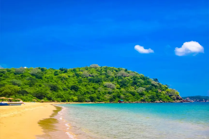
Trincomalee
Eastern Province
# Trincomalee: Sri Lanka's Serene Northeast Shore Nilaveli and Uppuveli are two neighbouring beach villages on Sri Lanka's northeast coast, just north of the historic harbour city of Trincomalee, prized for their long white-sand beaches, warm calm water and the coral reefs of Pigeon Island National Park just offshore. Their season is the mirror image of the south coast — roughly May to September — so when the southwest is stormy, this shore is glassy, golden and gloriously uncrowded. Uppuveli is the livelier, more walkable of the pair; Nilaveli, a little further north, is longer, whiter and quieter, and the launch point for snorkelling with reef sharks and turtles. ## History This stretch of coast has always lived in the shadow — and the shelter — of Trincomalee, home to one of the finest natural deep-water harbours in the world. That harbour made Trincomalee a prize fought over for centuries by Portuguese, Dutch, French and British fleets, and a strategic naval base into the Second World War, when the aircraft carrier HMS *Hermes* was sunk offshore in 1942. Around this contested port, Nilaveli and Uppuveli remained quiet Tamil fishing villages, their days shaped by the sea and the seasons. The late 20th century was hard on the whole east coast: the long civil conflict kept travellers away, and the 2004 tsunami struck this shore with terrible force. > Peace after 2009 reopened the northeast, and Nilaveli and Uppuveli have since emerged as a calmer, less-developed alternative to Sri Lanka's busy south — beaches with room to breathe. Today the villages balance a growing but still low-key tourism with their fishing roots, offering some of the island's most beautiful and least crowded sand. ## What to See ### Uppuveli Beach The more sociable of the twins, about 6 km north of Trincomalee, Uppuveli is a clean, wide, golden-sand beach backed by a walkable strip of restaurants, bars, dive shops and guesthouses. It's the natural base for whale-watching boats and has an easy, welcoming atmosphere. The southern end near the war cemetery draws local visitors; the north is quieter. ### Nilaveli Beach A little further north, *Nilaveli* is longer, whiter and more tranquil — a broad sweep of pale sand and shallow, warm, turquoise water made for slow days and long swims. It feels wonderfully unhurried, and it's the departure point for boats to Pigeon Island. ### Pigeon Island National Park Just a short boat ride off Nilaveli lies one of only two marine national parks in Sri Lanka, and one of its finest snorkelling sites. Around its coral reefs you can drift among tropical fish, sea turtles, rays and — thrillingly — harmless *blacktip reef sharks* in the shallows. > Buy your ticket yourself at the Wildlife Department hut on Nilaveli beach — you don't need a broker. Go early, wear a rash guard, and never touch or stand on the coral. ### Whale & Dolphin Watching Off Trincomalee, the continental shelf brings *blue whales* and *sperm whales* within about 6–8 nautical miles of shore, roughly a 30-minute boat ride. Pods of spinner dolphins are common too. It's a quieter, less crowded alternative to the south coast's whale scene, and its season falls in the northern summer. ### Wreck Diving The waters off Trincomalee hide some of Asia's great wreck dives, including the WWII aircraft carrier HMS *Hermes* and the SS *British Sergeant*. PADI dive centres in Uppuveli and Nilaveli run trips for certified divers and courses for beginners, exploring reefs and encrusted wrecks alive with fish. ### Trincomalee's Temples & Hot Wells A short ride south, Trincomalee rewards a day of sightseeing: the clifftop *Koneswaram* Hindu temple on Swami Rock within Fort Frederick, the sacred *Kanniya Hot Wells*, the moving Commonwealth War Cemetery, and the Navy-kept calm of Marble Beach. ## Ticket Prices & Opening Hours The beaches are free; the paid experiences are Pigeon Island, boats, whale trips and dives. All figures were checked this year; **prices vary and should be confirmed on the ground.** - *Pigeon Island National Park entry:* foreigner **around US$10 per adult and US$5 per child**, plus a per-group service charge (around US$8) and VAT. Buy at the Wildlife Department hut on Nilaveli beach, open **daily from 9 a.m.** - *Boat to Pigeon Island:* around **Rs 15,000 per 6–8-seat boat return**, split across your group, sometimes including a short dolphin detour. Snorkel gear is extra (around 1,000 LKR per head). - *Whale & dolphin watching:* shared trips roughly **€22–50 per person** depending on the operator and boat; private charters around **$80–150**. Boats depart about **5:45–6:00 a.m.** and return by around 9 a.m. - *Diving:* priced per operator and dive; expect wreck and reef dives through the PADI centres in Uppuveli and Nilaveli. **Season & timing:** the northeast's dry season runs **May to September** (with April and October as shoulders), when the sea is calm and clear. Whale watching runs roughly **March/April to September**, peaking **June to August**, with July often the calmest. Pigeon Island and diving are best in these same months; November to March brings the northeast monsoon, rough seas and many closures. ## Practical Tips - *Come in the northern summer.* This coast is at its best May to September — the opposite of the south. Visiting in winter means rough seas and closed operators. - *Choose your base.* Stay in Uppuveli for restaurants, bars and easy whale-boat access; choose Nilaveli for a longer, quieter, whiter beach. - *Buy Pigeon Island tickets yourself.* Purchase at the Wildlife Department hut on Nilaveli beach and arrange your boat at the boat-owners' hut nearby — no brokers required. - *Protect the reef.* Never touch, stand on or chase coral, turtles or reef sharks, and use reef-safe sunscreen; Pigeon Island is a fragile, recovering marine park. - *Take seasickness precautions.* Swell can build mid-morning even on calm days — take a tablet an hour or two before a whale trip. - *Go early.* Snorkel Pigeon Island and set out for whales soon after dawn, before wind and crowds pick up. - *Carry cash in rupees.* ATMs are mainly in Trincomalee town; bring enough for tickets, boats and meals. - *Pair it with the Cultural Triangle.* [Polonnaruwa](/polonnaruwa-travel-guide) and [Sigiriya](/sigiriya-travel-guide) are only about 2.5–3 hours away. ## How to Get There Nilaveli and Uppuveli sit just north of [Trincomalee](/trincomalee-travel-guide), roughly 260 km from Colombo on the northeast coast. - *By car or private transfer:* the most flexible option. From Colombo it's around **6 to 7 hours**; the villages are a 15–30 minute tuk-tuk ride north of Trincomalee town. - *By train:* a train runs from Colombo to Trincomalee (including a useful overnight service), taking roughly 7–8 hours, from where it's a short tuk-tuk to the beaches. - *By air:* domestic flights serve Trincomalee (China Bay), cutting the journey to under an hour from Colombo. - *From the Cultural Triangle:* [Sigiriya](/sigiriya-travel-guide), [Dambulla](/dambulla-travel-guide) and [Polonnaruwa](/polonnaruwa-travel-guide) are only about 2.5–3 hours away, making Trincomalee a natural add-on to an inland tour. ## Chasing the Season: The Northeast vs the South Coast Sri Lanka's two monsoons give it two beach seasons on opposite coasts, and Nilaveli and Uppuveli shine exactly when the famous south goes quiet. - *Nilaveli & Uppuveli (northeast):* best **May to September**, when the sea is calm and clear. - *The south — [Mirissa](/mirissa-travel-guide), Unawatuna, Hikkaduwa:* best **November to April**, when the northeast turns stormy. So if you're travelling in the northern summer, the northeast is where the calm water and clear skies will be — and you'll share it with a fraction of the south coast's crowds. It's also the same season as east-coast [Arugam Bay](/arugam-bay-travel-guide), making a combined east-coast trip easy. --- ## Why Nilaveli & Uppuveli Stay With You These twin beaches stay with you as a feeling of spaciousness — pale sand stretching further than the eye can follow, water so warm and clear it barely seems real, and the rare luxury of a beautiful shore without the crowds. Add a morning drifting over coral beside a reef shark, or a blue whale surfacing in an empty sea, and the northeast quietly outshines places far more famous. You leave with the sense of having found something the guidebooks are only just catching up to: a calmer, gentler side of Sri Lanka's coast, where the pace slows to the rhythm of the tide and there is always room to breathe. ## Frequently Asked Questions ### Is Nilaveli or Uppuveli better? It depends on your style. Uppuveli is closer to Trincomalee, more developed and more social, with restaurants and bars within walking distance and easy whale-boat access. Nilaveli is longer, whiter, quieter and the base for Pigeon Island snorkelling. Many travellers enjoy both, as they're only about ten minutes apart. ### What is the best time to visit Nilaveli and Uppuveli? The best months are May to September (with April and October as shoulders), when the northeast is dry and the sea is calm and clear. This is the opposite of Sri Lanka's south coast. November to March brings the northeast monsoon, rough seas and many closures. ### How much does it cost to visit Pigeon Island? Foreigner entry is around US$10 per adult and US$5 per child, plus a per-group service charge and VAT. Boat hire from Nilaveli is roughly Rs 15,000 for a 6–8-seat boat return, split across your group, with snorkel gear extra. Buy tickets at the Wildlife Department hut on Nilaveli beach. ### Can you see reef sharks at Pigeon Island? Yes. Pigeon Island's shallow reefs are known for harmless blacktip reef sharks, often seen by snorkellers close to shore, along with sea turtles, rays and abundant reef fish. Keep a respectful distance, never touch the wildlife or coral, and go early for the calmest, clearest water. ### Is Trincomalee good for whale watching? Very. Blue and sperm whales pass within about 6–8 nautical miles of Trincomalee, and it's far less crowded than the south coast. The season runs roughly March/April to September, peaking June to August, and boats leave from Uppuveli and Nilaveli before dawn. ### How do you get to Nilaveli from Colombo? Nilaveli is about 260 km from Colombo, roughly 6–7 hours by car. You can also take the Colombo–Trincomalee train (including an overnight service) or a domestic flight to Trincomalee, then a short tuk-tuk north to the beaches. ### Can you combine Trincomalee with Sigiriya or Polonnaruwa? Yes, easily. Sigiriya, Dambulla and Polonnaruwa in the Cultural Triangle are only about 2.5–3 hours from Trincomalee, so many travellers pair a few days of inland sightseeing with beach time in Nilaveli or Uppuveli.
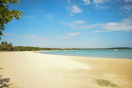
Pasikudah
Eastern Province
# Pasikudah: The Bay Where You Can Wade Out to Sea Pasikudah is a resort beach town on Sri Lanka's east coast, about 35 km north of Batticaloa and roughly 300 km from Colombo, famous for having one of the longest stretches of shallow, calm water in the world — a crescent bay where you can wade out a hundred metres or more over warm, waist-deep, turquoise sea. Its gentle, current-free water makes it arguably the most family-friendly beach in Sri Lanka, lined with comfortable resorts and paired with the quieter, near-empty sands of Kalkudah next door. The season runs roughly May to September, when the east coast is calm, dry and gloriously sunny while the famous south is under cloud. ## History Pasikudah — its name is often taken to mean "green-algae bay" — was for centuries a quiet, sheltered fishing bay in the predominantly Tamil district of Batticaloa. Its shallow, reef-protected water was a gift to local fishermen long before it was a gift to holidaymakers. The bay's modern history is bound up with hardship and renewal. The 2004 Indian Ocean tsunami struck this coast with devastating force, wrecking the once-popular resorts of neighbouring Kalkudah, and the long civil conflict kept the whole east away from travellers for decades. > After the war ended in 2009, the government developed Pasikudah as a flagship tourism zone, and around fourteen resorts rose along the bay — turning a remote fishing shore into the most developed beach on the east coast. Today Pasikudah is a relaxed, resort-lined destination that has kept its calm, shallow magic, with the old village and its fishing boats still lending local colour at the southern end of the bay. ## What to See ### Pasikudah Bay The star of the show is the bay itself — a wide, crescent sweep of soft golden sand and astonishingly shallow, clear water. You can walk out well over a hundred metres and still be only waist-deep, floating in warm, calm, current-free sea. It's a paradise for families, children and non-swimmers, and the east-coast sunrises over the water are spectacular. > The water is so shallow and gentle that Pasikudah is one of the safest swimming beaches in the country — but it also means real depth for swimming laps is a long walk out. ### Kalkudah Beach Just a short drive north lies Kalkudah, Pasikudah's wilder twin — a long, undeveloped beach of sand, palms and sea with almost no hotels or restaurants. Once a thriving resort before the tsunami, it now offers pure, quiet escapism and a glimpse of east-coast fishing life. The reef offshore shelters the shore, though the waves here can be less predictable. ### Snorkelling, Diving & Wrecks Offshore reefs bring *snorkelling* and *diving* within reach, with tropical fish, coral and the occasional turtle or reef shark. Serious divers come for the wrecks — the WWII aircraft carrier HMS *Hermes*, the SS *British Sergeant* and the Boiler wreck lie within reach of east-coast dive operators. ### Elephant Rock At one end of the bay sits *Elephant Rock*, a natural formation said to resemble an elephant resting by the sea. It's a scenic landmark and a pleasant short walk, and a lovely spot to watch the light change over the water. ### Water Sports & Sailing In season, the calm bay becomes a playground for *kayaking*, stand-up paddleboarding, jet skiing, banana-boat rides, windsurfing and sailing. A sunset catamaran cruise across the flat, glassy water is one of the loveliest ways to end a day here. ### Batticaloa's Lagoon & Town South of the bay, the city of Batticaloa rewards a day trip with its vast lagoon — famous for the local legend of "singing fish," a mysterious music heard over still water on quiet nights — plus the historic Kallady Bridge, a Dutch-era fort and a British lighthouse from 1913. ## Ticket Prices & Opening Hours Pasikudah's beach is free and open; the paid experiences are water sports, snorkelling and diving. All figures were checked this year; **water-sport and boat prices vary by operator and are negotiable, so agree the rate before you start.** - *Pasikudah & Kalkudah beaches:* **free** to access, with no entrance gate. Sunrise is the magic hour. - *Water sports (kayak, SUP, jet ski, banana boat, sailing):* priced per operator and per activity, mostly run through the resorts and beach operators in the **May–September** season. - *Snorkelling & diving trips:* priced per operator; there's reportedly no formal reserve conservation fee at the Pasikudah reef. Confirm the price and inclusions first, and choose operators who don't anchor on the coral. - *Batticaloa lagoon boat trips:* a modest per-person or per-boat fee — agree it with the boatman beforehand. **Season & timing:** the east coast is at its best from **May to September** (with March/April and October as shoulders), when the sea is calm, shallow and clear. **November to February** brings rougher seas and grey skies, and many water-sport operators wind down — though the beach itself is still walkable and beautiful. Come for sunrise, when the bay is at its most magical and least crowded. ## Practical Tips - *Travel in the northern summer.* Pasikudah shines May to September — the opposite of the south coast. Off-season, the sea turns rough and operators close. - *It's a wading beach, not a lap-swimming one.* The joy here is the vast, safe shallows; if you want deep water for swimming, expect a long walk out. - *Choose water-sport operators with care.* Agree prices upfront, and favour snorkel and dive operators who protect the reef rather than anchoring on it. - *Come for the sunrise.* Being on the east coast, Pasikudah delivers glorious dawn colours right over the water — set an early alarm. - *Visit Kalkudah for solitude.* Twenty minutes north gives you a near-empty beach; bring your own water and shade, as facilities are minimal. - *Bring cash in rupees.* ATMs are mainly in Valaichchenai and Batticaloa; carry enough for activities and meals outside the resorts. - *Combine with the Cultural Triangle.* [Polonnaruwa](/polonnaruwa-travel-guide) is only about 2.5 hours inland and pairs beautifully with beach time. - *Watch weekends.* The beach can get busy with local visitors on weekends and public holidays. ## How to Get There Pasikudah sits on the east coast between [Trincomalee](/trincomalee-travel-guide) to the north and Batticaloa to the south, roughly 282–300 km from Colombo. - *By car or private transfer:* the most flexible option. From Colombo it's around **6 hours**, often via the scenic Cultural Triangle route through Habarana and [Polonnaruwa](/polonnaruwa-travel-guide). - *By train:* the Colombo–Batticaloa line stops at **Valaichchenai**, the nearest station, about a 15-minute tuk-tuk from the beach; the journey takes roughly 7–8 hours, including a useful overnight service. - *By air:* domestic flights serve **Batticaloa Airport** (about a 45-minute drive away), cutting the trip from Colombo to around an hour. - *From nearby coasts:* [Trincomalee](/trincomalee-travel-guide) is about 2 hours north and [Arugam Bay](/arugam-bay-travel-guide) around 3 hours south, making an east-coast chain easy to plan. ## Pasikudah vs. Kalkudah: Which Bay? These twin east-coast beaches sit minutes apart but feel worlds apart, and knowing the difference helps you pick your base — or better, enjoy both. - *Pasikudah:* the developed, resort-lined bay with the famous ultra-shallow water, water sports and full facilities — ideal for families and comfort-seekers. - *Kalkudah:* the wild, undeveloped twin — a long, quiet, near-empty beach for pure escapism, with few amenities. Stay in Pasikudah for ease, activities and safe shallow swimming; slip over to Kalkudah when you want solitude and a desert-island feeling. And because the season here mirrors the south, Pasikudah is your calm-sea choice in the northern summer, when [Mirissa](/mirissa-travel-guide) and the south coast turn stormy. --- ## Why Pasikudah Stays With You Pasikudah stays with you as a feeling of weightless calm — the surreal pleasure of walking far out into a warm, glassy sea that never rises past your waist, the dawn sky flushing pink over the water, the hush of a bay with no crashing surf. It is Sri Lanka's most effortless beach, the one where nothing is asked of you but to float. You leave remembering how safe and unhurried it all felt: children laughing in water they couldn't sink in, the long shallow shimmer stretching to the horizon, and the quiet knowledge that you'd found the east coast at its gentlest. That serene, shallow magic is what calls people back. ## Frequently Asked Questions ### Why is Pasikudah beach so shallow? Pasikudah sits in a sheltered, reef-protected crescent bay with an exceptionally gentle underwater slope, so the water stays shallow and calm for a very long way out — often 100 to 200 metres. This makes it one of the safest swimming beaches in Sri Lanka, ideal for families, children and non-swimmers. ### What is the best time to visit Pasikudah? The best months are May to September (with March/April and October as shoulders), when the east coast is dry and the sea is calm and clear. This is the opposite of Sri Lanka's south coast. November to February brings rougher seas and cloudier skies, and many water-sport operators pause. ### Is Pasikudah good for families? Exceptionally. Its warm, shallow, current-free water is arguably the most family-friendly sea in Sri Lanka, safe for young children and non-swimmers to wade and play in. Add resort facilities, gentle water sports and calm conditions, and it's a top pick for a relaxed family beach holiday. ### Pasikudah or Kalkudah — which is better? Pasikudah is developed and resort-lined, with the famous shallow water, water sports and full facilities. Kalkudah is quiet, wild and near-empty, for pure escapism with few amenities. They're only about 20 minutes apart, so many visitors stay in Pasikudah and visit Kalkudah for a peaceful change of scene. ### How do you get to Pasikudah from Colombo? Pasikudah is about 300 km from Colombo — roughly 6 hours by car, often via the Cultural Triangle. You can also take the Colombo–Batticaloa train to Valaichchenai station (about 15 minutes from the beach) or a domestic flight to Batticaloa Airport, around a 45-minute drive away. ### Can you snorkel or dive at Pasikudah? Yes. Offshore reefs offer snorkelling and diving in the May–September season, with tropical fish and coral, though some coral is degraded. Experienced divers can explore WWII wrecks including HMS Hermes nearby. Agree prices in advance and choose responsible operators who protect the reef. ### Can you combine Pasikudah with Polonnaruwa or Trincomalee? Yes. Polonnaruwa in the Cultural Triangle is only about 2.5 hours inland, and Trincomalee is roughly 2 hours up the coast, so Pasikudah pairs easily with a Cultural Triangle tour or a wider east-coast beach trip.
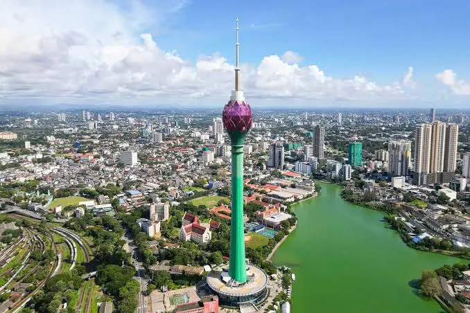
Colombo
Western Province
# Colombo: The Island's Gateway and Its Beating Heart Colombo is Sri Lanka's largest city and commercial capital, a bustling port metropolis on the west coast where most island journeys begin and end, about 35 km south of the international airport. It's a layered, energetic place — colonial arcades and candy-striped mosques, gleaming skyscrapers and the lotus-shaped tower, sea-breeze promenades and some of the finest food on the island. Not a beach or an ancient ruin but a living, reinventing city, Colombo rewards a day or two of wandering before or after the rest of your Sri Lankan adventure. ## History Colombo owes its existence to its harbour. For more than a thousand years, Arab and Moor traders sheltered here on the monsoon routes, drawn by cinnamon and the safe anchorage, long before Europeans arrived. The colonial centuries left deep marks. The Portuguese built a fort here in the early 1500s; the Dutch seized it in 1656 and laid out the canals and the district still called *Pettah* (from the Tamil for "outer town"); and the British, taking over in 1796, made Colombo the capital of Ceylon, building the grand port, the railways and the leafy mansions of *Cinnamon Gardens*. > Colombo has been the country's beating commercial heart for centuries — though since 1982 the official administrative capital has technically been neighbouring Sri Jayawardenepura Kotte, a distinction few visitors ever notice. Since the civil war's end in 2009, Colombo has transformed at speed — a new skyline of towers, the vast reclaimed-land Port City project, and a confident food and arts scene. It remains a city of layers, where a colonial arcade, a Buddhist temple, a Hindu kovil, a mosque and a glass tower can all share a single skyline. ## What to See ### Galle Face Green Colombo's great seafront lawn is the city's living room — a half-mile promenade where, as the sun sets, families fly kites, couples stroll, and vendors grill *isso wade* (prawn fritters) and serve king coconuts. Come at dusk for the breeze, the colour and the crowd; it's the most Colombo of experiences. ### Gangaramaya Temple & Seema Malaka The city's most important and eclectic Buddhist temple, *Gangaramaya* is a treasure-house of Buddha images, gifts and curiosities, part temple and part museum. Its serene sister site, the *Seema Malaka* — a cluster of pavilions floating on Beira Lake, designed by the great architect Geoffrey Bawa — is one of the loveliest quiet corners in the city. ### Colombo National Museum Housed in a gracious colonial building, the island's largest museum tells Sri Lanka's whole story, from ancient statuary and Kandyan royal regalia to swords, masks and manuscripts. It's the single best place to make sense of everything you'll see elsewhere on the island — allow a couple of hours. ### Colombo Lotus Tower Rising 356 metres over the city in the shape of a lotus, this is Sri Lanka's tallest structure and its boldest modern landmark. The observation deck offers a sweeping 360-degree panorama of the city, the harbour and the Indian Ocean. > Time your visit for late afternoon to catch both the daytime view and the sunset, then watch the city lights blink on. Weekday mornings are quietest. ### Pettah & the Red Mosque The frenetic *Pettah* bazaar is Colombo at full volume — a grid of streets each devoted to its own trade, from textiles to electronics to spices. At its heart stands the *Jami Ul-Alfar Mosque*, an unforgettable candy-striped confection of red-and-white brick that's one of the city's most photographed buildings. ### Independence Square & Cinnamon Gardens In the elegant *Cinnamon Gardens* district, the columned Independence Memorial Hall commemorates the end of colonial rule, surrounded by joggers at dawn and dusk. Nearby, the restored *Arcade Independence Square* offers boutique shopping in a beautiful old colonial building. ### The Fort & the New Waterfront The historic *Fort* district blends colonial grandeur — the restored Old Dutch Hospital, now a dining and shopping precinct — with the gleaming ambition of Port City Colombo, a vast reclaimed-land development with a brand-new city beach. ## Ticket Prices & Opening Hours Many of Colombo's pleasures are free; a handful of sights are ticketed. All figures were checked this year; **prices and hours change, so confirm before visiting.** - *Colombo Lotus Tower:* observation deck **around US$20 per adult and US$10 per child**. Open roughly weekdays 9 AM–9 PM and weekends until about 10 PM (ticket counter closes about an hour earlier). - *Colombo National Museum:* foreigner entry **around US$5 per adult and US$2.50 per child**. Open daily about 9 AM–5 PM (last entry around 4:30); closed on some public holidays. - *Gangaramaya Temple:* entry commonly **around LKR 300**, including the temple, museum, library and Seema Malaka — though some sources list a higher foreigner rate, so confirm at the counter. Open daily about 6 AM–8 PM. Dress modestly. - *Free to visit:* Galle Face Green, Independence Square, Pettah market and the Red Mosque (a donation is welcome), Viharamahadevi Park, the Old Dutch Hospital, and the Port City waterfront and beach. **Season & timing:** Colombo is warm and humid year-round, with the driest, most pleasant weather roughly **December to March**. The southwest monsoon (around May to September) brings afternoon downpours, but the city carries on regardless — just carry an umbrella. Early mornings and late afternoons are the coolest, kindest times to explore on foot. ## Practical Tips - *Give it a day or two, not a rushed hour.* Colombo isn't a single sight but a city to graze — temples, markets, food and sea air. - *Use ride-hailing apps.* PickMe and Uber (including tuk-tuks) are cheap, easy and save haggling; agree metered or app fares over street quotes. - *Beat the heat.* Sightsee in the morning and late afternoon, and duck into a café or mall during the midday heat. - *Dress respectfully for temples and mosques.* Cover shoulders and knees, and remove shoes and hats before entering; the Red Mosque and Gangaramaya both expect modest dress. - *Eat everywhere.* Colombo is the island's food capital — try kottu, hoppers, short eats and a proper rice and curry, from street stalls to smart rooftops. - *Head to Galle Face at sunset.* It's free, lively and quintessentially Colombo — bring an appetite for street snacks. - *Carry small cash.* For markets, tuk-tuks, temple entry and street food, though cards work in malls and hotels. - *Mind the traffic.* Colombo's congestion is real; plan cross-city trips around the worst of the rush hours. ## How to Get There As the country's main hub, Colombo is the easiest place in Sri Lanka to reach and to leave from. - *From the airport:* Bandaranaike International Airport (CMB) sits about 35 km north near [Negombo](/negombo-travel-guide); the airport expressway brings you into the city in around 30–60 minutes by taxi. - *By train:* Colombo Fort is the heart of the rail network, with scenic lines south along the coast to [Galle](/galle-travel-guide) and up into the hills toward [Kandy](/kandy-travel-guide) and the tea country. - *By expressway:* the Southern Expressway speeds you to the south coast and [Bentota](/bentota-travel-guide), while highways head inland toward the Cultural Triangle sights of [Dambulla](/dambulla-travel-guide) and [Sigiriya](/sigiriya-travel-guide). - *Around the city:* tuk-tuks and ride-hailing apps are the simplest way to get around. ## Why Colombo Is Worth Your Time Some travellers treat Colombo as just an airport transfer — and miss the point. The city isn't competing with the beaches or the ruins; it offers something they can't. - *Layered history:* Portuguese, Dutch and British legacies stacked beside temples, kovils and mosques. - *The island's best food scene:* from street kottu to rooftop fine dining, this is where Sri Lanka eats. - *A real, living city:* markets, galleries, shopping and sea-breeze promenades, unpolished and genuine. - *The perfect bookend:* an easy, rewarding start or finish to any Sri Lankan itinerary. Give Colombo a day at the beginning or end of your trip and it repays you with context, colour and the island's best meals. --- ## Why Colombo Stays With You Colombo stays with you as a city of the senses — the sizzle of a kottu griddle, the salt breeze off Galle Face at dusk, the red-and-white dazzle of a mosque above a chaotic bazaar, the hush of pavilions floating on a city lake. It doesn't hand you its charms on a postcard; it makes you find them, street by street. You leave with the feeling of having glimpsed the real, unvarnished pulse of Sri Lanka — a place that is old and new at once, trading and praying and building and eating, all in the same salt-scented afternoon. That living, layered energy is Colombo's quiet gift. ## Frequently Asked Questions ### Is Colombo worth visiting? Yes, if you give it a chance. Colombo isn't a beach or a ruin but a vibrant, layered city with colonial architecture, temples, markets, a striking modern skyline and the island's best food scene. A day or two at the start or end of a Sri Lanka trip adds real context and colour. ### What are the best things to do in Colombo? Highlights include watching sunset at Galle Face Green, visiting Gangaramaya Temple and its lake pavilion Seema Malaka, exploring the Pettah bazaar and Red Mosque, taking in the view from the Lotus Tower, and browsing the National Museum — all wrapped around plenty of excellent eating. ### How many days do you need in Colombo? One to two days is usually enough to see the main sights, eat well and get a feel for the city. Many travellers spend a day here at the start or end of their trip, often combining it with the airport town of Negombo. ### How do you get from Colombo airport to the city? Bandaranaike International Airport is about 35 km north of Colombo. The quickest way is a taxi via the airport expressway, taking around 30–60 minutes depending on traffic. Ride-hailing apps and airport taxis are readily available, and many hotels arrange transfers. ### How much does the Colombo Lotus Tower cost? Entry to the observation deck is around US$20 for adults and US$10 for children. It's open roughly 9 AM to 9 or 10 PM, with the ticket counter closing about an hour earlier. Late afternoon is the best time to catch both the view and the sunset. ### Is Colombo safe for tourists? Colombo is generally considered a safe city for visitors, with the usual big-city precautions: watch your belongings in crowded markets, use reputable taxis or ride-hailing apps, and agree fares in advance. As anywhere, stay aware of your surroundings, especially at night. ### What food should you try in Colombo? Colombo is Sri Lanka's food capital, so try kottu roti, egg and milk hoppers, string hoppers, "short eats," fresh seafood and a full rice and curry. Sample street food at Galle Face, then work up to the city's excellent cafés and rooftop restaurants.

Galle
Southern Province
# Galle: The Living Fort Where Time Slows to a Sea Breeze Galle is a walled Dutch colonial city on Sri Lanka's southwest coast, about 120 km south of Colombo, and its UNESCO-listed Galle Fort is the cultural jewel of the south — the largest European-built fortress in Asia, still lived-in and loved after nearly four centuries. Inside its sea-girt ramparts lies a maze of cobbled lanes, colonial villas, boutique cafés, art galleries and jewellers, all wrapped by ocean on three sides. Free to wander and made for slow afternoons, Galle is at its most magical at sunset on the walls, and its season runs roughly December to April. ## History Galle was Sri Lanka's great southern port long before Colombo rose to prominence — a natural harbour on the spice and trade routes that some romantics even link to the biblical "Tarshish." Its documented story as a fortress begins with the Portuguese, who built the first stronghold here in 1588. When the Dutch seized Galle in 1640, they rebuilt it on a grand scale, completing by around 1663 the massive coral-and-granite ramparts, bastions and gateways that still stand today. Under Dutch rule it became a thriving walled town of warehouses, churches and merchants' villas; the British, taking over in 1796, added the lighthouse and other flourishes but let Galle's importance drift as Colombo's harbour grew. > When the 2004 tsunami devastated the south coast, Galle Fort's centuries-old walls sheltered the old town within, sparing it much of the destruction suffered just outside — a striking testament to Dutch engineering. Named a UNESCO World Heritage Site in 1988, Galle Fort remains a rare thing: not a museum-piece ruin but a living, breathing town, where families, shopkeepers and artists still call the ramparts home. ## What to See ### The Ramparts The heart of any visit is a walk along the fort's roughly 3 km of walls, which trace the peninsula above the crashing Indian Ocean. Wander from bastion to bastion past cannons, gateways and sea views, and time it for *sunset*, when the light turns gold and the whole town comes out to stroll. > There's no better free experience in southern Sri Lanka than walking the Galle ramparts at sunset. Arrive an hour before dusk and let the walls lead you. ### Flag Rock & the Cliff Jumpers At the fort's southern tip, *Flag Rock* is the classic sunset-watching spot, where local daredevils leap from the rocks into the sea below for tips and applause. It's dramatic, photogenic and quintessentially Galle. ### Galle Lighthouse The white, palm-framed *Galle Lighthouse* is the oldest in Sri Lanka and the fort's most photographed landmark, standing on the ramparts above a little beach. You can't climb it, but the view of it — palms, white tower, blue sea — is pure postcard. ### The Streets, Cafés & Boutiques Half the joy of Galle is simply getting lost in its lanes — *Church Street*, *Pedlar Street* and their neighbours — lined with restored villas now home to boutique hotels, art galleries, jewellers, tea shops and some of the island's best cafés. It's a place to browse, sip and linger. ### Churches & Museums The fort holds layers of history in its buildings: the Dutch Reformed Church (*Groote Kerk*) with its old gravestones, the National Maritime Museum in a Dutch warehouse, the Historical Mansion Museum's private collection, and a striking mosque and temple sharing the same small streets. ### Galle Cricket Stadium Just outside the walls sits the *Galle International Stadium*, one of the most beautiful Test cricket grounds in the world, ringed by the ramparts and the sea. On a match day, you can watch play for free from the fort walls above. ## Ticket Prices & Opening Hours Walking Galle Fort is free; only a few museums inside charge. All figures were checked this year; **prices and hours change, so confirm before visiting.** - *Galle Fort, ramparts, streets & lighthouse:* **free** to walk and enjoy. (A foreigner ramparts fee of around US$15 has been proposed in the past but is *not* currently in force — worth reconfirming before you travel.) - *National Maritime Museum:* around **US$1.50**. - *Swart Bastion / Moon Bastion galleries:* around **US$3**. - *Historical Mansion Museum & Dutch Reformed Church:* free or by donation. - *Photography:* a small fee applies at some sites. **Opening hours & season:** the fort is a living town and always open; its museums keep roughly **9 AM to 5 PM** hours. The best time to visit is **December to April**, the south coast's dry season, with calm seas and clear skies. Aim to walk the ramparts in the late afternoon for cooler air and that famous golden-hour light. ## Practical Tips - *Walk the walls at sunset.* It's the single best thing to do in Galle, and it's free — arrive about an hour before dusk. - *Explore on foot.* The fort is compact and best seen slowly; wear comfortable shoes for the cobbles and bring water. - *Come early or late.* Midday is hot and busy; mornings and late afternoons are cooler and more atmospheric. - *Dress respectfully for the mosque, church and temple.* Cover shoulders and knees, and remove shoes where required. - *Stay a night if you can.* Galle is enchanting after the day-trippers leave, when the lantern-lit lanes empty out. - *Support local makers.* The fort's galleries, jewellers and boutiques showcase genuine Sri Lankan craft, gems and tea. - *Base your beach days nearby.* [Unawatuna](/unawatuna-travel-guide) and [Hikkaduwa](/hikkaduwa-travel-guide) are just minutes away for swimming and snorkelling. - *Carry small cash.* For museums, tuk-tuks, cafés and market stalls, though cards work in many shops and hotels. ## How to Get There Galle sits on the southwest coast, about 120 km south of Colombo, and is one of the easiest and most rewarding trips on the island. - *By car or private transfer:* via the Southern Expressway (E01), Colombo to Galle takes around **1.5 to 2 hours** — quick and comfortable. - *By train:* the coastal railway is a joy, running from Colombo down the shoreline to Galle in around **2 to 2.5 hours**; the station sits a short walk from the fort. - *By bus:* frequent Colombo–Matara coast-road buses stop at Galle's bus stand, right beside the fort. - *From nearby beaches:* [Unawatuna](/unawatuna-travel-guide) is about 15 minutes away, [Hikkaduwa](/hikkaduwa-travel-guide) around 30 minutes north, and [Mirissa](/mirissa-travel-guide) roughly 45 minutes east. ## Why Galle Is Special Sri Lanka has grander monuments and wilder beaches, but nothing quite like Galle — because Galle isn't a sight you visit, it's a place you inhabit. - *A living heritage town:* people still live, work and create inside a 350-year-old fort, so it hums with real life, not just history. - *An effortless blend:* Dutch architecture, Sri Lankan street life, boutique cool and ocean views, all in a few walkable streets. - *The south coast's cultural anchor:* the perfect counterpoint to the beach days of [Mirissa](/mirissa-travel-guide) and [Unawatuna](/unawatuna-travel-guide). Where the Cultural Triangle's [Polonnaruwa](/polonnaruwa-travel-guide) and [Sigiriya](/sigiriya-travel-guide) show you ancient Sri Lanka, Galle shows you its colonial, seafaring soul — beautifully, and still alive. --- ## Why Galle Stays With You Galle stays with you as a mood as much as a place — the warm coral glow of ramparts at sunset, the clatter of a café spilling onto a cobbled lane, the sudden blue of the ocean framed in an old stone gateway, the leap of a cliff jumper against the dusk. It asks nothing of you but to slow down and wander. You leave carrying the particular romance of a town where centuries layer gently on one another and the sea is never far from view. Long after the trip, it's Galle's golden light on old walls that you'll find yourself missing. ## Frequently Asked Questions ### Is there an entrance fee for Galle Fort? No — entry to Galle Fort is free, and you can walk the ramparts, streets and past the lighthouse at no charge. Only a few museums inside charge small fees. A foreigner ramparts fee has been proposed in the past but is not currently in force, so it's worth reconfirming before you travel. ### What is the best time to visit Galle? The best months are December to April, the south coast's dry season, with calm seas and clear skies. Within a day, late afternoon is ideal — cooler air and golden light for walking the ramparts at sunset, the fort's signature experience. ### How do you get from Colombo to Galle? By car via the Southern Expressway it takes around 1.5 to 2 hours. The scenic coastal train takes about 2 to 2.5 hours and drops you near the fort, and frequent coast-road buses also run. It's one of the easiest day trips or overnight escapes from Colombo. ### Is Galle worth visiting? Very much so. Galle Fort is a beautifully preserved, still-lived-in UNESCO World Heritage Site — a walkable maze of colonial architecture, cafés, galleries and sea-view ramparts. It's the cultural highlight of the south coast and pairs perfectly with nearby beaches. ### How long do you need in Galle? Half a day covers the ramparts and main sights, but a full day — ideally with an overnight stay — lets you enjoy the fort's quieter, magical evenings after the day-trippers leave. Many travellers base themselves here to explore the wider south coast. ### Is Galle Fort or Galle town the tourist area? The historic Galle Fort, the walled peninsula, is the main attraction, with the cobbled streets, ramparts, museums and boutique hotels. The modern town of Galle spreads just outside the walls with the bus and train stations, markets and everyday life. ### Can you swim in Galle Fort? There's no proper swimming beach inside the fort, though locals dip near the walls. For proper swimming and snorkelling, head a few minutes to [Unawatuna](/unawatuna-travel-guide)'s sheltered bay or the beaches around [Hikkaduwa](/hikkaduwa-travel-guide) just up the coast.

Negombo
Western Province
# Negombo: The Gateway Town of Lagoons, Churches and the Morning Catch Negombo is a lively fishing town on Sri Lanka's west coast, just 10–12 km — about 15 to 20 minutes — from Bandaranaike International Airport, which makes it the natural first or last stop of almost any Sri Lankan journey. Known affectionately as "Little Rome" for its many Catholic churches, it's a place of golden-sand beaches, a bustling dawn fish market, a broad lagoon threaded with Dutch-era canals, and some of the freshest seafood on the island. Its beach season runs roughly November to April, though the markets, waterways and churches reward a visit at any time of year. ## History Negombo's story is written in cinnamon and the sea. Long a coastal settlement of Arab and Moor traders, it became a prize the moment Europeans arrived, for the finest cinnamon in the world grew in the marshes around it. The Portuguese came in the early 1600s, built a fort and spread Catholicism so successfully that the town earned its "Little Rome" nickname. The Dutch seized Negombo in the 1640s, prized it as a cinnamon port, and cut the network of *canals* that still lace the town — waterways once heavy with spice barges. The British, taking over in 1796, extended these into the long Hamilton Canal. > Negombo remains the largest Catholic town in Sri Lanka, its skyline punctuated by church spires and its lanes lined with shrines — a legacy of four centuries of Portuguese and Dutch influence. Through it all, one thing never changed: the fishing. Negombo's Karava fishing community and their outrigger canoes have worked the lagoon and the sea for generations, and that daily rhythm of nets and boats is still the town's beating heart. ## What to See ### Negombo Beach A long, golden strand backed by resorts, guesthouses and seafood restaurants, Negombo Beach is the town's easygoing front porch. It's not the pristine sand of the south coast, but it's pleasant, convenient and made for a first-day swim or a last-evening sunset with a cold drink in hand. ### The Fish Market (Lellama) Negombo's dawn *fish market* is the town at its most vivid — a riot of colour, noise and silver catch as fishermen auction tuna, mackerel, squid and shark, and racks of fish dry in the sun nearby. > Arrive between 5 and 7 AM to catch the auction in full swing. Wear shoes you don't mind getting wet, and carry small cash if you'd like to tip a fisherman for a photo. ### Negombo Lagoon & the Dutch Canal The wide, shallow *lagoon* is a world of fishing boats, mangroves and birdlife, best explored by boat. The historic *Dutch Canal* (the Hamilton Canal) runs alongside, its palm-shaded towpath perfect for a gentle cycle or a slow boat ride into the town's trading past. ### Muthurajawela Wetland At the lagoon's southern end lies *Muthurajawela*, Sri Lanka's largest saltwater marsh and a rich wildlife sanctuary. A boat safari here glides through channels alive with herons, egrets, kingfishers, water monitors and even crocodiles — a surprising slice of wilderness minutes from the airport. ### Little Rome's Churches Negombo's Catholic heart shows in its grand churches. *St. Mary's Church*, one of the largest in Sri Lanka, dazzles with painted ceilings, while *St. Sebastian's* and countless smaller chapels lend the town its distinctive, spire-studded skyline. ### Angurukaramulla Temple & the Dutch Fort For a change of faith and pace, the *Angurukaramulla Temple* houses a striking reclining Buddha, vivid murals and a dramatic dragon-arch entrance. In the town centre, the lone surviving gate of the old *Dutch Fort* — now the prison entrance — makes a quick, atmospheric photo stop. ## Ticket Prices & Opening Hours Most of Negombo's pleasures are free; the main paid experiences are the boat safaris. All figures were checked this year; **boat prices are set by operators and vary widely, so confirm before booking.** - *Beach, fish market, Dutch Fort gate & Dutch Canal towpath:* **free** to visit. The fish market is liveliest 5–7 AM. - *Churches:* free to enter; a donation is welcome, and modest dress is expected. - *Angurukaramulla Temple:* free or by donation; remove shoes and hats and dress modestly. - *Muthurajawela & Negombo Lagoon boat safaris:* priced **per operator** for roughly a 2–4 hour private trip, usually including hotel pickup. Morning (around 7 AM) and sunset are the best times; confirm the rate and route first. - *Outrigger, catamaran & deep-sea fishing trips:* also priced per operator — agree the price before you set off. **Season & timing:** the west-coast beach is at its best from **November/December to April**, when seas are calm and skies clear. The southwest monsoon (around May to August) brings rougher seas and less swimming, but the fish market, lagoon safaris, canals and churches are enjoyable **year-round**. For wildlife, take boat trips early in the morning. ## Practical Tips - *Use it as a soft landing.* Negombo is the perfect first or last night — close to the airport and a gentle, authentic introduction to Sri Lanka. - *Do the fish market at dawn.* It's the town's must-see, and the early light and the auction are the whole point — go before 7 AM. - *Take an early boat safari.* Wildlife on the lagoon and in Muthurajawela is most active soon after sunrise. - *Dress respectfully at churches and the temple.* Cover shoulders and knees and remove shoes and hats where required. - *Eat the lagoon crab.* Negombo's seafood — crab, prawns, cuttlefish — is among the freshest on the island; seek out a lagoon-side restaurant. - *Use PickMe or a pre-booked transfer.* Ride-hailing apps and arranged airport pickups save haggling after a long flight. - *Carry small cash.* For the market, tuk-tuks, temple donations and street food. - *Don't expect south-coast beaches.* Come for the character, the seafood and the convenience rather than postcard sand. ## How to Get There Negombo's greatest practical asset is its location — it's the easiest coastal town in Sri Lanka to reach. - *From the airport:* Bandaranaike International Airport is just **10–12 km away**, a 15–20 minute taxi or tuk-tuk ride — closer than Colombo itself. - *From Colombo:* around **35–40 km**, roughly 30–60 minutes by car via the coastal road or expressway, or about 90 minutes by train. - *Onward travel:* Negombo is a handy springboard for the whole island — south to [Colombo](/colombo-travel-guide) and [Bentota](/bentota-travel-guide), or inland to the Cultural Triangle sights of [Dambulla](/dambulla-travel-guide) and [Sigiriya](/sigiriya-travel-guide) and the hills of [Kandy](/kandy-travel-guide). - *Around town:* tuk-tuks and ride-hailing apps like PickMe are cheap and easy. ## Why Start or End Your Trip in Negombo Negombo isn't trying to out-beach the south coast — its magic is being the right place at the right moment in your journey. - *Unbeatable convenience:* minutes from the airport, so there's no long, jet-lagged drive on arrival or a nervous dash on departure. - *An authentic first taste:* a working fishing town of markets, churches and canals feels more real than a polished resort strip. - *A gentle springboard:* rest here, then head to the beaches, the hills or the ancient cities refreshed. Where [Colombo](/colombo-travel-guide) throws you straight into the big city, Negombo offers a calmer, salt-scented welcome — which is exactly why so many travellers begin and end here. --- ## Why Negombo Stays With You Negombo stays with you as the bookends of a Sri Lankan journey — the first lungful of warm, fish-and-frangipani air after a long flight, and the last golden sunset over the lagoon before you leave. It's the town of church bells and outrigger canoes, of crab curry eaten with your fingers and boats sliding through mangrove shade. You may arrive thinking of it as just the airport town, but you'll remember it as something warmer: the gentle threshold where Sri Lanka first said hello, and where, at the end, it waved you a reluctant goodbye. ## Frequently Asked Questions ### Is Negombo worth visiting? Yes — especially as the first or last stop of a trip. Negombo won't rival the south coast's beaches, but its dawn fish market, lagoon and wetland boat safaris, Dutch-era canals, "Little Rome" churches and fresh seafood give it a genuine, working-town character many travellers love. ### How far is Negombo from the airport? Negombo is only about 10–12 km from Bandaranaike International Airport — a 15 to 20 minute taxi or tuk-tuk ride. That proximity makes it the most popular first-night and last-night base in Sri Lanka, avoiding a long, tiring transfer after a flight. ### What is Negombo famous for? Negombo is famous for its huge fishing industry and dawn fish market, its many Catholic churches (earning it the nickname "Little Rome"), its lagoon and Dutch-built canals, and its fresh seafood — especially lagoon crab and prawns. It's also known as Sri Lanka's convenient airport gateway town. ### What is the best time to visit Negombo? For the beach, the best months are November/December to April, when the west coast is dry and the sea is calm. The southwest monsoon around May to August brings rougher seas, but the fish market, boat safaris, canals and churches can be enjoyed all year. ### How many days do you need in Negombo? One or two nights is usually plenty — enough to see the fish market, take a lagoon or Muthurajawela boat safari, wander the churches and enjoy the seafood. Many travellers stay a single night on arrival or departure, sometimes longer to unwind before heading on. ### Can you swim at Negombo beach? Yes, in the dry season (roughly November to April) when the sea is calm, though the beach is more relaxed than pristine. During the southwest monsoon the sea can be rough and swimming is less advisable — enjoy the sunsets, seafood and boat trips instead. ### What food should you try in Negombo? Negombo is a seafood town, so try the famous lagoon crab (often as a spicy crab curry), fresh prawns, cuttlefish and the day's catch from the market, ideally at a lagoon-side restaurant. Wash it down with a king coconut and finish with local sweets.
✦ Plan smarter
Best Time to Visit Sri Lanka
Sri Lanka has two monsoon seasons meaning some part of the island is always sunny. December–March is ideal for the south and west coasts; May–September for the east coast.